Kruishoutem
Village and former municipality in Flemish Region
From Wikipedia, the free encyclopedia
Kruishoutem (Dutch: [krœysˈɦʌutəm]; French: Cruyshautem, also used in English) is a village and was a municipality located in the Belgian province of East Flanders. The municipality comprised the towns of Kruishoutem proper, Nokere and Wannegem-Lede. In January 2018, the municipality of Kruishoutem had a total population of 8,086. The total area is 46.76 km2.[2] On 1 January 2019, Kruishoutem and Zingem merged into the new municipality of Kruisem.

Kruishoutem | |
|---|---|
Village and former municipality | |
Street view | |
 Flag  Seal | |
 Kruishoutem Location in Belgium | |
| Coordinates: 50°54′N 03°31′E | |
| Country | |
| Region | Flemish Region |
| Province | East Flanders |
| Arrondissement | Oudenaarde |
| Municipality | Kruisem |
| Area | |
• Total | 27.24 km2 (10.52 sq mi) |
| Population (2021)[1] | |
• Total | 5,394 |
| • Density | 198.0/km2 (512.9/sq mi) |
| Time zone | CET |
| Postal code | 9770-9772 |
| Dialing code | 09 |
| Website | www |
The SONS Museum is located in Kruisem.
Notable people
- Charles Louis Spilthoorn (Spilthooren), born 12 October 1804 in Kruishoutem; died 12 September 1872 in Brussels, lawyer and politician.
- Henry Gabriëls, born in Wannegem-Lede on 6 October 1838, professor & rector in Saint Joseph's Seminary in Troy, New York; bishop of Ogdensburg, New York, until his death in 1921. Created Sanatorium Gabriels and town Gabriels, New York.[3]
- Adolf Daens, priest in Kruishoutem in 1878–1879, later member of the Parliament.
Gallery
 Church of Nokere
 Town hall
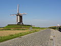 Windmill Schietsjampettermolen
 Pub in Kruishoutem


