't Zandt
Village in Groningen, Netherlands
From Wikipedia, the free encyclopedia
't Zandt (Dutch pronunciation: [Ét ËsÉnt]; Gronings: t Zaand [ËtsaËnt]) is a village in the Dutch province of Groningen. It is located in the municipality of Eemsdelta.

't Zandt | |
|---|---|
't Zandt in 2011 | |
 't Zandt Location of 't Zandt in the province of Groningen  't Zandt 't Zandt (Netherlands) | |
| Coordinates: 53°21â²57â³N 6°46â²28â³E | |
| Country | Netherlands |
| Province | Groningen |
| Municipality | Eemsdelta |
| Area | |
⢠Total | 33.74 km2 (13.03 sq mi) |
| Elevation | 1.1 m (3.6 ft) |
| Population (2021)[1] | |
⢠Total | 970 |
| ⢠Density | 29/km2 (74/sq mi) |
| Time zone | UTC+1 (CET) |
| ⢠Summer (DST) | UTC+2 (CEST) |
| Postal code | 9915[1] |
| Dialing code | 0596 |
't Zandt was a separate municipality until 1990, when it was merged with Loppersum.[3] The municipality covered the villages 't Zandt, Zeerijp, Leermens, Eenum and Oosterwijwerd, and the hamlets Zijldijk, Kolhol, Korendijk and 't Zandstervoorwerk.[4]
History
The village was first mentioned in 1257 as "in Sonde", and means sand. That year, the monks of Wittewierum started to a dike in order to polder the former Fivel estuary. The polder was completed in 1266, and a sluice was constructed in 1272.[5] At the intersection of the new dike and the perpendicular older dike, a settlement appeared.[6]
The Dutch Reformed church dates from the late-13th century, and was enlarged in the 15th century. The tower is detached from the church, and dates from the early 13th century.[6]
't Zandt was home to 779 people in 1840.[7] In 1990, it ceased to be an independent municipality and was merged into Loppersum.[7]
Gallery
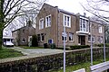 Former town hall
 Fire department
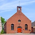 Reformed church
 Zandstermaar

.jpg)

