Altmühl Valley Nature Park
From Wikipedia, the free encyclopedia
| Altmühl Valley Nature Park (Naturpark Altmühltal) | |
|---|---|
 Rosenburg in Altmühltal | |
 Map | |
| Location | Franconian Jura |
| Coordinates | 48°49′04″N 11°13′37″E / 48.81782°N 11.22707°E |
| Area | 2,962 km2 (1,144 sq mi)[1] |
| Designation | NP-00016 |
| Established | 1969 |
The Altmühl Valley Nature Park (German: Naturpark Altmühltal) is a nature park, 2,962 km2[1] in area, in the south German state of Bavaria. The area of the park is almost coextensive with that of the natural region major unit of the Southern Franconian Jura (Südliche Frankenalb). It lies immediately north of the city of Ingolstadt on the River Danube and is divided into a southern and northern Altmühl Valley.[2][3]
The nature park was established on 25 July 1969[4] in Pappenheim by society formed for the purpose, the Naturpark Altmühltal (Südliche Frankenalb) ("Altmühl Valley Nature Park (Southern Franconian Jura)"). It is the fourth largest nature park in Germany after the Central/North Black Forest Nature Park, Bergstraße-Odenwald Nature Park and Southern Black Forest Nature Park.
 Arnsberger Leite
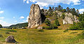 Burgstein
 Zwölf Apostel
 Weltenburger Enge
 Danube at Weltenburger Enge
 Villages and valleys
 Arzberg
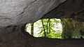 Cave-systems
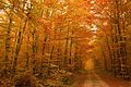 Autumn in Harburger Karab forest
 Autumn at Galgenberg
 Figurenfeld sculpture park
 Nature park sign


.JPG)
.jpg)


_02.jpg)


