Broad Run–Little Georgetown Rural Historic District
Historic district in Virginia, United States
From Wikipedia, the free encyclopedia
The Broad Run–Little Georgetown Rural Historic District encompasses a large rural landscape in northeastern Fauquier County, Virginia, and a small portion of neighboring Prince William County, Virginia. The district covers about 9,500 acres (3,800 ha) of rolling hills, that has an agricultural history dating to the 18th century. It is roughly divided by the John Marshall Highway (Virginia State Route 55), and is bounded on the west by The Plains, the east by the Bull Run Mountains, and the south by Pignut Mountain.[2]

Broad Run–Little Georgetown Rural Historic District | |
Contributing building | |
    | |
| Location | Roughly bounded by The Plains, Bull Run Mountains, John Marshall Hwy., Bust Head Rd., and Hopewell Rd., near Broad Run, Virginia |
|---|---|
| Coordinates | 38°51′4″N 77°44′17″W |
| Area | 9,500 acres (3,800 ha) |
| NRHP reference No. | 16000205[1] |
| Added to NRHP | April 21, 2016 |
The district was listed on the National Register of Historic Places in 2016.[1] It includes two individually listed properties: Heflin's Store, and the Beverley Mill.[2]
Gallery
 Heflin's Store
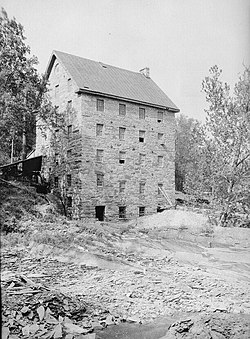 Beverley's Mill

.jpg)
