Carrera Séptima
Transit artery in Bogotá, Colombia
From Wikipedia, the free encyclopedia
Carrera Séptima (Seventh Carrera), also known as Alberto Lleras Camargo Avenue, is one of the principal transit arteries which crosses the eastern side of Bogotá north and south.[1] It is the most important thoroughfare of the city in the sense of history, culture, economy, and society. Seventh Street is bound to the east by the Eastern Hills. The road was part of the Camino Real de Santafé-Honda, a colonial royal way from Bogotá to Honda.[2][3]

 Bolívar Square and San Francisco Church on Carrera Séptima | |
  Location within Bogotá | |
| Location | Bogotá Colombia Colombia |
|---|---|
| Coordinates | 4°41′34″N 74°01′57″W |
| South end | Avenida Primero de Mayo |
| North end | Autopista Norte |
Points of interest

Seventh Street passes through the localities of Usaquén, Chapinero, Santa Fe, and La Candelaria.
Usaquén
- The Usaquén historic zone
- El Centro Comercial Hacienda Santa Bárbara
- El Centro Empresarial Santa Bárbara
- El Cantón Norte del Ejército
- El Complejo América Centro Mundial de Negocios
Chapinero
- Parque Museo del Chicó
- Avenida Chile (Calle 72) Financial District
- Universidad Distrital Francisco José de Caldas
- Pontifical Xavierian University
Santa Fe
- Parque Nacional Enrique Olaya Herrera (Parque Nacional)
- The National Museum of Colombia[4]
- Centro Internacional de Bogotá
- Centro Comercial Terraza Pasteur
- Torre Colpatria
- Banco de la República
- Iglesia de Las Nieves
- Iglesia de San Francisco [5]
- Parque Santander
La Candelaria
Gallery
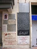 Memorial to Jorge Eliécer Gaitán
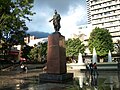 Statue of Francisco de Paula Santander in Santander Park
 José de San Martín Monument
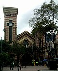 Nuestra Señora de las Nieves Church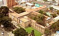


_y_la_Universidad_Colegio_Mayor_de_Cundinamarca_(atrás).jpg)
