| Community |
Airport name |
PU
PR
MI |
AOE[A] |
Operator |
Elevation |
ICAO |
TC
LID |
IATA |
Image |
Coordinates |
|---|
| Airdrie | Airdrie Aerodrome | PR | CANPASS[5] | Airdrie Airpark | 3,653 ft
(1,113 m) | | CEF4 | |  | 51°15′50″N 113°56′04″W |
| Airdrie | Airdrie/Waldhof Heliport | PR | | Don Bell | 3,690 ft
(1,120 m) | | CAW3 | | | 51°15′18″N 114°04′25″W |
| Alhambra | Alhambra/Ahlstrom Aerodrome | PU | | Ahlstrom Air | 3,212 ft
(979 m) | | CAM4 | | | 52°20′45″N 114°40′02″W |
| Athabasca | Athabasca Regional Airport | PU | | Athabasca County | 1,971 ft
(601 m) | CYWM | | | | 54°44′35″N 113°12′19″W |
| Athabasca oil sands | Anzac (Long Lake) Heliport | PR | | Nexen Energy | 1,612 ft
(491 m) | | CNZ2 | | | 56°25′27″N 110°57′52″W |
| Banff | Banff Airport | PR | | Parks Canada | 4,583 ft
(1,397 m) | CYBA | | |  | 51°12′00″N 115°32′00″W |
| Banff | Banff Mineral Springs (Hospital) Heliport | PR | | Alberta Health Services - Mineral Springs Hospital | 4,540 ft
(1,380 m) | | CBM7 | |  | 51°10′47″N 115°34′34″W |
| Banff | Banff (Park Compound) Heliport | PR | | Banff Park Warden Service | 4,570 ft
(1,390 m) | | CBP2 | | | 51°11′30″N 115°33′30″W |
| Barrhead | Barrhead Airport | PU | | County of Barrhead | 2,121 ft
(646 m) | | CEP3 | | | 54°05′49″N 114°26′20″W |
| Barrhead | Barrhead (Healthcare Centre) Heliport | PR | | Barrhead Healthcare Centre | 2,116 ft
(645 m) | | CHC3 | | | 54°07′06″N 114°24′01″W |
| Bashaw | Bashaw Airport | PR | | Town of Bashaw | 2,610 ft
(800 m) | | CFK2 | | | 52°33′27″N 112°57′53″W |
| Bassano | Bassano Airport | PU | | Town of Bassano | 2,613 ft
(796 m) | | CEN2 | | | 50°48′00″N 112°28′00″W |
| Bassano | Bassano (Health Centre) Heliport | PR | | Bassano Health Centre | 2,606 ft
(794 m) | | CBL4 | |  | 50°47′26″N 112°27′39″W |
| Bawlf | Bawlf (Blackwells) Airport | PU | | R. Blackwell | 2,325 ft
(709 m) | | CFR2 | | | 52°53′36″N 112°32′46″W |
| Beaverlodge | Beaverlodge Airport | PU | | North Peace Bracket Racing Association | 2,289 ft
(698 m) | | CEU2 | |  | 55°11′03″N 119°25′51″W |
| Beaverlodge | Beaverlodge/Clanachan Aerodrome | PU | | Jim Leask | 2,694 ft
(821 m) | | CLN4 | | | 55°14′04″N 119°50′31″W |
| Beiseker | Beiseker Airport | PU | | CFV2 Ltd. | 3,036 ft
(925 m) | | CFV2 | | | 51°23′36″N 113°28′19″W |
| Benalto | Benalto/Hillman's Farm Aerodrome | PU | | Gary Hillman | 3,020 ft
(920 m) | | CBH7 | | | 52°13′33″N 114°15′21″W |
| Birch Mountain | Birch Mountain Aerodrome | PU | | Alberta Sustainable Resource Development, Forest Protection Division, Fort McMurray | 2,600 ft
(790 m) | | CFM2 | | | 57°41′42″N 111°50′20″W |
| Bistcho Lake | Bistcho Airport | PR | | Strategic Oil and Gas | 1,951 ft
(595 m) | | CPB8 | | | 59°38′18″N 118°19′59″W |
| Black Diamond | Black Diamond/Cu Nim Airport | PU | | Cu Nim Gliding Club | 3,700 ft
(1,100 m) | | CEH2 | | | 50°43′21″N 114°10′46″W |
| Black Diamond | Black Diamond/Flying R Ranch Aerodrome | PU | | Doug Robertson | 4,060 ft
(1,240 m) | | CBD8 | | | 50°38′42″N 114°12′11″W |
| Black Diamond | Black Diamond (Oilfields General Hospital) Heliport | PR | | Alberta Health Services | 3,924 ft
(1,196 m) | | CFL3 | | | 50°40′39″N 114°14′05″W |
| Blackfalds | Lacombe (Mustang Helicopters) Heliport | PR | | Mustang Helicopters | 2,889 ft
(881 m) | | CMH3 | | | 52°22′44″N 113°49′21″W |
| Blackie | Blackie/McElroy Ranch Heliport | PR | | Tyler McElroy | 3,415 ft
(1,041 m) | | CMC5 | | | 50°37′52″N 113°35′30″W |
| Blackie | Blackie/Wilderman Farm Airport | PU | | W. E. Wilderman | 3,350 ft
(1,020 m) | | CFT2 | | | 50°33′09″N 113°35′48″W |
| Blairmore | Blairmore (Crowsnest Pass Hospital) Heliport | PR | | Alberta Health Services | 4,292 ft
(1,308 m) | | CBS9 | | | 49°36′58″N 114°27′26″W |
| Bonnyville | Bonnyville Aerodrome | PU | | Municipal District of Bonnyville No. 87 | 1,839 ft
(561 m) | CYBF | | | | 54°18′17″N 110°44′28″W |
| Bonnyville | Bonnyville Health Centre Heliport | PR | | Bonnyville Health Centre | 1,825 ft
(556 m) | | CBN2 | | | 54°15′50″N 110°44′25″W |
| Bottrel | Bottrel/Anchor 9 Ranch Aerodrome | PR | | Thomas Thomas | 4,252 ft
(1,296 m) | | CBR9 | | | 51°24′46″N 114°34′49″W |
| Bow Island | Bow Island Aerodrome | PU | | Town of Bow Island | 2,634 ft
(803 m) | | CEF3 | | | 49°53′00″N 111°20′00″W |
| Boyle | Boyle Airport | PU | | Village of Boyle | 2,154 ft
(657 m) | | CFM7 | | | 54°34′24″N 112°49′12″W |
| Brant | Brant (Dixon Farm) Airport | PR | | H. J. Dixon | 3,342 ft
(1,019 m) | | CEX9 | | | 50°25′10″N 113°32′27″W |
| Brooks | Brooks (Community Health Centre) Heliport | PR | | Brooks Community Health Centre | 2,498 ft
(761 m) | | CFV8 | | 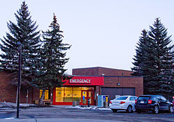 | 50°34′07″N 111°53′18″W |
| Brooks | Brooks Regional Aerodrome | PU | | City of Brooks | 2,491 ft
(759 m) | CYBP | | | | 50°38′01″N 111°55′33″W |
| Buffalo | Buffalo (Jaques Farms) Aerodrome | PU | | Arthur Jaques / Byron Jaques | 2,000 ft
(610 m) | | CJF4 | | | 50°51′39″N 110°39′18″W |
| Calgary | Calgary (Aerial Recon) Heliport | PR | | Eric Gould | 3,820 ft
(1,160 m) | | CAR3 | | | 50°52′05″N 114°08′17″W |
| Calgary | Calgary (Alberta Children's Hospital) Heliport | PR | | Alberta Health Services | 3,670 ft
(1,120 m) | | CAC6 | |  | 51°04′33″N 114°08′52″W |
| Calgary | Calgary/Blue Con Heliport | PR | | Matt Haasen | 3,440 ft
(1,050 m) | | CBC6 | | | 50°59′49″N 113°53′38″W |
| Calgary | Calgary (Bow Crow) Heliport | PR | | Sustainable Resource Development, Forest Protection Division | 3,540 ft
(1,080 m) | | CEP2 | | | 51°06′11″N 114°12′54″W |
| Calgary | Calgary/Eastlake Heliport | PR | | Al Morrison | 3,418 ft
(1,042 m) | | CEL9 | | | 50°57′18″N 113°58′22″W |
| Calgary | Calgary/Elephant Enterprises Inc. Heliport | PR | | Elephant Enterprises | 3,596 ft
(1,096 m) | | CEE2 | | | 51°06′55″N 114°17′44″W |
| Calgary | Calgary (Foothills Hospital McCaig Tower) Heliport | PR | | Alberta Health Services | 3,765 ft
(1,148 m) | | CMT3 | |  | 51°03′55″N 114°08′06″W |
| Calgary | Calgary/K. Coffey Residence Heliport | PR | | Ken Coffey | 4,204 ft
(1,281 m) | | CKC4 | | | 51°09′56″N 114°18′52″W |
| Calgary | Calgary (Peter Lougheed Centre) Heliport | PR | | Alberta Health Services | 3,684 ft
(1,123 m) | | CLC3 | | 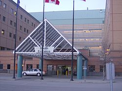 | 51°04′46″N 113°58′58″W |
| Calgary | Calgary (Rockyview Hospital) Heliport | PR | | Alberta Health Services | 3,590 ft
(1,090 m) | | CEM2 | |  | 50°59′18″N 114°05′54″W |
| Calgary | Calgary (South Health Campus Hospital) Heliport | PR | | Alberta Health Services | 3,486 ft
(1,063 m) | | CSH3 | | | 50°52′58″N 113°57′07″W |
| Calgary | Calgary/Springbank Airport (Springbank Airport) | PU | CANPASS[6] | Calgary Airport Authority | 3,940 ft
(1,200 m) | CYBW | CYBW | YBW | 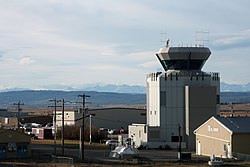 | 51°06′11″N 114°22′28″W |
| Calgary | YYC Calgary International Airport
(Calgary/YYC Calgary International Airport) | PU | AOE,[7] AOE/CARGO[8] | Transport Canada | 3,606 ft
(1,099 m) | CYYC | CYYC | YYC |  | 51°06′50″N 114°01′13″W |
| Calling Lake | Calling Lake Airport | PU | | Municipal District of Opportunity No. 17 | 2,092 ft
(638 m) | | CFK4 | | | 55°19′00″N 113°15′00″W |
| Calmar | Calmar/Wizard Lake Aerodrome | PU | | Rivervista Ventures | 2,600 ft
(790 m) | | CWL3 | | | 53°06′57″N 113°46′19″W |
| Calmar | Edmonton/Calmar (Maplelane Farm) Aerodrome | PU | | Howard Lengert | 2,520 ft
(770 m) | | CMF2 | | | 53°11′04″N 113°44′22″W |
| Camrose | Camrose Airport | PU | | City of Camrose | 2,426 ft
(739 m) | | CEQ3 | | | 53°02′23″N 112°48′58″W |
| Camrose | Camrose/St. Mary's Hospital Heliport | PR | | FM&E Covenant Health | 2,428 ft
(740 m) | | CMR6 | | | 53°00′54″N 112°49′49″W |
| Camrose | Canmore (Hospital) Heliport | PR | | Alberta Health Services | 4,305 ft
(1,312 m) | | CCH3 | |  | 51°05′33″N 115°20′58″W |
| Canmore | Canmore Municipal Heliport | PU | | Canmore (Alpine) Heliport | 4,296 ft
(1,309 m) | | CEW9 | | | 51°04′43″N 115°20′20″W |
| Canmore | Canmore/Nakoda Heliport | PU | | Alpine Helicopters | 4,260 ft
(1,300 m) | | CNK7 | | | 51°06′12″N 115°00′44″W |
| Cardston | Cardston Airport | PU | | Cardston County | 3,887 ft
(1,185 m) | | CEA6 | | | 49°09′45″N 113°14′28″W |
| Carstairs | Carstairs/Bishell's Airport | PU | | G & A Bishell | 3,400 ft
(1,000 m) | | CGB2 | | | 51°34′58″N 114°03′07″W |
| Carway | Carway/Grizzly Creek Ranch Heliport | PR | | Mark Pilling | 4,683 ft
(1,427 m) | | CGC4 | | | 49°00′16″N 113°30′19″W |
| Castor | Castor Airport | PU | | Town of Castor | 2,704 ft
(824 m) | | CER2 | | | 52°13′00″N 111°56′00″W |
| Cayley | Cayley/A. J. Flying Ranch Airport | PR | | A.J. Flying Ranch | 3,450 ft
(1,050 m) | | CAJ7 | | | 50°27′00″N 113°45′00″W |
| Cheadle | Cheadle/Country Lane Farms Aerodrome | PR | | Jerry Kamphuis | 3,250 ft
(990 m) | | CLF2 | | | 51°02′29″N 113°33′16″W |
| Chestermere | Chestermere (Kirkby Field) Airport | PR | | Bob Kirkby | 3,339 ft
(1,018 m) | | CFX8 | |  | 51°02′30″N 113°45′06″W |
| Chipewyan Lake | Chipewyan Lake Airport | PU | | Municipal District 17 | 1,800 ft
(550 m) | | CEG5 | | | 56°57′09″N 113°29′44″W |
| Chipman | Chipman Airport | PU | | Edmonton Soaring Club | 2,195 ft
(669 m) | | CFU3 | | | 53°43′00″N 112°38′00″W |
| Chipman | Chipman/M.Y. Airfield | PR | | Mark Yashchyshyn | 2,214 ft
(675 m) | | CMY2 | | | 53°38′11″N 112°36′03″W |
| Christina Basin | Christina Basin Airport | PU | | Alberta Sustainable Resource Development, Forest Protection Division, Lac La Biche | 2,365 ft
(721 m) | | CFF2 | | | 55°35′24″N 111°49′23″W |
| Christina Lake | Christina Lake Aerodrome | PR | | MEG Energy Corp | 1,905 ft
(581 m) | | CCL3 | | | 55°37′43″N 110°44′59″W |
| Clairmont | Clairmont/Meyer’s Airstrip | PR | | Arnie & Susan Meyer | 2,234 ft
(681 m) | | CMY3 | | | 55°17′12″N 118°49′36″W |
| Claresholm | Claresholm (General Hospital) Heliport | PR | | Alberta Health Services | 3,383 ft
(1,031 m) | | CFV7 | | | 50°01′06″N 113°34′59″W |
| Claresholm | Claresholm Industrial Airport
(RCAF Station Claresholm) | PR | | Municipal District of Willow Creek | 3,325 ft
(1,013 m) | | CEJ4 | | | 50.00360°N 113.62781°W / 50.00360; -113.62781 (Claresholm Industrial Airport) |
| Clearwater River | Clearwater River Airport | PR | | Olds-Didsbury Flying Association | 4,100 ft
(1,200 m) | | CFS8 | | | 51°59′17″N 115°13′42″W |
| Cline River | Cline River Heliport | PR | | Rockies Heli Tours Canada | 4,386 ft
(1,337 m) | | CCR5 | | | 52°10′44″N 116°28′45″W |
| Coaldale | Coaldale (Rednek Air) Aerodrome | PR | | Larry Oddan | 2,820 ft
(860 m) | | CRD2 | | | 49°49′18″N 112°31′50″W |
| Cochrane | Cochrane/Arkayla Springs Airport | PR | | Rod Keller | 4,000 ft
(1,200 m) | | CKY8 | | | 51°12′17″N 114°46′28″W |
| Cold Lake | CFB Cold Lake
(Cold Lake/Group Captain R.W. McNair Airport) | MI | AOE/M[9] | Royal Canadian Air Force | 1,775 ft
(541 m) | CYOD | CYOD | YOD |  | 54°24′19″N 110°16′56″W |
| Cold Lake | Cold Lake Healthcare Centre Heliport | PR | | Alberta Health Services | 1,706 ft
(520 m) | | CCH9 | | | 54°29′06″N 110°11′44″W |
| Cold Lake | Cold Lake Regional Airport | PU | | City of Cold Lake | 1,787 ft
(545 m) | | CEN5 | | | 54°28′39″N 110°16′07″W |
| Cold Lake | Cold Lake/Three Bears Landing Aerodrome | PU | | Robert A. Pionteck | 1,841 ft
(561 m) | | CTB8 | | | 54°16′24″N 110°09′45″W |
| Conklin | Conklin (Leismer) Airport | PR | | Leismer Aerodrome | 1,913 ft
(583 m) | | CET2 | | | 55°41′46″N 111°16′46″W |
| Consort | Consort Airport | PU | | Consort | 2,499 ft
(762 m) | | CFG3 | | | 52°01′27″N 110°44′56″W |
| Consort | Consort (Health Centre) Heliport | PR | | FM&E AHS | 2,445 ft
(745 m) | | CCS2 | | | 52°00′33″N 110°46′55″W |
| Coronation | Coronation Airport | PU | | Town of Coronation | 2,595 ft
(791 m) | CYCT | | | | 52°04′30″N 111°26′43″W |
| Coronation | Coronation (Health Centre) Heliport | PR | | FM&E AHS | 2,618 ft
(798 m) | | CRH2 | | | 52°05′46″N 111°27′34″W |
| Coutts | Coutts/Ross International Airport | PU | 15[10] | Montana Aeronautics Division | 3,552 ft
(1,083 m) | | CEP4 | | | 48°59′54″N 111°58′42″W |
| Cowley | Cowley Airport | PU | | Alberta Soaring Council | 3,876 ft
(1,181 m) | CYYM | | | | 49°38′11″N 114°05′40″W |
| Daysland | Daysland Health Centre Heliport | PR | | Alberta Health Services | 2,318 ft
(707 m) | | CDL3 | | | 52°52′08″N 112°16′22″W |
| DeBolt | DeBolt Aerodrome | PU | | Municipal District of Greenview No. 16 | 2,120 ft
(650 m) | | CFG4 | | | 55°14′00″N 118°02′00″W |
| DeBolt | DeBolt Fire Hall Heliport | PR | | Municipal District of Greenview No. 16 | 2,093 ft
(638 m) | | CDB2 | | | 55°13′00″N 118°01′46″W |
| Del Bonita | Del Bonita/Whetstone International Airport | PU | 15[11] | Montana DOT Aeronautics Division | 4,336 ft
(1,322 m) | | CEQ4 | | | 48°59′55″N 112°46′34″W |
| Delburne | Delburne/Hall Residence Heliport | PR | | Dean Hall | 2,769 ft
(844 m) | | CDB3 | | | 52°14′11″N 113°24′32″W |
| Delburne | Delburne/Stonehill Farms Aerodrome | PR | | Jeff Deuchar | 2,933 ft
(894 m) | | CSF6 | | | 52°08′19″N 113°17′31″W |
| De Winton | De Winton (Hamlet) Heliport | PR | | Mike Holcroft | 3,593 ft
(1,095 m) | | CDW3 | | | 50°49′35″N 114°01′26″W |
| De Winton | De Winton (Highwood) Heliport | PR | | 2124068 Alberta | 3,435 ft
(1,047 m) | | CED6 | | | 50°48′11″N 113°53′34″W |
| De Winton | De Winton/South Calgary Airport
(RAF Station De Winton) | PR | | Cordillera Petroleum of Canada | 3,355 ft
(1,023 m) | | CEH4 | | | 50°49′19″N 113°49′28″W |
| Didsbury | Didsbury District Health Services Heliport | PR | | Alberta Health Services | 3,374 ft
(1,028 m) | | CDD7 | | | 51°39′42″N 114°07′22″W |
| Didsbury | Didsbury/Minty Field Aerodrome | PR | | C Minty | 3,501 ft
(1,067 m) | | CDM2 | | | 51°39′12″N 114°21′04″W |
| Donnelly | Donnelly Airport | PU | | Smoky River Airport Commission | 1,950 ft
(590 m) | | CFM4 | | | 55°42′34″N 117°05′40″W |
| Drayton Valley | Drayton Valley (Hospital & Care Centre) Heliport | PR | | Alberta Health Services | 2,882 ft
(878 m) | | CFV9 | | | 53°12′44″N 114°58′15″W |
| Drayton Valley | Drayton Valley Industrial Airport | PU | | Town of Drayton Valley | 2,774 ft
(846 m) | | CER3 | | | 53°15′48″N 114°57′31″W |
| Drumheller | Drumheller (Health Centre) Heliport | PR | | Alberta Health Services | 2,246 ft
(685 m) | | CDH2 | | | 51°28′09″N 112°43′42″W |
| Drumheller | Drumheller Municipal Airport | PU | | Town of Drumheller | 2,599 ft
(792 m) | | CEG4 | | | 51°29′47″N 112°44′55″W |
| Eaglesham | Eaglesham/Bice Farm Aerodrome | PR | | Terrence or Christine Bice | 1,932 ft
(589 m) | | CBI2 | | | 55°41′50″N 117°56′21″W |
| Eaglesham | Eaglesham/Codesa South Aerodrome | PR | | Gary Sanocki | 2,000 ft
(610 m) | | CCP7 | | | 55°43′12″N 118°02′22″W |
| Eaglesham | Eaglesham/Delta Tango Field Aerodrome | PR | | David Suter | 1,850 ft
(560 m) | | CDT8 | | | 55°48′33″N 117°53′35″W |
| Eaglesham | Eaglesham South Aerodrome | PR | | Edmond Pawluski | 1,920 ft
(590 m) | | CGL4 | | | 55°40′16″N 117°56′08″W |
| Edmonton | Edmonton (City) Heliport | PR | | City of Edmonton | 2,254 ft
(687 m) | | CCE7 | | | 53°22′09″N 113°39′49″W |
| Edmonton Metropolitan Region | Edmonton/Gartner Airport | PR | | L. Gartner | 2,390 ft
(730 m) | | CFQ7 | | | 53°16′54″N 113°27′18″W |
| Edmonton | Edmonton/Grey Nuns Community Hospital Heliport | PR | | Covenant Health | 2,274 ft
(693 m) | | CES8 | |  | 53°27′44″N 113°25′40″W |
| Edmonton | Edmonton/Kelsonae Heliport | PR | | Sunwapta Helicopters | 2,325 ft
(709 m) | | CSG6 | | | 53°21′58″N 113°50′16″W |
| Edmonton | Edmonton/Misericordia (Community Hospital) Heliport | PR | | Covenant Health | 2,215 ft
(675 m) | | CMC2 | | | 53°31′13″N 113°36′40″W |
| Edmonton | Edmonton/Morinville (Currie Field) Aerodrome | PU | | Scott Currie | 2,374 ft
(724 m) | | CCF6 | | | 53°49′11″N 113°45′39″W |
| Edmonton | Edmonton/Morinville (Mike's Field) Aerodrome | PR | | Michael Poworoznik | 2,302 ft
(702 m) | | CMN6 | | | 53°50′13″N 113°33′48″W |
| Edmonton | CFB Edmonton (Edmonton/Namao Heliport) | MI | | 408 OPS Department of National Defence | 2,257 ft
(688 m) | CYED | CYED | YED |  | 53°40′09″N 113°28′32″W |
| Edmonton | Edmonton (Royal Alexandra Hospital) Heliport | PU | | Royal Alexandra Hospital | 2,254 ft
(687 m) | | CFH7 | |  | 53°33′28″N 113°29′47″W |
| Edmonton | Edmonton/Sturgeon Community Hospital Heliport | PR | | Alberta Health Services | 2,250 ft
(690 m) | | CSA3 | | | 53°39′17″N 113°37′38″W |
| Edmonton | Edmonton/University of Alberta (Stollery Children's Hospital) Heliport | PR | | Alberta Health Services | 2,367 ft
(721 m) | | CEW7 | |  | 53°31′13″N 113°31′19″W |
| Edra | Edra Airport | PU | | Alberta Sustainable Resource Development,
Forestry and Emergency Response Division, Fort McMurray | 2,652 ft
(808 m) | | CEV2 | | | 57°51′00″N 113°15′00″W |
| Edson | Edson Airport | PU | | Town of Edson | 3,043 ft
(928 m) | CYET | | YET | | 53°34′44″N 116°27′54″W |
| Elk Point | Elk Point Airport | PU | | County of St. Paul No. 19 | 1,981 ft
(604 m) | | CEJ6 | | | 53°53′35″N 110°46′22″W |
| Elk Point | Elk Point (Healthcare Centre) Heliport | PR | | Alberta Health Services | 1,980 ft
(600 m) | | CEP7 | | | 53°53′54″N 110°54′29″W |
| Empress | Empress Airport | PU | | Village of Empress | 2,212 ft
(674 m) | CYEA | | |  | 50°56′01″N 110°00′49″W |
| Fairview | Fairview Airport | PU | | Municipal District of Fairview No. 136 | 2,169 ft
(661 m) | | CEB5 | | | 56°04′53″N 118°26′00″W |
| Foremost | Foremost Airport | PU | | Village of Foremost | 2,909 ft
(887 m) | | CFD4 | | | 49°28′59″N 111°29′40″W |
| Fort Chipewyan | Fort Chipewyan Airport | PU | | Regional Municipality of Wood Buffalo | 761 ft
(232 m) | CYPY | | YPY | | 58°46′02″N 111°07′02″W |
| Fort Macleod | Fort Macleod Airport
(RCAF Station Fort Macleod) | PU | | Town of Fort Macleod | 3,138 ft
(956 m) | | CEY3 | | | 49°42′00″N 113°25′00″W |
| Fort Macleod | Fort Macleod (Alcock Farm) Airport | PR | | Jim Alcock | 3,335 ft
(1,017 m) | | CFM8 | | | 49°35′00″N 113°18′00″W |
| Fort Macleod | Fort Macleod (Hospital) Heliport | PR | | Alberta Health Services | 3,095 ft
(943 m) | | CFM9 | | | 49°43′32″N 113°23′32″W |
| Fort McKay | Fort MacKay/Albian Aerodrome | PR | | Canadian Natural Upgrading | 1,048 ft
(319 m) | | CAL4 | | | 57°13′26″N 111°25′08″W |
| Fort McKay | Fort MacKay/Firebag Aerodrome | PR | | Suncor Energy | 1,762 ft
(537 m) | CYFI | | YFI | | 57°16′33″N 110°58′36″W |
| Fort McKay | Fort MacKay/Horizon Airport | PR | | Canadian Natural Resources Limited | 916 ft
(279 m) | CYNR | | | | 57°22′54″N 111°42′04″W |
| Fort McMurray | Fort McMurray International Airport | PU | | Fort McMurray Airport Authority | 1,211 ft
(369 m) | CYMM | | YMM |  | 56°39′12″N 111°13′24″W |
| Fort McMurray | Fort McMurray (Legend) Aerodrome | PR | | Athabasca Oil Corporation | 2,061 ft
(628 m) | | CLG7 | | | 57°11′49″N 112°53′44″W |
| Fort McMurray | Fort McMurray (North Liege) Aerodrome | PR | | Athabasca Oil Corporation | 2,236 ft
(682 m) | | CNL2 | | | 57°08′10″N 113°17′23″W |
| Fort McMurray | Fort McMurray/Northern Lights Regional Health Centre Heliport | PR | | Alberta Health Services | 850 ft
(260 m) | | CNO9 | | | 56°43′01″N 111°21′35″W |
| Fort McMurray | Fort McMurray (South Liege) Aerodrome | PR | | Athabasca Oil Corporation | 1,707 ft
(520 m) | | CLS3 | | | 56°49′56″N 113°05′55″W |
| Fort McMurray | Fort McMurray Water Aerodrome | PU | | McMurray Aviation | 795 ft
(242 m) | | CES7 | | | 56°43′58″N 111°22′39″W |
| Fort Saskatchewan | Fort Saskatchewan (Community Hospital) Heliport | PR | | Alberta Health Services | 2,055 ft
(626 m) | | CSV4 | |  | 53°41′35″N 113°12′37″W |
| Fort Vermilion | Fort Vermilion/Country Gardens B&B Heliport | PU | | Daryl & Marg Zielsdorf | 915 ft
(279 m) | | CKV9 | | | 58°21′02″N 115°56′57″W |
| Fort Vermilion | Fort Vermilion (Wop May Memorial) Aerodrome | PU | | Mackenzie County | 843 ft
(257 m) | | CEZ4 | |  | 58°24′15″N 115°57′03″W |
| Fox Creek | Fox Creek Airport | PU | | Town of Fox Creek | 2,842 ft
(866 m) | | CED4 | | | 54°22′48″N 116°45′59″W |
| Fox Lake | Fox Lake Airport | PR | | Little Red River Cree Nation | 834 ft
(254 m) | | CEC3 | | | 58°28′23″N 114°32′39″W |
| Garden River | Garden River Airport | PR | | Little Red River Cree Nation | 790 ft
(240 m) | | CFU4 | | | 58°42′50″N 113°52′34″W |
| Glenwood | Glenwood Aerodrome | PR | | George Porter | 3,606 ft
(1,099 m) | | CGW2 | | | 49°21′16″N 113°39′44″W |
| Gordon Lake | Gordon Lake Airport | PU | | Environment and Sustainable Resource Development | 1,600 ft
(490 m) | | CFW2 | | | 56°37′00″N 110°30′00″W |
| Grande | Grande Airport | PU | | Environment and Sustainable Resource Development | 1,750 ft
(530 m) | | CFA5 | | | 56°18′00″N 112°14′00″W |
| Grande Cache | Grande Cache (Community Health Complex) Heliport | PR | | Environment and Sustainable Resource Development | 4,136 ft
(1,261 m) | | CGC3 | | | 53°53′28″N 119°07′08″W |
| Grande Prairie | Grande Prairie Airport | PU | | Grande Prairie Airport Commission | 2,196 ft
(669 m) | CYQU | | YQU |  | 55°10′55″N 118°53′14″W |
| Grande Prairie | Grande Prairie Regional Hospital Heliport | PR | | Grande Prairie Regional Hospital | 2,180 ft
(660 m) | | CGP4 | | | 55°10′34″N 118°47′16″W |
| Grimshaw | Grimshaw Airport | PU | | Grimshaw Flying Club / Darren Kuester | 2,050 ft
(620 m) | | CFD5 | | | 56°11′46″N 117°37′31″W |
| Grovedale | Grovedale Fire Hall Heliport | PR | | Municipal District of Greenview No. 16 | 2,182 ft
(665 m) | | CGR8 | | | 55°01′18″N 118°51′43″W |
| Half Moon Lake | Edmonton/Twin Island Airpark | PR | | Twin Island Resident's Association | 2,435 ft
(742 m) | | CEE6 | |  | 53°28′16″N 113°09′16″W |
| Halkirk | Halkirk/Paintearth (Fetaz) Aerodrome | PR | | Gerard and Donna Fetaz | 2,458 ft
(749 m) | | CPE8 | | | 52°22′58″N 112°00′06″W |
| Hanna | Hanna Airport | PU | | Town of Hanna | 2,738 ft
(835 m) | | CEL4 | | | 51°37′56″N 111°54′17″W |
| Hanna | Hanna (Health Centre) Heliport | PR | | Alberta Health Services | 2,687 ft
(819 m) | | CHD3 | | | 51°39′04″N 111°55′44″W |
| Hardisty | Hardisty Airport | PU | | Town of Hardisty | 2,324 ft
(708 m) | | CEA5 | |  | 52°38′48″N 111°23′08″W |
| Hardisty | Hardisty (Health Centre) Heliport | PR | | FM&E AHS | 2,080 ft
(630 m) | | CHD2 | | | 52°40′08″N 111°18′25″W |
| Hespero | Hespero Airport | PU | | Skocdopole Construction | 3,175 ft
(968 m) | | CFB3 | | | 52°18′00″N 114°27′49″W |
| Hespero | Hespero/Safron Residence Heliport | PR | | Terry Safron | 3,192 ft
(973 m) | | CTS6 | | | 52°16′49″N 114°25′41″W |
| High Level | High Level Airport | PU | | Town of High Level | 1,109 ft
(338 m) | CYOJ | | YOJ |  | 58°37′17″N 117°09′53″W |
| High Level | High Level (Monashee Helicopters) Heliport | PR | | Monashee Helicopters | 1,060 ft
(320 m) | | CHL5 | | | 58°30′51″N 117°06′53″W |
| High Prairie | High Prairie Airport | PU | | Big Lakes County | 1,975 ft
(602 m) | CZHP | | | | 55°23′37″N 116°28′30″W |
| High River | High River (Hospital) Heliport | PR | | Alberta Health Services | 3,407 ft
(1,038 m) | | CHR2 | | | 50°34′34″N 113°52′46″W |
| High River | Foothills Regional Aerodrome | PU | | Foothills County | 3,447 ft
(1,051 m) | | CEN4 | | | 50°32′00″N 113°50′27″W |
| Hill Spring | Hillspring (Beck Farm) Aerodrome | PR | | Jim Beck | 3,700 ft
(1,100 m) | | CHS3 | | | 49°20′12″N 113°34′24″W |
| Hinton | Hinton/Entrance Airport | PU | | Hinton Flying Club | 3,450 ft
(1,050 m) | | CEE4 | | | 53°22′53″N 117°42′04″W |
| Hinton | Hinton/Jasper-Hinton Airport | PU | | Yellowhead County | 4,006 ft
(1,221 m) | | CEC4 | | | 53°19′08″N 117°45′11″W |
| Huggett | Huggett/Goodwood Field Aerodrome | PU | | Geffo Building | 2,390 ft
(730 m) | | CGF5 | | | 53°20′43″N 114°09′21″W |
| Indus | Indus/Winters Aire Park Airport | PR | | Blue Yonder Aviation | 3,370 ft
(1,030 m) | | CFY4 | |  | 50°54′00″N 113°47′00″W |
| Innisfail | Innisfail/Big Bend Aerodrome (Big Bend Airport) | PU | | Innisfail Flying Club | 3,017 ft
(920 m) | | CEM4 | | | 52°04′43″N 114°01′39″W |
| Innisfail | Innisfail (Hospital) Heliport | PU | | Town of Innisfail | 3,138 ft
(956 m) | | CSF2 | | | 52°01′10″N 113°57′13″W |
| Janvier | Janvier Airport | PU | | Municipality of Wood Buffalo | 157 ft
(48 m) | | CEP5 | | | 55°54′00″N 110°44′00″W |
| Jasper | Jasper Airport | PR | | Superintendent, Jasper National Park | 3,350 ft
(1,020 m) | CYJA | | |  | 52°59′48″N 118°03′34″W |
| Jean Lake | Jean Lake Airport | PU | | Environment and Sustainable Resource Development | 2,370 ft
(720 m) | | CFF3 | | | 57°29′00″N 113°53′00″W |
| John D'Or Prairie | John D'Or Prairie Aerodrome | PR | | Little Red River Cree Nation | 950 ft
(290 m) | | CFG5 | | | 58°29′29″N 115°08′18″W |
| Johnson Lake | Johnson Lake Airport | PU | | Environment and Sustainable Resource Development | 2,000 ft
(610 m) | | CFL9 | | | 57°34′00″N 110°19′00″W |
| Josephburg | Edmonton/Josephburg Aerodrome | PU | | Strathcona County | 2,069 ft
(631 m) | | CFB6 | | | 53°43′41″N 113°05′13″W |
| Kananaskis Village | Kananaskis Village Helistop Heliport | PU | | Alberta Environment & Sustainable Development - Parks Division, Kananaskis Region | 5,027 ft
(1,532 m) | | CFE7 | | | 50°55′22″N 115°08′37″W |
| Killam | Killam (Health Centre) Heliport | PR | | FM&E Covenant Health | 2,222 ft
(677 m) | | CKH5 | | | 52°47′15″N 111°51′35″W |
| Killam | Killam-Sedgewick/Flagstaff Regional Airport | PU | | Flagstaff County | 2,181 ft
(665 m) | | CEK6 | | | 52°47′44″N 111°45′38″W |
| Kirby Lake | Kirby Lake Aerodrome | PR | | Canadian Natural Resources | 2,260 ft
(690 m) | | CRL4 | | | 55°21′20″N 110°38′15″W |
| La Crete | La Crete (Jake Fehr Memorial) Aerodrome | PU | | Mackenzie County | 1,048 ft
(319 m) | | CFN5 | | | 58°10′00″N 116°20′00″W |
| Lac La Biche | Lac La Biche Airport | PU | | County of Lac La Biche | 1,884 ft
(574 m) | CYLB | | | | 54°46′13″N 112°01′54″W |
| Lacombe | Lacombe Regional Airport | PU | | Lacombe Flying Club | 2,785 ft
(849 m) | | CEG3 | | | 52°29′19″N 113°42′42″W |
| Lamont | Lamont (Health Care Centre) Heliport | PR | | Alberta Health Services | 2,124 ft
(647 m) | | CLM4 | | | 53°45′49″N 112°45′15″W |
| Leslieville | Leslieville/W. Pidhirney Residence Heliport | PR | | Wayne Pidhirney | 3,130 ft
(950 m) | | CWP3 | | | 52°21′33″N 114°34′17″W |
| Lethbridge | Lethbridge Airport | PU | CANPASS[12] | City of Lethbridge | 3,049 ft
(929 m) | CYQL | | YQL | | 49°37′49″N 112°47′59″W |
| Lethbridge | Lethbridge (Chinook Regional Hospital) Heliport | PR | | Alberta Health Services | 3,037 ft
(926 m) | | CLH4 | | | 49°41′09″N 112°49′00″W |
| Lethbridge | Lethbridge (Gunnlaugson) Aerodrome | PR | | Dalyce and Jim Hubek | 3,058 ft
(932 m) | | CGN3 | | | 49°38′10″N 112°41′29″W |
| Lethbridge | Lethbridge (J3 Airfield) Aerodrome | PR | | Ron Janzen | 2,910 ft
(890 m) | | CLJ3 | | | 49°44′30″N 112°44′22″W |
| Lethbridge | Lethbridge (Mercer Field) Aerodrome | PR | | Ryan Mercer | 3,085 ft
(940 m) | | CMF3 | | | 49°33′17″N 112°33′49″W |
| Lethbridge | Lethbridge (Taylor Field) Aerodrome | PR | | Kimberly Taylor | 2,980 ft
(910 m) | | CTF6 | | | 49°42′58″N 112°45′02″W |
| Lloydminster | Lloydminster Airport | PU | | City of Lloydminster | 2,194 ft
(669 m) | CYLL | | YLL |  | 53°18′33″N 110°04′21″W |
| Loon River | Loon River Airport | PU | | Alberta Sustainable Resource Development, Forest Protection Division, Slave Lake | 1,550 ft
(470 m) | | CFS6 | | | 57°08′31″N 115°04′31″W |
| Manning | Manning Airport | PU | | County of Northern Lights | 1,612 ft
(491 m) | | CFX4 | | | 56°57′03″N 117°38′39″W |
| Margaret Lake | Margaret Lake Airport | PR | | Little Red River Cree Nation | 2,750 ft
(840 m) | | CFV6 | | | 58°57′00″N 115°15′00″W |
| Markerville | Markerville/Safron Farms Aerodrome | PR | | Dan / Cindy Safron | 2,995 ft
(913 m) | | CSF5 | | | 52°11′57″N 114°14′15″W |
| Mayerthorpe | Mayerthorpe Airport | PU | | Lac Ste. Anne County | 2,432 ft
(741 m) | | CEV5 | | | 53°56′15″N 115°10′44″W |
| Mayerthorpe | Mayerthorpe (Healthcare Centre) Heliport | PR | | Mayerthorpe Healthcare Centre | 2,351 ft
(717 m) | | CMC3 | | | 53°56′56″N 115°07′59″W |
| Medicine Hat | Medicine Hat Airport | PU | | Municipality of Medicine Hat | 2,351 ft
(717 m) | CYXH | | YXH |  | 50°01′08″N 110°43′14″W |
| Medicine Hat | Medicine Hat (Regional Hospital) Heliport | PR | | Alberta Health Services | 2,423 ft
(739 m) | | CMH5 | |  | 50°02′07″N 110°42′07″W |
| Medicine Hat | Medicine Hat/Schlenker Airport | PU | | Sherry Irvine | 2,375 ft
(724 m) | | CFZ3 | | | 49°58′20″N 110°43′25″W |
| Milk River | Milk River Airport | PU | CANPASS[13] | Town of Milk River | 3,449 ft
(1,051 m) | | CEW5 | | | 49°08′00″N 112°03′00″W |
| Mobil Bistcho | Mobil Bistcho Airport | PU | | Alberta Sustainable Resource Development,
Forest Operations Branch, High Level | 2,000 ft
(610 m) | | CFV3 | | | 59°29′00″N 119°01′00″W |
| Muskeg Tower | Muskeg Tower Airport | PU | | Alberta Sustainable Resource Development,
Forestry and Emergency Response Division, Fort McMurray | 2,020 ft
(620 m) | | CFW4 | | | 57°08′15″N 110°53′33″W |
| Nampa | Nampa/Hockey Aerodrome | PR | | Burt Hockey | 2,050 ft
(620 m) | | CNP6 | | | 55°54′52″N 117°08′07″W |
| Namur Lake | Namur Lake Airport | PU | | Namur Lake Lodge, Fort McMurray | 2,560 ft
(780 m) | | CFB5 | | | 57°23′00″N 112°48′00″W |
| Nisku | Edmonton International Airport | PU | AOE,[14] AOE/CARGO[15] | Edmonton Airports | 2,373 ft
(723 m) | CYEG | | YEG |  | 53°18′35″N 113°34′47″W |
| Nordegg | Nordegg/Ahlstrom Heliport | PU | | Ahlstrom Air | 4,411 ft
(1,344 m) | | CEG6 | | | 52°29′29″N 116°03′06″W |
| Okotoks | Calgary/Christiansen Field Aerodrome | PR | | Soren Christiansen | 3,820 ft
(1,160 m) | | CRS3 | | | 50°47′58″N 114°03′04″W |
| Okotoks | Calgary/Okotoks Air Ranch Airport | PR | | OAR GP INC. | 3,601 ft
(1,098 m) | | CFX2 | | | 50°44′02″N 113°56′04″W |
| Okotoks | Calgary/Okotoks (GG Ranch) Heliport | PR | | Brian Van Humbeck | 3,622 ft
(1,104 m) | | COK2 | | | 50°44′41″N 113°59′30″W |
| Okotoks | Calgary/Okotoks (Rowland Field) Aerodrome | PR | | W Rowland | 3,800 ft
(1,200 m) | | CRF4 | | | 50°45′53″N 113°57′29″W |
| Olds | Olds-Didsbury Airport | PU | | KS2 Management | 3,360 ft
(1,020 m) | | CEA3 | | | 51°42′40″N 114°06′24″W |
| Olds / Didsbury | Olds (Hospital) Heliport | PR | | Alberta Health Services | 3,390 ft
(1,030 m) | | CFU9 | | | 51°48′05″N 114°07′00″W |
| Olds | Olds (Netook) Airport | PU | | Air Cadet League of Canada | 3,330 ft
(1,010 m) | | CFK6 | | | 51°50′51″N 114°03′53″W |
| Oyen | Oyen Municipal Airport | PU | | Town of Oyen | 2,495 ft
(760 m) | | CED3 | | | 51°20′05″N 110°29′24″W |
| Parkland County | Edmonton Parkland Executive Airport | PU | | Edmonton Parkland Executive Airport | 2,330 ft
(710 m) | CYEP | | | | 53°28′27″N 113°49′27″W |
| Peace River | Peace River Airport | PU | | Peace River Regional Airport Authority | 1,872 ft
(571 m) | CYPE | | YPE | | 56°13′37″N 117°26′50″W |
| Pincher Creek | Pincher Creek Airport | PU | | Municipal District of Pincher Creek | 3,903 ft
(1,190 m) | CZPC | | | | 49°31′14″N 113°59′46″W |
| Pincher Creek | Pincher Creek (Hospital) Heliport | PR | | Alberta Health Services | 3,754 ft
(1,144 m) | | CPR8 | | | 49°29′33″N 113°56′51″W |
| Ponoka | Ponoka (Hospital & Care Centre) Heliport | PR | | FM&E AHS | 2,676 ft
(816 m) | | CHC4 | | | 52°41′07″N 113°35′22″W |
| Ponoka | Ponoka (Labrie Field) Airport | PU | CANPASS[16] | Ponoka Flying Club | 2,669 ft
(814 m) | | CEH3 | | | 52°39′07″N 113°36′16″W |
| Primrose | Primrose Aerodrome | PR | | Canadian Natural Resources | 2,304 ft
(702 m) | | CFN6 | | | 55°23′26″N 111°07′13″W |
| Provost | Provost Airport | PU | | Municipal District of Provost | 2,200 ft
(670 m) | | CEH6 | | | 52°20′15″N 110°16′40″W |
| Rainbow Lake | Rainbow Lake Airport | PU | | Town of Rainbow Lake | 1,757 ft
(536 m) | CYOP | | | | 58°29′28″N 119°24′24″W |
| Red Deer | Red Deer/Allan Dale Residence Heliport | PR | | Allan Dale | 3,123 ft
(952 m) | | CAD2 | | | 52°16′11″N 113°41′59″W |
| Red Deer | Red Deer/Allan Dale Trailers & RV Heliport | PR | | Allan Dale | 2,936 ft
(895 m) | | CAD3 | | | 52°18′32″N 113°51′48″W |
| Red Deer | Red Deer/Chong Residence Heliport | PR | | Glenn Chong | 2,856 ft
(871 m) | | CRE5 | | | 52°21′00″N 113°56′01″W |
| Red Deer | Red Deer/Leblanc Heliport | PR | | Marcel LeBlanc | 3,028 ft
(923 m) | | CLB5 | | | 52°12′52″N 113°42′00″W |
| Red Deer | Red Deer Regional Airport | PU | | Red Deer Regional Airport Authority | 2,968 ft
(905 m) | CYQF | | YQF |  | 52°11′06″N 113°53′34″W |
| Red Deer | Red Deer Regional Hospital Centre Heliport | PR | | Alberta Health Services | 2,876 ft
(877 m) | | CRD3 | |  | 52°15′43″N 113°48′57″W |
| Red Deer | Red Deer/Truant Aerodrome | PR | | Mario Truant | 3,100 ft
(940 m) | | CRD5 | | | 52°17′19″N 113°54′42″W |
| Red Deer | Red Deer/Truant South Aerodrome | PU | | Mike Truant | 3,100 ft
(940 m) | | CRD6 | | | 52°16′40″N 113°54′55″W |
| Red Deer County | Antler Valley Farm Heliport | PR | | Antler Valley Farm | 3,040 ft
(930 m) | | CAV2 | | | 52°05′14″N 113°51′00″W |
| Red Earth Creek | Red Earth Creek Airport | PU | | Municipal District of Opportunity No. 17 | 1,789 ft
(545 m) | | CEH5 | | | 56°32′47″N 115°16′27″W |
| Redwater | Redwater (Health Centre) Heliport | PR | | Alberta Health Services | 2,083 ft
(635 m) | | CRW8 | | | 53°56′59″N 113°07′38″W |
| Redwater | Redwater (Heliworks) Heliport | PR | | Heliworks Aviation | 2,200 ft
(670 m) | | CRW2 | | | 53°55′09″N 113°06′15″W |
| Redwater | Redwater (Pembina) Heliport | PR | | Pembina Corporation | 2,081 ft
(634 m) | | CRP3 | | | 53°49′29″N 113°07′47″W |
| Rimbey | Rimbey Airport | PU | | R.V. Heaven & Marina | 2,963 ft
(903 m) | | CFC7 | | | 52°40′55″N 114°14′15″W |
| Rimbey | Rimbey (Hospital & Care Centre) Heliport | PR | | Alberta Health Services | 3,066 ft
(935 m) | | CRH5 | | | 52°38′25″N 114°14′50″W |
| Rocky Mountain House | Rocky Mountain House Airport | PU | | Town of Rocky Mountain House | 3,244 ft
(989 m) | CYRM | | YRM |  | 52°25′47″N 114°54′15″W |
| Rocky Mountain House | Rocky Mountain House (Health Centre) Heliport | PR | | FM&E AHS | 3,330 ft
(1,010 m) | | CEU4 | | | 52°22′44″N 114°55′15″W |
| Rockyford | Rockyford Airport | PU | | Katterhagen Farms | 2,860 ft
(870 m) | | CFC6 | | | 51°15′35″N 113°06′39″W |
| Rockyford | Rockyford/Early Bird Air Aerodrome | PR | | Calvin Murray | 2,870 ft
(870 m) | | CEB4 | | | 51°10′40″N 113°16′45″W |
| St. Albert | Edmonton/St. Albert (Delta Helicopters) Heliport | PR | | Delta Helicopters | 2,265 ft
(690 m) | | CES3 | | | 53°41′12″N 113°41′14″W |
| St. Paul | St. Paul Aerodrome | PU | | Town of St. Paul | 2,148 ft
(655 m) | | CEW3 | | | 53°59′36″N 111°22′49″W |
| St. Paul | St. Paul (Saint Therese Healthcare Centre) Heliport | PR | | Alberta Health Services | 2,113 ft
(644 m) | | CTP5 | | | 53°59′17″N 111°17′26″W |
| Sherwood Park | Edmonton/Bailey Heliport | PR | | Dan Jacobs | 2,392 ft
(729 m) | | CBY2 | | | 53°30′28″N 113°14′11″W |
| Sherwood Park | Edmonton/Eastport Heliport | PR | | Carol Mulkay | 2,367 ft
(721 m) | | CEP8 | | | 53°30′18″N 113°19′56″W |
| Shunda | Shunda (Fire Base) Heliport | PR | | FERD – Rocky Mountain House Wildfire Management Area | 4,690 ft
(1,430 m) | | CDA7 | | | 52°29′26″N 115°45′31″W |
| Slave Lake | Slave Lake Airport | PU | | Slave Lake Airport Services Commission | 1,912 ft
(583 m) | CYZH | | YZH | | 55°17′35″N 114°46′38″W |
| Slave Lake | Slave Lake/Slave Lake Helicopters Heliport | PR | | Slave Lake Helicopters | 1,902 ft
(580 m) | | CSL6 | | | 55°17′36″N 114°46′53″W |
| Smoky Lake | Smokey Lake (George McDougall Health Centre) Heliport | PR | | Alberta Health Services | 2,009 ft
(612 m) | | CGM2 | | | 54°07′18″N 112°27′57″W |
| South Cooking Lake | Edmonton/Cooking Lake Airport | PU | CANPASS[17] | Cooking Lake Condominium Association | 2,437 ft
(743 m) | | CEZ3 | |  | 53°25′39″N 113°06′57″W |
| South Cooking Lake | Edmonton/Cooking Lake Water Aerodrome | PU | | Cooking Lake Condominium Association | 2,419 ft
(737 m) | | CEE7 | |  | 53°25′22″N 113°06′16″W |
| Spirit River | Spirit River Airport | PU | | Town of Spirit River | 2,043 ft
(623 m) | | CFS5 | | | 55°47′02″N 118°50′27″W |
| Stettler | Stettler Airport | PU | | Town of Stettler and County of Stettler No. 6 | 2,688 ft
(819 m) | | CEJ3 | | | 52°18′36″N 112°45′16″W |
| Stettler | Stettler (Hospital & Care Centre) Heliport | PR | | Alberta Health Services | 2,694 ft
(821 m) | | CLH2 | | | 52°19′24″N 112°43′31″W |
| Stettler | Stettler/Lyster Field Aerodrome | PR | | Norman Lyster | 2,585 ft
(788 m) | | CLY3 | | | 52°23′28″N 112°36′15″W |
| Stony Plain | Stony Plain (Stony Field) Aerodrome | PU | | Ken and Maureen Lovsin | 2,415 ft
(736 m) | | CSP3 | | | 53°32′15″N 114°04′06″W |
| Stony Plain | Stony Plain (Westview Health Centre) Heliport | PR | | Capital Health Authority | 2,311 ft
(704 m) | | CSP2 | | | 53°32′17″N 113°58′42″W |
| Strathmore | Strathmore (Appleton Field) Aerodrome | PR | | R & C Appleton | 3,025 ft
(922 m) | | CAP9 | | | 50°59′38″N 113°22′19″W |
| Strathmore | Strathmore (District Health Services) Heliport | PR | | Alberta Health Services | 3,216 ft
(980 m) | | CSM2 | | | 51°03′36″N 113°23′10″W |
| Strathmore | Strathmore (D.J. Murray) Airport | PU | | Don Murray | 3,099 ft
(945 m) | | CDJ5 | | | 51°08′01″N 113°33′35″W |
| Suffield | CFB Suffield | MI | | Department of National Defence | 2,525 ft
(770 m) | CYSD | CYSD | YSD | | 50°16′00″N 111°11′00″W |
| Sundre | Red Deer Forestry Airport | PR | | Sundre Flying Club | 4,646 ft
(1,416 m) | | CFR7 | | | 51°39′05″N 115°14′21″W |
| Sundre | Sundre Airport | PU | | KS2 Management Ltd. | 3,663 ft
(1,116 m) | | CFN7 | | | 51°46′27″N 114°40′37″W |
| Sundre | Sundre/Goodwins Farm Airport | PU | | B. Goodwin | 3,700 ft
(1,100 m) | | CFZ5 | | | 51°44′00″N 114°40′00″W |
| Sundre | Sundre (Hospital & Health Care Centre) Heliport | PR | | Alberta Health Services | 3,588 ft
(1,094 m) | | CSD2 | | | 51°48′26″N 114°38′12″W |
| Swan Hills | Swan Hills Airport | PU | | Big Lakes County | 3,474 ft
(1,059 m) | | CEM5 | | | 54°40′15″N 115°24′54″W |
| Taber | Taber Airport | PU | | Municipal District of Taber | 2,648 ft
(807 m) | | CED5 | | | 49°49′36″N 112°11′06″W |
| Taber | Taber (Health Centre) Heliport | PR | | Alberta Health Services | 2,670 ft
(810 m) | | CTB7 | | | 49°47′08″N 112°09′58″W |
| Teepee | Teepee Airport | PU | | Alberta Sustainable Resource Development
Wildlife Management Branch, Slave Lake WMA | 2,565 ft
(782 m) | | CFM6 | | | 56°27′34″N 114°07′09″W |
| Three Hills | Three Hills Airport | PU | | Town of Three Hills | 2,975 ft
(907 m) | | CEN3 | | | 51°41′47″N 113°12′34″W |
| Three Hills | Three Hills (Hospital) Heliport | PR | | Alberta Health Services | 3,000 ft
(910 m) | | CFA8 | | | 51°42′31″N 113°15′07″W |
| Tofield | Tofield Airport | PU | | Town of Tofield | 2,311 ft
(704 m) | | CEV7 | |  | 53°22′16″N 112°41′48″W |
| Tofield | Tofield (Health Centre) Heliport | PR | | Alberta Health Services | 2,297 ft
(700 m) | | CTF2 | | | 53°22′23″N 112°39′02″W |
| Trout Lake | Trout Lake Aerodrome | PU | | Municipal District of Opportunity No. 17 | 2,290 ft
(700 m) | | CFB4 | | | 56°30′00″N 114°43′00″W |
| Two Hills | Two Hills Airport | PU | | County of Two Hills No. 21 | 2,010 ft
(610 m) | | CEL6 | | | 53°42′36″N 111°47′18″W |
| Two Hills | Two Hills (Health Centre) Heliport | PR | | Two Hills Health Centre | 2,075 ft
(632 m) | | CTH4 | | | 53°42′49″N 111°43′51″W |
| Valleyview | Valleyview Airport | PU | | Town of Valleyview | 2,435 ft
(742 m) | | CEL5 | | | 55°01′59″N 117°17′40″W |
| Valleyview | Valleyview (Health Centre) Heliport | PR | | Valleyview Health Centre | 2,339 ft
(713 m) | | CVV2 | | | 55°04′03″N 117°16′18″W |
| Vauxhall | Vauxhall Airport | PU | | Municipal District of Taber | 2,579 ft
(786 m) | | CEN6 | | | 50°02′00″N 112°05′00″W |
| Vegreville | Vegreville Airport | PU | | Town of Vegreville | 2,072 ft
(632 m) | | CEV3 | | | 53°30′52″N 112°01′39″W |
| Vegreville | Vegerville (St. Joseph's General Hospital) Heliport | PR | | Alberta Health Services | 2,087 ft
(636 m) | | CVG8 | | | 53°29′38″N 112°01′57″W |
| Vermilion | Vermilion Airport | PU | | Town of Vermilion | 2,020 ft
(620 m) | CYVG | | | | 53°21′25″N 110°49′29″W |
| Vermilion | Vermilion Health Centre Heliport | PR | | FM&E AHS | 2,022 ft
(616 m) | | CVH2 | | | 53°21′21″N 110°52′18″W |
| Viking | Viking Airport | PU | | Town of Viking | 2,260 ft
(690 m) | | CEE8 | |  | 53°06′34″N 111°51′52″W |
| Viking | Viking Health Centre (George H. Roddick) Heliport | PR | | Alberta Health Services | 2,255 ft
(687 m) | | CGR5 | | | 53°06′06″N 111°46′36″W |
| Villeneuve | Villeneuve Airport
(Edmonton/Villeneuve Airport) | PU | CANPASS[18] | Edmonton Airports | 2,256 ft
(688 m) | CZVL | CZVL | |  | 53°40′03″N 113°51′16″W |
| Villeneuve | Edmonton/Villeneuve (Rose Field) Aerodrome | PU | | Simon A. Rose | 2,190 ft
(670 m) | | CRF3 | | | 53°38′44″N 113°48′10″W |
| Vulcan | Vulcan Airport | PU | | Town & Vulcan County | 3,437 ft
(1,048 m) | | CFX6 | | | 50°24′17″N 113°17′00″W |
| Vulcan | Vulcan/Agro 1 Aerodrome | PR | | Faraday Energenics | 3,416 ft
(1,041 m) | | CAG4 | | | 50°19′03″N 113°15′26″W |
| Vulcan | Vulcan (Hospital) Heliport | PR | | Alberta Health Services | 3,452 ft
(1,052 m) | | CVH7 | | | 50°23′45″N 113°15′33″W |
| Vulcan | Vulcan/Kirkcaldy Aerodrome
(RCAF Station Vulcan) | PU | | Wheatland Industries | 3,418 ft
(1,042 m) | | CVL2 | | | 50°19′55″N 113°21′28″W |
| Vulcan | Vulcan/Wlid Rose Aerodrome | PR | | Faraday Energenics | 3,475 ft
(1,059 m) | | CWR2 | | | 50°21′39″N 113°24′26″W |
| Wabasca | Wabasca Airport | PU | | Municipal District of Opportunity No. 17 | 1,827 ft
(557 m) | | CEE5 | | | 55°57′43″N 113°49′09″W |
| Wabasca oil field | Pelican Airport | PR | | Canadian Natural Resources | 2,059 ft
(628 m) | | CFT8 | |  | 56°09′39″N 113°28′29″W |
| Wainwright | Wainwright Aerodrome | PU | | Town of Wainwright | 2,230 ft
(680 m) | CYWV | | YWV | | 52°47′48″N 110°51′31″W |
| Wainwright | CFB Wainwright
(Wainwright/Camp Wainwright Field Heliport)[B] | MI | | DND | 2,170 ft
(660 m) | | CFF7 | | | 52°49′41″N 110°54′16″W |
| Wainwright | Wainwright/Wainwright (Field 21) Airport
(CFB Wainwright)[B] | MI | | DND | 2,260 ft
(690 m) | CYWN | | | | 52°49′51″N 111°06′04″W |
| Warburg | Warburg/Zajes Airport | PR | | K.S. Zajes | 2,530 ft
(770 m) | | CFH8 | | | 53°13′00″N 114°20′00″W |
| Warner | Warner Airport | PU | | Village of Warner | 3,319 ft
(1,012 m) | | CEP6 | | | 49°17′36″N 112°11′21″W |
| Westlock | Westlock Airport | PU | | Westlock County | 2,215 ft
(675 m) | | CES4 | | | 54°08′30″N 113°44′24″W |
| Westlock | Westlock (Healthcare Centre) Heliport | PR | | Alberta Health Services | 2,153 ft
(656 m) | | CAA3 | | | 54°08′48″N 113°51′18″W |
| Westlock | Westlock (Hnatko Farms) Aerodrome | PR | | Hnatko Farms | 2,030 ft
(620 m) | | CHF3 | | | 54°12′24″N 114°07′14″W |
| Wetaskiwin | Wetaskiwin (Hospital & Care Centre) Heliport | PR | | Alberta Health Services | 2,494 ft
(760 m) | | CWC4 | | | 52°59′18″N 113°22′05″W |
| Wetaskiwin | Wetaskiwin Regional Airport | PU | | City of Wetaskiwin | 2,508 ft
(764 m) | | CEX3 | |  | 52°57′55″N 113°24′42″W |
| Whitecourt | Whitecourt Airport | PU | | Woodlands County | 2,567 ft
(782 m) | CYZU | | YZU |  | 54°08′38″N 115°47′12″W |
| Wildwood | Wildwood/Loche Mist Farms Aerodrome | PU | | Jens Jorgensen | 2,880 ft
(880 m) | | CJJ3 | | | 53°32′47″N 115°15′38″W |


.jpg)


.jpg)


_AN1291451.jpg)


.jpg)

.jpg)


