Heel, Netherlands
Place in Limburg, Netherlands
From Wikipedia, the free encyclopedia
Heel (Dutch: [ɦeːl] ⓘ; Limburgish: Hael) is a village and former municipality in the southeastern Netherlands. The village is located near the E25 motorway and the river Meuse.

Heel
Hael | |
|---|---|
St. Stephanus church | |
 Flag | |
  Heel Location in the Netherlands  Heel Location in the province of Limburg in the Netherlands | |
| Coordinates: 51°10′N 5°53′E | |
| Country |  Netherlands Netherlands |
| Province | .svg) Limburg Limburg |
| Municipality |  Maasgouw Maasgouw |
| Area | |
• Total | 10.47 km2 (4.04 sq mi) |
| Elevation | 24 m (79 ft) |
| Population (2021)[1] | |
• Total | 4,225 |
| • Density | 403.5/km2 (1,045/sq mi) |
| Time zone | UTC+1 (CET) |
| • Summer (DST) | UTC+2 (CEST) |
| Postal code | 6097[1] |
| Dialing code | 0475 |
History
In pre-Roman times, this was the location of the Gallic town of Catualium.[3]
In 1821, the municipality of Pol en Panheel, covering the village of Panheel and the hamlet Pol, merged with Heel to form a municipality called Heel en Panheel.[4] In 1991, it was renamed simply Heel. On January 1, 2007, the municipality of Heel was merged into the municipality of Maasgouw.
Surrounding area
Major cities in the surrounding areas are;
- Roermond (Northeast, 10 kilometers)
- Maastricht (South, 45 kilometers)
- Eindhoven (Northwest, 50 kilometers)
Notable people
- Lies Visschedijk (born 1974), actress
- Jesse Huta Galung (born 1985), tennis player
Gallery
 House in Heel
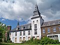 Building in Heel
 Former town hall
 Canal view

.jpg)


