List of neighbourhoods in Calgary
From Wikipedia, the free encyclopedia
This is a list of neighbourhoods in Calgary, Alberta.
As of 2016, Calgary has 197 neighbourhoods, which are referred to as "communities" by the municipal government,[1] and 42 industrial areas.[2] A further 15 communities were included in the civic censuses from 2015 to 2019,[3] bringing the total to 212. Calgary Open Data also confirms six more communities yet to be developed (Alpine Park, Ambleton, Glacier Ridge, Lewisburg, TwinHills, and Symons Valley Ranch).[2]
Centre City
The area collectively known as the Centre City comprises Downtown (including the Downtown West End and Downtown East Village) and the adjacent neighbourhoods of Eau Claire, Chinatown, and the Beltline (including Connaught and Victoria Park).[4][5]
Within Centre City, those neighbourhoods below that have an area redevelopment plan (ARP) in effect[6] are indicated with "ARP" in parentheses.
Downtown
Downtown Calgary is bordered by 11th Street W. on the west, 3rd Avenue S. and the Bow River on the north, the Elbow River on the east and the CPR mainline tracks on the south.
Downtown neighbourhoods:
Unofficial districts:[8]
- Stephen Avenue Retail Core
- Entertainment District
- Government District
Other
The remaining Centre City neighbourhoods are predominantly residential and mixed-use. These areas are often considered to be an extension of downtown. Other Centre City neighbourhoods include:
- Beltline — is physically separated from downtown proper by the CPR mainline tracks, and is the densest and most populous neighbourhood in Calgary. It comprises the former neighbourhoods of Connaught on the west and Victoria Park on the east.
- Chinatown[9]
- Eau Claire
Inner city
The inner city includes Downtown Calgary and the adjoining communities, and overlays roughly the city limits before 1961. It is delimited by Sarcee Trail to the west; Glenmore Reservoir and Glenmore Trail to the south; Bow River and Deerfoot Trail to the east; and Bow River and 32 Avenue to the north.[10]
The inner city includes the following neighbourhoods (by city quadrant):
Quadrants
Calgary is divided into four geographic quadrants generally described below.[11]
- Northwest Calgary – west of a combination of Centre Street/Harvest Hills Boulevard and north of a combination of the Bow River, Sarcee Trail, Memorial Drive, and Highway 1 (Trans-Canada Highway)
- Northeast Calgary – east of a combination of Centre Street//Harvest Hills Boulevard and north of a combination of the Bow River, a Canadian Pacific Kansas City rail line, Centre Avenue and Memorial Drive
- Southwest Calgary – south of a combination of the Bow River, Sarcee Trail and Highway 1 (Trans-Canada Highway) and west of a combination of Centre Street, a Canadian Pacific Kansas City rail line, Macleod Trail and Sheriff King Street
- Southeast Calgary – south of a combination of the Bow River, a Canadian Pacific Kansas City rail line, Centre Avenue and Memorial Drive and east of a combination of Centre Street, a Canadian Pacific Kansas City rail line, Macleod Trail and Sheriff King Street
The following is a list of all neighbourhoods within the City of Calgary including residential communities, industrial areas, major parks and residual areas by electoral ward.[12]
List
| Name[12] | Quadrant | Sector[13] | Ward
2021 |
Type[13] | Founded | Population (2021)[14] | Population (2011)[12] |
Dwellings (2012)[12] |
Area (km2)[15] |
Population density |
Notes |
|---|---|---|---|---|---|---|---|---|---|---|---|
| Abbeydale | NE/SE | Northeast | 10 | Residential | 1976 | 5925 | 5,700 | 2,023 | 1.7 | 3,480.6 | Very small section falls into the SE |
| Acadia | SE | South | 11 | Residential | 1960 | 9915 | 10,615 | 5,053 | 3.9 | 2,744.9 | |
| Albert Park/Radisson Heights | SE | East | 9 | Residential | 1910 | 6740 | 6,217 | 2,709 | 2.5 | 2,493.6 | Commonly confused with Forest Lawn |
| Altadore | SW | Centre | 8 | Residential | 1945 | 7290 | 8,907 | 4,486 | 2.9 | 3,143.4 | |
| Alpine Park | SW | 13 | |||||||||
| Alyth/Bonnybrook | SE | Centre | 9 | Industrial | 0 | 17 | 14 | 3.8 | 4.2 | ||
| Applewood Park | SE/NE | East | 9 | Residential | 1982 | 6830 | 6,404 | 2,215 | 1.6 | 4,061.3 | |
| Arbour Lake | NW | Northwest | 2 | Residential | 1992 | 10335 | 10,762 | 3,918 | 4.4 | 2,462.7 | Sometimes referred to as Crowfoot |
| Aspen Woods | SW | West | 6 | Residential | 2001 | 9435 | 4,469 | 2,281 | 3.8 | 1,387.1 | |
| Auburn Bay | SE | Southeast | 12 | Residential | 2005 | 18090 | 5,769 | 2,808 | 4.5 | 1,598.4 | |
| Aurora Business Park | NE | North | Industrial | 0 | 0 | 2.4 | 0 | ||||
| Banff Trail | NW | Centre | 7 | Residential | 1952 | 3805 | 3,582 | 1,950 | 1.5 | 2,558 | |
| Bankview | SW | Centre | 8 | Residential | 1908 | 5125 | 4,754 | 3,528 | 0.7 | 7,458.6 | |
| Bayview | SW | South | 11 | Residential | 675 | 648 | 249 | 0.4 | 1,705 | ||
| Beddington Heights | NW/NE | North | 4 | Residential | 11295 | 11,457 | 4,348 | 3.2 | 3,620.3 | ||
| Bel-Aire | SW | Centre | 11 | Residential | 1960 | 400 | 449 | 159 | 0.3 | 1,413.3 | |
| Belmont | 13 | 800 | |||||||||
| Beltline | SW/SE | Centre | 8 | Residential | 25880 | 19,556 | 14,456 | 2.9 | 6,786.6 | Created as a merger between the neighborhoods of Connaught and Victoria Park | |
| Belvedere | SE | East | 9 | 2013 | Sometimes referred to as East Hills | ||||||
| Bonavista Downs | SE | South | Residential | 1973 | 830 | 947 | 370 | 0.5 | 1,850 | ||
| Bowness | NW | Northwest | 1 | Residential | 1896 | 10770 | 10,700 | 5,313 | 5.6 | 1,966.4 | |
| Braeside | SW | South | 11 | Residential | 1965 | 5700 | 5,978 | 2,544 | 2 | 2,970 | |
| Brentwood | NW | Northwest | 2 | Residential | 1960 | 7410 | 6,049 | 2,595 | 2.9 | 2,089.3 | |
| Bridgeland/Riverside | NE/SE | Centre | 9 | Residential | 1908 | 6350 | 5,254 | 3,274 | 3.1 | 1,804.5 | |
| Bridlewood | SW | South | 13 | Residential | 1997 | 12545 | 11,641 | 4,200 | 3.2 | 3,698.4 | |
| Britannia | SW | Centre | 8 | Residential | 1956 | 765 | 746 | 309 | 0.5 | 1,606 | |
| Burns Industrial | SE | Centre | Industrial | 11 | 2 | 2.9 | 0 | ||||
| Calgary International Airport | NE | Northeast | 5 | Industrial | 0 | 4 | 20.6 | 0 | |||
| Cambrian Heights | NW | Centre | 4 | Residential | 2000 | 2,039 | 930 | 0.9 | 2,287.8 | ||
| Canada Olympic Park | SW | West | 6 | Major Park | 0 | 0 | 0.9 | 0 | |||
| Canyon Meadows | SW | South | Residential | 1965 | 7435 | 7,895 | 3,195 | 3.1 | 2,511.9 | ||
| Capitol Hill | NW | Centre | 7 | Residential | 1948 | 4670 | 4,003 | 2,291 | 1.4 | 2,867.9 | |
| Carrington | NW | North | Residential | 2750 | |||||||
| Castleridge | NE | Northeast | 5 | Residential | 1980 | 6130 | 6,098 | 1,954 | 1.2 | 5,080 | |
| Cedarbrae | SW | South | 11 | Residential | 1973 | 5935 | 6,264 | 2,609 | 2.1 | 2,970 | |
| Chaparral | SE | South | Residential | 1995 | 12500 | 11,151 | 3,759 | 5.4 | 2,139.3 | ||
| Charleswood | NW | Northwest | 4 | Residential | 1959 | 3595 | 3,357 | 1,494 | 1.8 | 1,900.6 | |
| Chinatown | SW/SE | Centre | 7 | Residential | 2250 | 1,269 | 1,381 | 0.179 | 7,885 | ||
| Chinook Park | SW | South | 11 | Residential | 1959 | 1535 | 1,703 | 589 | 0.6 | 2,845 | |
| Christie Park | SW | West | 6 | Residential | 1993 | 1880 | 2,180 | 728 | 0.8 | 2,745 | |
| Citadel | NW | Northwest | Residential | 10180 | 10,171 | 3,479 | 2.7 | 3,776.7 | |||
| Cityscape[16] | NE | Northeast | 5 | Residential | 5085 | ||||||
| Cliff Bungalow | SW | Centre | 8 | Residential | 1805 | 1,912 | 1,377 | 0.243 | 4,840 | ||
| Coach Hill | SW | West | 6 | Residential | 3275 | 3,194 | 1,480 | 1.1 | 2,980.9 | ||
| Collingwood | NW | Northwest | 4 | Residential | 2290 | 2,231 | 978 | 1.6 | 1,388.8 | ||
| Copperfield | SE | Southeast | Residential | 14095 | 7,162 | 3,043 | 4.4 | 1,780.5 | |||
| Coral Springs | NE | Northeast | 10 | Residential | 5610 | 5,838 | 1,508 | 1.8 | 3,260 | ||
| Cougar Ridge | SW | West | 6 | Residential | 7150 | 5,813 | 1,908 | 2.2 | 2,670 | ||
| Country Hills | NW | North | 3 | Residential | 3660 | 3,720 | 1,426 | 1.9 | 1,962.1 | ||
| Country Hills Village | NE | North | 3 | Residential | 2480 | 2,342 | 1,467 | 1 | 2,615 | Sometimes referred to as North Pointe | |
| Coventry Hills | NE | North | 3 | Residential | 17350 | 15,722 | 5,322 | 4.1 | 3,894.9 | ||
| Cranston | SE | Southeast | Residential | 2000 | 20850 | 10,831 | 4,625 | 8.3 | 1,428.6 | ||
| Crescent Heights | NE/NW | Centre | 7 | Residential | 6240 | 5,895 | 3,614 | 1.6 | 3,919.4 | ||
| Crestmont | SW | West | Residential | 2275 | 1,430 | 462 | 0.6 | 2,423.3 | |||
| Currie | SW | West | Residential | 1275 | 24 | 76 | 1.1 | 156.4 | |||
| Dalhousie | NW | Northwest | 4 | Residential | 8530 | 8,917 | 3,739 | 3.3 | 2,753 | ||
| Deer Ridge | SE | South | Residential | 3795 | 3,991 | 1,501 | 1.4 | 2,917.1 | |||
| Deer Run | SE | South | Residential | 4910 | 5,390 | 2,113 | 1.9 | 2,811.1 | |||
| Deerfoot Business Centre | NE | Northeast | Industrial | 0 | 0 | 2 | 0 | ||||
| Diamond Cove | SE | South | Residential | 625 | 716 | 271 | 0.5 | 1,398 | |||
| Discovery Ridge | SW | West | 6 | Residential | 4330 | 4,321 | 1,649 | 3.6 | 1,208.3 | ||
| Douglasdale/Glen | SE | Southeast | Residential | 12920 | 11,768 | 4,217 | 6.4 | 1,857.8 | |||
| Dover | SE | East | Residential | 10795 | 10,302 | 4,722 | 4.2 | 2,493.8 | |||
| Downtown Commercial Core | SW/SE | Centre | Residential | 8225 | 8,071 | 5,121 | 1.3 | 6,165.4 | |||
| Downtown East Village | SE | Centre | Residential | 3140 | 2,747 | 1,230 | 0.5 | 5,564 | Sometimes referred to as the East Village | ||
| Downtown West End | SW | Centre | Residential | 2825 | 2,483 | 1,628 | 0.4 | 5,805 | |||
| Eagle Ridge | SW | South | 11 | Residential | 260 | 443 | 110 | 0.4 | 1,037.5 | ||
| East Fairview Industrial | SE | South | Industrial | 0 | 1 | 2.3 | 0 | ||||
| East Shepard Industrial | SE | Southeast | Industrial | 0 | 0 | 17.4 | 0 | ||||
| Eastfield | SE | East | Industrial | 0 | 0 | 1.1 | 0 | ||||
| Eau Claire | SW | Centre | 7 | Residential | 1885 | 1875 | 1,711 | 1,328 | 0.5 | 3,702 | |
| Edgemont | NW | Northwest | 4 | Residential | 15225 | 16,082 | 5,421 | 6.6 | 2,408.8 | ||
| Elbow Park | SW | Centre | 8 | Residential | 3285 | 3,408 | 1,221 | 1.8 | 1,876.1 | ||
| Elboya | SW | Centre | 8 | Residential | 1835 | 1,747 | 783 | 0.7 | 2,445.7 | ||
| Erin Woods | SE | East | Residential | 6790 | 6,794 | 2,453 | 1.6 | 4,313.1 | |||
| Erlton | SW/SE | Centre | Residential | 1280 | 1,231 | 742 | 0.5 | 2,468 | |||
| Evanston | NW | North | Residential | 18710 | 5,889 | 2,576 | 4.9 | 1,345.7 | |||
| Evergreen | SW | South | Residential | 20780 | 19,487 | 6,961 | 4.6 | 4,371.7 | |||
| Fairview | SE | South | Residential | 3675 | 3,552 | 1,606 | 1.3 | 2,786.9 | |||
| Fairview Industrial | SE | South | Industrial | 0 | 2 | 1.3 | 0 | ||||
| Falconridge | NE | Northeast | 5 | Residential | 10325 | 10,043 | 3,478 | 2.2 | 4,718.6 | ||
| Fish Creek Park | SE/SW | South | 12/13/14 | Major Park | 430 | 0 | 0 | 15.6 | 0 | ||
| Foothills Industrial | SE | East | Industrial | 326 | 2 | 7.6 | 39.2 | ||||
| Forest Heights | SE | East | 9 | Residential | 5985 | 6,185 | 2,221 | 1.5 | 4,141.3 | Commonly confused with Forest Lawn | |
| Forest Lawn | SE | East | 9 | Residential | 7230 | 7,313 | 3,352 | 2.3 | 3,255.2 | ||
| Forest Lawn Industrial | SE | East | 9 | Industrial | 120 | 63 | 1.5 | 86.7 | Sometimes referred to as Hubalta | ||
| Franklin | NE/SE | Northeast | 10 | Industrial | 0 | 3 | 1.5 | 0 | |||
| Garrison Green | SW | West | 11 | Residential | 1680 | 6,242 | 2,988 | 2 | 3,188 | Formerly a part of Lincoln Park | |
| Garrison Woods | SW | West | 8 | 2860 | Formerly a part of Altadore | ||||||
| Glacier Ridge | NW | ||||||||||
| Glamorgan | SW | West | 6 | Residential | 6575 | 6,242 | 2,988 | 2 | 3,188 | ||
| Glenbrook | SW | West | 6 | Residential | 7240 | 6,893 | 3,247 | 1.9 | 3,713.7 | ||
| Glendale | SW | West | 6 | Residential | 2715 | 2,730 | 1,111 | 1.4 | 1,963.6 | ||
| Glendeer Business Park | SE | South | Industrial | 0 | 0 | 0.3 | 0 | ||||
| Glenmore Park | SW | West | Major Park | 0 | 3 | 10.2 | 0 | ||||
| Golden Triangle | SE | East | Industrial | 0 | 1 | 0.5 | 0 | ||||
| Great Plains | SE | East | Industrial | 0 | 0 | 4.3 | 0 | ||||
| Greenview | NE | North | Residential | 2100 | 1,956 | 1,120 | 0.5 | 3,950 | |||
| Greenview Industrial Park | NE | North | Industrial | 0 | 5 | 2.1 | 0 | ||||
| Greenwood/Greenbriar | NW | Northwest | Residential | 932 | 501 | 1.2 | 788.3 | ||||
| Hamptons | NW | Northwest | Residential | 7360 | 7,843 | 2,471 | 3.5 | 2,258.6 | |||
| Harvest Hills | NE | North | 3 | Residential | 7805 | 7,485 | 2,569 | 2.2 | 3,364.5 | ||
| Hawkwood | NW | Northwest | Residential | 9115 | 9,898 | 3,331 | 3.2 | 3,072.2 | |||
| Haysboro | SW | South | 11 | Residential | 6960 | 6,724 | 3,637 | 2.7 | 2,571.5 | ||
| Hidden Valley | NW | North | Residential | 11540 | 11,657 | 3,867 | 4.3 | 2,744 | |||
| Highfield | SE | Centre | 9 | Industrial | 0 | 0 | 2.7 | 0 | |||
| Highland Park | NW/NE | Centre | Residential | 4105 | 3,539 | 2,123 | 1.4 | 2,708.6 | |||
| Highwood | NW | Centre | Residential | 2205 | 2,098 | 993 | 0.9 | 2,460 | |||
| Hillhurst | NW | Centre | Residential | 5475 | 5,914 | 3,557 | 2.1 | 2,995.7 | |||
| Horizon | NE | Northeast | 10 | Industrial | 74 | 4 | 2.3 | 13.5 | Commonly referred to as Whitehorn | ||
| Hotchkiss[17] | SE | Northeast | Residential | ||||||||
| Hounsfield Heights/Briar Hill | NW | Centre | Residential | 2470 | 2,927 | 1,109 | 1.2 | 2,461.7 | Sometimes referred to as North Hill | ||
| Huntington Hills | NW/NE | North | Residential | 13120 | 13,279 | 5,580 | 4.8 | 2,752.7 | |||
| Huxley | 9 | ||||||||||
| Inglewood | SE | Centre | Residential | 4130 | 3,473 | 2,241 | 2.5 | 1,425.6 | |||
| Kelvin Grove | SW | South | Residential | 1805 | 2,334 | 903 | 0.8 | 2,928.8 | |||
| Keystone Hills | 3 | ||||||||||
| Killarney/Glengarry | SW | Centre | Residential | 7920 | 6,543 | 3,679 | 1.8 | 3,786.7 | |||
| Kincora | NW | North | Residential | 7030 | 4,625 | 1,548 | 2.3 | 2,120 | |||
| Kingsland | SW | South | Residential | 4900 | 4,418 | 2,383 | 1.3 | 3,471.5 | |||
| Lake Bonavista | SE | South | Residential | 10145 | 10,610 | 4,106 | 5.2 | 2,014.4 | |||
| Lakeview | SW | West | Residential | 5640 | 5,501 | 2,338 | 2.2 | 2,485.5 | |||
| Legacy | SE | South | Residential | 8000 | 11 | 0 | 6.1 | 0 | Located within Calgary City Council's Ward 14;[18] home to All Saints High School, with a student population capacity of 1,500.[19] | ||
| Lincoln Park | SW | West | Residential | 1590 | 2,501 | 1,413 | 1.5 | 1,670 | |||
| Livingston | NW/NE | North | 3 | Residential | 2017 | 3985 | 4.85 | Ongoing development, estimated population of 30k when complete. | |||
| Lower Mount Royal | SW | Centre | Residential | 2990 | 2,981 | 2,266 | 0.3 | 10,600 | |||
| MacEwan Glen | NW | North | Residential | 4740 | 5,138 | 1,781 | 1.4 | 3,642.9 | |||
| Mahogany | SE | Southeast | Residential | 13860 | 788 | 572 | 6.4 | 197.8 | |||
| Manchester | SE/SW | Centre | Residential | 950 | 669 | 448 | 0.5 | 1,236 | |||
| Manchester Industrial | SE/SW | Centre | Industrial | 0 | 0 | 3 | 4.6 | 0 | Not to be confused with Manchester | ||
| Maple Ridge | SE | South | Residential | 1830 | 1,978 | 811 | 2.8 | 682.1 | |||
| Marlborough | NE | Northeast | 10 | Residential | 8910 | 8,310 | 3,123 | 2.7 | 3,123.7 | ||
| Marlborough Park | NE | Northeast | 10 | Residential | 8290 | 8,278 | 3,050 | 2.5 | 3,356.4 | ||
| Martindale | NE | Northeast | 5 | Residential | 14540 | 12,987 | 3,912 | 2.7 | 5,064.4 | ||
| Mayfair | SW | Centre | Residential | 410 | 470 | 156 | 0.3 | 1,603.3 | |||
| Mayland | SE/NE | Northeast | 10 | Industrial | 0 | 0 | 1 | 1.2 | 0 | ||
| Mayland Heights | NE | Northeast | 10 | Residential | 5925 | 5,835 | 2,787 | 2 | 2,916.5 | ||
| McCall | NE | Northeast | 10 | Industrial | 0 | 0 | 0 | 2.4 | 0 | ||
| McKenzie Lake | SE | Southeast | Residential | 13290 | 14,062 | 4,653 | 5.1 | 2,754.9 | |||
| McKenzie Towne | SE | Southeast | Residential | 17505 | 15,395 | 6,783 | 4.8 | 3,354.6 | |||
| Meadowlark Park | SW | Centre | Residential | 610 | 605 | 277 | 0.6 | 1,038.3 | |||
| Meridian | NE/SE | Northeast | 10 | Industrial | 0 | 0 | 0 | 1.4 | 0 | ||
| Midnapore | SE | South | Residential | 6480 | 6,888 | 2,726 | 2.9 | 2,365.9 | |||
| Millrise | SW/SE | South | Residential | 6655 | 6,717 | 2,635 | 1.8 | 3,828.9 | |||
| Mission | SW/SE | Centre | Residential | 4505 | 4,363 | 3,177 | 0.5 | 8,650 | |||
| Monterey Park | NE | Northeast | 10 | Residential | 10475 | 10,460 | 3,164 | 3.4 | 3,079.4 | ||
| Mount Pleasant | NW | Centre | Residential | 6325 | 4,718 | 2,654 | 1.9 | 2,553.2 | |||
| Montgomery | NW | Northwest | 7 | Residential | *1956(1911) | 4175 | 3,686 | 1,839 | 3 | 1,286.7 | |
| New Brighton | SE | Southeast | Residential | 12885 | 7,314 | 3,247 | 2.9 | 2,863.1 | |||
| Nolan Hill | NW | North | Residential | 8755 | 0 | 23 | 2.1 | 0 | |||
| North Airways | NE | Northeast | 10 | Industrial | 0 | 20 | 3 | 1.2 | 0 | ||
| North Glenmore Park | SW | West | Residential | 2435 | 2,388 | 1,020 | 1.2 | 1,988.3 | |||
| North Haven | NW | North | 5 | Residential | 2365 | 2,282 | 988 | 0.8 | 2,860 | ||
| North Haven Upper | NW | North | 4 | Residential | 640 | 615 | 246 | 0.229 | 2,073.3 | ||
| Nose Hill Park | NW | Northwest | 4 | Major Park | 0 | 0 | 0 | 11.6 | 0 | ||
| Oakridge | SW | South | Residential | 5620 | 5,719 | 2,291 | 2.4 | 2,354.6 | |||
| Ogden | SE | Southeast | Residential | 8315 | 8,432 | 3,879 | 4.1 | 2,122.4 | |||
| Ogden Shops | SE | East | Industrial | 0 | 0 | 0 | 2.2 | 0 | |||
| Osprey Hill | 1 | ||||||||||
| Palliser | SW | South | Residential | 3285 | 3,301 | 1,707 | 1 | 3,293 | |||
| Panorama Hills | NW | North | 3 | Residential | 25535 | 19,851 | 7,398 | 6.3 | 3,531.3 | ||
| Parkdale | NW | Centre | Residential | 2300 | 2,317 | 1,020 | 1.1 | 2,087.3 | |||
| Parkhill | SW | Centre | Residential | 1770 | 1,623 | 849 | 0.7 | 2,274.3 | |||
| Parkland | SE | South | Residential | 3430 | 3,772 | 1,448 | 1.8 | 2,102.8 | |||
| Patterson | SW | West | Residential | 4145 | 4,162 | 2,008 | 2 | 2,140.5 | |||
| Pegasus | NE | Northeast | 5 | Industrial | 0 | 0 | 2 | 0.3 | 0 | ||
| Penbrooke Meadows | SE | East | Residential | 8235 | 8,188 | 3,212 | 2 | 4,273.5 | Commonly confused with Forest Lawn | ||
| Pine Creek | 245 | Commonly referred as Creekside | |||||||||
| Pineridge | NE | Northeast | 10 | Residential | 1974 | 9850 | 9,626 | 3,799 | 2.6 | 3,709.2 | |
| Point Mckay | NW | Centre | Residential | 1330 | 1,318 | 846 | 0.4 | 3,295 | |||
| Pump Hill | SW | South | Residential | 1455 | 1,655 | 563 | 0.9 | 1,793.3 | |||
| Queens Park Village | NW | Centre | Residential | 375 | 400 | 188 | 0.6 | 691.7 | |||
| Queensland | SE | South | Residential | 4585 | 4,877 | 1,894 | 1.6 | 2,981.9 | |||
| Ramsay | SE | Centre | Residential | 2155 | 2,006 | 1,132 | 1 | 2,110 | |||
| Ranchlands | NW | Northwest | Residential | 7490 | 7,529 | 3,051 | 2.3 | 3,315.7 | |||
| Rangeview | SE | ||||||||||
| Red Carpet | SE | East | 9 | Residential | 1745 | 1,630 | 917 | 0.6 | 2,591.7 | ||
| Redstone | NE | Northeast | 5 | Residential | 9050 | 0 | 0 | 1.9 | 0 | ||
| Renfrew | NE | Centre | Residential | 6580 | 5,669 | 3,231 | 2.7 | 2,165.2 | |||
| Residual Ward 1 | NW/SW | West/ Northwest |
Residual Area | 343 | 110 | n/a | — | ||||
| Residual Ward 2 | NW | North/ Northwest |
Residual Area | 1,140 | 25 | n/a | — | ||||
| Residual Ward 3 | NE/NW | North/ Northeast |
Residual Area | 109 | 31 | n/a | — | ||||
| Residual Ward 4 | Residual Area | 4 | 0 | n/a | — | ||||||
| Residual Ward 5 | NE | Northeast | Residual Area | 28 | 11 | n/a | — | ||||
| Residual Ward 6 | SW | West | Residual Area | 36 | 13 | n/a | — | ||||
| Residual Ward 7 | Residual Area | 0 | 0 | n/a | — | ||||||
| Residual Ward 8 | Residual Area | 0 | 0 | n/a | — | ||||||
| Residual Ward 9 | SE | East/ Southeast |
Residual Area | 40 | 7 | n/a | — | ||||
| Residual Ward 10 | SE/NE | East | Residual Area | 827 | 378 | n/a | — | ||||
| Residual Ward 11 | Residual Area | 6 | 0 | n/a | — | ||||||
| Residual Ward 12 | SE | Southeast | Residual Area | 327 | 135 | n/a | — | ||||
| Residual Ward 13 | SW | South | Residual Area | 60 | 36 | n/a | — | ||||
| Residual Ward 14 | SE/SW | South | Residual Area | 58 | 27 | n/a | — | ||||
| Richmond | SW | Centre | Residential | 5250 | 4,113 | 2,259 | 1.8 | 2,349.4 | |||
| Rideau Park | SW | Centre | Residential | 675 | 627 | 342 | 0.3 | 2,120 | |||
| Riverbend | SE | Southeast | Residential | 9205 | 9,749 | 3,449 | 4.1 | 2,362 | |||
| Rockland Park | NW | Northwest | 1 | Residential | 2021 | 1.76 | Ongoing development. estimated total population of 9000 across 3100 dwellings. | ||||
| Rocky Ridge | NW | Northwest | Residential | 8195 | 7,266 | 2,972 | 2.8 | 2,736.4 | |||
| Rosedale | NW | Centre | Residential | 1495 | 1,592 | 636 | 0.7 | 2,241.4 | |||
| Rosemont | NW | Centre | Residential | 1155 | 1,208 | 563 | 0.5 | 2,482 | |||
| Rosscarrock | SW | West | Residential | 3490 | 3,175 | 1,645 | 1.1 | 3,050.9 | Sometimes referred to as Westbrook | ||
| Roxboro | SW | Centre | Residential | 415 | 441 | 161 | 0.231 | 1,403.3 | |||
| Royal Oak | NW | Northwest | Residential | 11580 | 10,979 | 3,940 | 3.6 | 3,125.6 | |||
| Royal Vista | NW | Northwest | Industrial | 0 | 0 | 0 | 1.3 | 0 | |||
| Rundle | NE | Northeast | 10 | Residential | 1973 | 10545 | 11,029 | 3,836 | 2.6 | 4,330 | |
| Rutland Park | SW | West | Residential | 2140 | 2,309 | 972 | 0.7 | 3,181.4 | |||
| Saddle Ridge | NE | Northeast | 5 | Residential | 1960 | 24365 | 13,388 | 3,668 | 5.5 | 2,613.1 | Sometimes referred to as Saddletowne |
| Saddle Ridge Industrial | NE | Northeast | 5 | Industrial | 0 | 60 | 24 | 2.5 | 14 | ||
| Sage Hill | NW | North | Residential | 9345 | 1,425 | 992 | 3.8 | 576.1 | |||
| Sandstone Valley | NW | North | Residential | 5795 | 6,142 | 2,120 | 1.8 | 3,473.9 | |||
| Scarboro | SW | Centre | Residential | 1010 | 870 | 343 | 0.5 | 1,760 | |||
| Scarboro/Sunalta West | SW | Centre | Residential | 465 | 397 | 165 | 0.4 | 1,025 | |||
| Scenic Acres | NW | Northwest | Residential | 7850 | 8,710 | 2,921 | 4.3 | 2,011.6 | |||
| Section 23 | SE | Southeast | Industrial | 0 | 1 | 3.1 | 0 | ||||
| Seton | SE | Southeast | 12 | Residential | 2018 | 3590 | 0 | 1.7 | 0 | ||
| Seton Ridge | SE | Southeast | 12 | Residential | 2024 | 0.8 | |||||
| Shaganappi | SW | Centre | Residential | 1765 | 1,459 | 862 | 1.5 | 1,035.3 | |||
| Shawnee Slopes | SW | South | Residential | 2020 | 1,529 | 866 | 1.2 | 1,304.2 | |||
| Shawnessy | SW/SE | South | Residential | 1981 | 9055 | 9,315 | 3,300 | 3.7 | 2,536.5 | ||
| Shepard Industrial | SE | Southeast | Residential | 265 | 250 | 151 | 4.2 | 59.8 | Sometimes referred to as just Shepard or South Hill | ||
| Sherwood | NW | North | Residential | 6520 | 2,109 | 979 | 2.4 | 1,051.3 | |||
| Signal Hill | SW | West | Residential | 13000 | 13,795 | 5,253 | 5.6 | 2,484.6 | |||
| Silver Springs | NW | Northwest | Residential | 8570 | 8,910 | 3,533 | 5 | 1,786.6 | |||
| Silverado | SW/SE | South | Residential | 7975 | 4,337 | 1,898 | 5.1 | 1,007.1 | |||
| Skyline East | NE | Northeast | Industrial | 0 | 0 | 0 | 0.6 | 0 | |||
| Skyline West | NE | North | Industrial | 0 | 0 | 0 | 0.8 | 0 | |||
| Skyview Ranch | NE | Northeast | Residential | 12870 | 1,805 | 1,306 | 4.6 | 650 | |||
| Somerset | SW/SE | South | Residential | 8320 | 8,401 | 3,136 | 2.3 | 3,713 | |||
| South Airways | NE | Northeast | 10 | Industrial | 0 | 0 | 2 | 1.9 | 0 | ||
| South Calgary | SW | Centre | Residential | 4540 | 3,642 | 2,244 | 0.9 | 4,108.9 | |||
| South Foothills | SE | Southeast | Industrial | 0 | 0 | 3 | 3.6 | 0 | |||
| Southview | SE | East | Residential | 1550 | 2,063 | 936 | 1.6 | 1,187.5 | Commonly confused with Forest Lawn | ||
| Southwood | SW | South | Residential | 6095 | 5,965 | 2,658 | 2.7 | 2,253.7 | Commonly referred to as Southland | ||
| Springbank Hill | SW | West | Residential | 9840 | 8,388 | 3,166 | 6.3 | 1,394.1 | |||
| Spruce Cliff | SW | West | Residential | 4195 | 3,992 | 2,344 | 1.1 | 3,895.5 | |||
| St. Andrews Heights | NW | Centre | Residential | 1345 | 1,470 | 645 | 1.2 | 1,323.3 | |||
| Starfield | SE | East | Industrial | 0 | 0 | 2 | 4.3 | 0 | |||
| Starling | NW | Northwest | 2 | Residential | 2024 | 1.14 | |||||
| Stonegate Landing | NE | Northeast | Industrial | 0 | 0 | 0 | 5.4 | 0 | |||
| Stoney 1 | NE | North | Industrial | 0 | 0 | 5 | 6.1 | 0 | |||
| Stoney 2 | NE | Northeast | Industrial | 0 | 0 | 1 | 4 | 0 | |||
| Stoney 3 | NE | Northeast | Industrial | 0 | 0 | 0 | 1.3 | 0 | |||
| Stoney 4 | NE | Northeast | Industrial | 0 | 0 | 3 | 5.6 | 0 | |||
| Strathcona Park | SW | West | Residential | 1980 | 6830 | 7,039 | 2,436 | 2.7 | 2,604.8 | ||
| Sunalta | SW | Centre | Residential | 1910 | 3090 | 3,116 | 2,130 | 0.9 | 3,682.2 | ||
| Sundance | SE | South | Residential | 1982 | 9590 | 10,623 | 3,406 | 4 | 2,624.8 | ||
| Sunnyside | NW | Centre | Residential | 1904 | 4000 | 3,751 | 2,340 | 1 | 3,704 | ||
| Sunridge | NE | Northeast | 10 | Industrial | 0 | 40 | 7 | 2.3 | 14.3 | ||
| Symons Valley Ranch | NW | North | Residential | 0.137 | Smallest neighborhood by land area | ||||||
| Taradale | NE | Northeast | 5 | Residential | 1984 | 17630 | 16,110 | 4,559 | 2.9 | 5,807.2 | |
| Temple | NE | Northeast | 10 | Residential | 1977 | 10525 | 10,580 | 3,648 | 2.6 | 4,190 | |
| Thorncliffe | NW/NE | North | Residential | 8695 | 8,640 | 3,858 | 3.3 | 2,634.2 | |||
| Tuscany | NW | Northwest | 1 | Residential | 1994 | 19700 | 18,838 | 6,492 | 6.9 | 2,755.5 | |
| Tuxedo Park | NE/NW | Centre | Residential | 5165 | 4,430 | 2,686 | 1.3 | 3,516.2 | |||
| University District | NW | Northwest | 7 | Residential | 960 | ? | ? | ? | ? | ||
| University Heights | NW | Northwest | 7 | Residential | 2965 | 2,890 | 1,380 | 0.8 | 3,660 | ||
| University of Calgary | NW | Northwest | 7 | Residential | ? | 2,355 | 927 | 2.7 | 1,009.3 | ||
| Upper Mount Royal | SW | Centre | Residential | 2735 | 2,536 | 1,071 | 1.3 | 1,955.4 | |||
| Valley Ridge | NW | West | Residential | 5365 | 5,042 | 1,768 | 3.3 | 1,519.1 | |||
| Valleyfield | SE | East | Industrial | 0 | 0 | 6 | 1.2 | 0 | |||
| Varsity | NW | Northwest | Residential | 12040 | 12,021 | 5,547 | 6.8 | 1,794.1 | |||
| Vermilion Hills | |||||||||||
| Vista Heights | NE | Northeast | Residential | 2300 | 2,274 | 844 | 1.1 | 2,003.6 | |||
| Walden | SE | South | Residential | 7650 | 594 | 450 | 2.4 | 389.6 | |||
| West Hillhurst | NW | Centre | Residential | 6635 | 5,757 | 2,947 | 2.4 | 2,417.5 | |||
| West Springs | SW | West | Residential | 11560 | 7,849 | 2,795 | 4.1 | 2,006.8 | |||
| Westgate | SW | West | Residential | 3225 | 3,101 | 1,334 | 1.2 | 2,643.3 | |||
| Westwinds | NE | Northeast | 5 | Industrial | 0 | 0 | 0 | 2 | 0 | ||
| Whitehorn | NE | Northeast | 10 | Residential | 11085 | 11,541 | 3,869 | 2.6 | 4,558.5 | ||
| Wildwood | SW | West | Residential | 1956 | 2765 | 2,582 | 1,056 | 2.6 | 999.2 | ||
| Willow Park | SE | South | Residential | 5050 | 5,308 | 2,282 | 3.4 | 1,537.9 | |||
| Windsor Park | SW | Centre | Residential | 4410 | 3,858 | 2,421 | 1.3 | 3,173.8 | |||
| Winston Heights/Mountview | NE | Centre | Residential | 3605 | 3,760 | 1,883 | 3 | 1,297 | |||
| Wolf Willow | SE | South | Residential | 525 | |||||||
| Woodbine | SW | South | Residential | 1980 | 8745 | 9,086 | 3,371 | 3.2 | 2,853.4 | ||
| Woodlands | SW | South | Residential | 1976 | 5830 | 6,201 | 2,397 | 2.8 | 2,214.6 | ||
| Yorkville | SW | South | 13 | Residential | 715 | ? | |||||
| Total City of Calgary | 1,090,936 | 459,339 | 848.20 | 1,320.7 | |||||||
Founded refers to the year which the first buildings finished construction in that neighborhood
*means about when the neighborhood was founded
(Year)refer to when the town was founded
Notable sub-communities
There are several notable sub-communities which are not official Calgary communities, but exist as distinct entities from the rest of their respective communities. Notable examples include:
Albert Park / Radisson Heights: Albert Park, Radisson Heights
Beltline: Connaught, Victoria Park, West Connaught
Belvedere: East Hills
Bowness: Lower Bowness, Upper Bowness
Chaparral: Chaparral Valley
Douglasdale / Douglas Glen: Douglas Glen, Douglasdale, Quarry Park
East Shepard Industrial: North Dufferin Industrial, Point Trotter Industrial
Greenwood / Greenbriar: Greenbriar, Greenwood
Hidden Valley: Hanson Ranch
Hillhurst: Broadview, Kensington, Southern Alberta Institute of Technology (SAIT), Westmount
Inglewood: East Inglewood, Mill's Estates
McKenzie Lake: Mountain Park
McKenzie Towne: Elgin, Inverness, McKenzie Towne Common, Prestwick
Ogden: Lynnwood, old Ogden
Pine Creek: Creekside
Pineridge: Village Square
Ricardo Ranch: Logan Landing, Nostalgia, Seton Ridge
Saddle Ridge: Saddletowne, Savanna, Saddlebrook
Shepard: South Hill
Tuxedo Park: Balmoral
Varsity: University Innovation Quarter, Varsity Estates
West Springs: Wentworth
Former communities
With Calgary having official sub-divisions for its neighborhoods, over time some neighborhoods have been discontinued as the city has increased.
| Name | Quadrant | Type | Founded | Discontinued | Now a part of |
|---|---|---|---|---|---|
| Albert Park | SE | Residential | 1910 | Albert Park/Radisson Heights | |
| Balmoral | NW | Residential | Tuxedo Park | ||
| Belfast | NE | Residential | Mayland Heights | ||
| Briar Hill | NW | Residential | Hounsfield Heights/Briar Hill | ||
| Bridgeland | NE | Residential | Bridgeland/Riverside | ||
| Broadview | NW | Residential | Early 1900s | Hillhurst | |
| Burnsland | SE | Industrial | Manchester Industrial | ||
| Capeear | SE | Residential | Ogden | ||
| Connaught | SW | Residential | 1914 | 2001 | Beltline |
| Dover Glen | SE | Residential | Dover | ||
| East Calgary | SE | Residential | 1876 | Inglewood | |
| East Manchester | SE | Industrial | Burns Industrial | ||
| Glendale Meadows | SW | Residential | Glendale | ||
| Glencoe | SW | Residential | Elbow Park | ||
| Glengarry | SW | Residential | Killarney/Glengarry | ||
| Grandview | SE | Residential | Early 1900s | Ramsay | |
| Happyland | NW | Residential | Early 1900s | Parkdale and parts of West Hillhurst | |
| Hounsfield Heights | NW | Residential | Hounsfield Heights/Briar Hill | ||
| Hubalta | SE | Residential | 1960s | Forest Lawn and Forest Lawn Industrial | |
| Knob Hill | SW | Residential | Richmond | ||
| Lake Bonaventure | SE | Residential | Lake Bonavista | ||
| Lynnview Ridge | SE | Residential | 1970s | 2001 | Evacuated due to contamination, now sits empty |
| Lynnwood | SE | Residential | Ogden | ||
| Manchester Works | SE | Industrial | Manchester Industrial | ||
| Mill's Estates | SE | Residential | 1871 | Inglewood | |
| Millican Estates | SE | Residential | Ogden | ||
| Parkview | SE/SW | Residential | Late 1990s | Erlton | |
| Pleasant Heights | NW | Residential | Capitol Hill | ||
| Radisson Heights | SE | Residential | Albert Park/Radisson Heights | ||
| Regal Terrace | NE | Residential | Renfrew | ||
| Richmond Park | SW | Residential | Richmond | ||
| Riverdale | SW | Residential | Britannia | ||
| Riverside | NE | Residential | Bridgeland/Riverside | ||
| Spring Gardens | NE | Industrial | Greenview Industrial | ||
| Stampede Corrall | SE | Industrial | Beltline | ||
| Sylvan Terrace | NW | Residential | Parkdale | ||
| Varsity Acres | NW | Residential | Varsity | ||
| Varsity Estates | NW | Residential | Varsity | ||
| Varsity Village | NW | Residential | Varsity | ||
| Victoria Park | SE/SW | Residential | 1910s | 2001 | Beltline |
| West Calgary | SW | Residential | Killarney/Glengarry, Scarboro/Sunalta West, Shaganappi | ||
| West Dover | SE | Residential | Dover | ||
| Westmount | NW | Residential | West Hillhurst |
Business improvement areas
Calgary's Business Improvement Areas (BIA; formerly Business Revitalization Zones or BRZ) are business districts established by businesses within an area to jointly raise and administer funds for various projects and promotional activities within that zone throughout the year.[22] BIAs in Calgary are established for one or more of the following purposes: "improving, beautifying and maintaining property" in the BIA; "developing, improving and maintaining public parking;" and/or promoting the BIA as a business or shopping area.[23]
The BRZ program in Calgary was established in 1983 to allow certain commercial areas of the city to administer and promote themselves internally. Many of the zones that emerged from this have since acquired a virtual "neighbourhood" status by the people of Calgary. (None of these zones are officially designated as neighbourhoods unto themselves, however.)
These are the 15 Business Improvement Areas of Calgary as of 2022[update]:[23]
- 17th Ave Retail & Entertainment District
- 4th Street South West BIA (located mostly within Mission)
- Beltline BIA
- Bridgeland BIA
- Calgary Downtown Association
- Chinatown BIA
- Crescent Heights Village BIA
- Greenview Industrial BIA (formerly HIPville BIA)
- Inglewood
- International Avenue
- Kensington BIA[24]
- Mainstreet Bowness BIA
- Marda Loop BIA
- Montgomery on the Bow BIA
- Victoria Park BIA
Planning areas
The City of Calgary has divided the city into 42 local planning areas to facilitate more comprehensive urban development.[25] These areas group multiple communities together based on shared amenities, geographic features, and common planning needs.
Boundaries are primarily determined by major roads (e.g., Crowchild Trail, Deerfoot Trail) and geographic features (rivers, large parks). This approach aims to create stronger community linkages, address common issues, and enable more holistic growth planning.
Known planning areas
- Chinook
- East Calgary/International Avenue (formerly Greater Forest Lawn Communities[26])
- Heritage
- North Hill
- Riley
- South Shaganappi
- West Elbow
- Westbrook
Industrial areas
Most industrial areas are located between Deerfoot Trail and 36 Street East in the northern half of the city; between Macleod Trail, Deerfoot Trail and Glenmore Trail in the south and east of Barlow Trail in the southeast.[27]
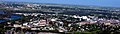
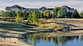
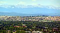
Gallery


 Medicine Hill


 Jane Seymour's Open Hearts sculpture is located in Legacy


.jpg)


.jpg)


.jpg)


.jpg)

See also
- Calgary (main article)
- List of neighbourhoods in Edmonton