Description
| Original
function?
| Built
| Architect
| Location
| Coordinates?
| No.?
| Image
|
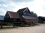
| Mill complex |
 Craft Craft |
end of the 18th century |
|
Zaagmolenweg 1 |
52°15′45″N 6°44′04″E / 52.26237°N 6.73441°E / 52.26237; 6.73441 (RM333099 - Zaagmolenweg 1) |
333099 |
|
| Sachsisch farm |
 Farm Farm |
1846 |
|
Brinkweg 3 |
52°15′20″N 6°42′18″E / 52.25563°N 6.70498°E / 52.25563; 6.70498 (RM34143 - Brinkweg 3) |
34143 |

|
| Farm Spoolder |
Farm |
1872 |
|
Brinkweg 15 |
52°15′18″N 6°42′25″E / 52.25506°N 6.70687°E / 52.25506; 6.70687 (RM34144 - Brinkweg 15) |
34144 |

|
| Buitenplaats |
House |
|
|
Hengelosestraat 5 |
52°15′48″N 6°42′57″E / 52.26324°N 6.71596°E / 52.26324; 6.71596 (RM34145 - Hengelosestraat 5) |
34145 |

|
| Stewardship |
Commerce and office |
1726 |
|
Hengelosestraat 2 |
52°15′46″N 6°43′01″E / 52.26277°N 6.71692°E / 52.26277; 6.71692 (RM34146 - Hengelosestraat 2) |
34146 |

|
| Simple one storey building |
Farm |
1750 |
|
Hengelosestraat 6 |
52°15′47″N 6°43′04″E / 52.26292°N 6.71783°E / 52.26292; 6.71783 (RM34147 - Hengelosestraat 6) |
34147 |

|
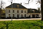
| Het Witte Paard |
Farm |
1750 |
|
Hengelosestraat 8 |
52°15′47″N 6°43′06″E / 52.26295°N 6.71831°E / 52.26295; 6.71831 (RM34148 - Hengelosestraat 8) |
34148 |
|
| Blasius Church |
Church |
1200 |
|
Kerkplein 3 |
52°15′47″N 6°42′42″E / 52.26310°N 6.71175°E / 52.26310; 6.71175 (RM34149 - Kerkplein 3) |
34149 |

|
| Oldest rectory |
House |
|
|
Kerkplein 1 |
52°15′46″N 6°42′40″E / 52.26290°N 6.71105°E / 52.26290; 6.71105 (RM34150 - Kerkplein 1) |
34150 |

|
| Tower of the Nederlands Hervormde Kerk |
Church |
1516 |
|
Kerkplein 3 |
52°15′47″N 6°42′42″E / 52.26310°N 6.71175°E / 52.26310; 6.71175 (RM34151 - Kerkplein 3) |
34151 |
|
| Corner building |
House |
1850 |
|
Langestraat 29 |
52°15′45″N 6°42′44″E / 52.26247°N 6.71222°E / 52.26247; 6.71222 (RM34152 - Langestraat 29) |
34152 |

|
| House |
House |
first half of the 19th century |
|
Langestraat 77 |
52°15′42″N 6°42′28″E / 52.26178°N 6.70783°E / 52.26178; 6.70783 (RM34153 - Langestraat 77) |
34153 |

|
| House |
House |
|
|
Langestraat 24-26 |
52°15′46″N 6°42′46″E / 52.26286°N 6.71285°E / 52.26286; 6.71285 (RM34154 - Langestraat 24-26) |
34154 |
|
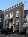
| Corner building |
House |
18th/19th century |
|
Langestraat 60 |
52°15′44″N 6°42′37″E / 52.26212°N 6.71029°E / 52.26212; 6.71029 (RM34155 - Langestraat 60) |
34155 |

|
| St. Blasius |
Church |
1872-1873 |
|
Langestraat 76 |
52°15′45″N 6°42′28″E / 52.26242°N 6.70781°E / 52.26242; 6.70781 (RM34156 - Langestraat 76) |
34156 |

|
| Rectory of the R.K. Kerk van de H. Blasius |
Church house |
1872 |
|
Langestraat 78 |
52°15′45″N 6°42′26″E / 52.26248°N 6.70736°E / 52.26248; 6.70736 (RM34157 - Langestraat 78) |
34157 |
|
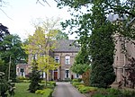
| De Kroon |
House |
1764 |
|
Markt 1 |
52°15′46″N 6°42′43″E / 52.26267°N 6.71205°E / 52.26267; 6.71205 (RM34158 - Markt 1) |
34158 |

|
| One storey building |
House |
first half of the 19th century |
|
Markt 2 |
52°15′46″N 6°42′45″E / 52.26288°N 6.71241°E / 52.26288; 6.71241 (RM34159 - Markt 2) |
34159 |

|
| House |
House |
first half of the 19th century |
|
Markt 3 |
52°15′46″N 6°42′43″E / 52.26272°N 6.71195°E / 52.26272; 6.71195 (RM34160 - Markt 3) |
34160 |

|
| Corner building |
House |
|
|
Markt 5 |
52°15′46″N 6°42′43″E / 52.26280°N 6.71201°E / 52.26280; 6.71201 (RM34161 - Markt 5) |
34161 |

|
| Storage building |
Storage |
18th century |
|
Meijlingstraat 3 |
52°15′47″N 6°42′46″E / 52.26307°N 6.71291°E / 52.26307; 6.71291 (RM34162 - Meijlingstraat 3) |
34162 |

|
| Youngest rectory |
House |
first half of the 19th century |
|
Spoorstraat 5 |
52°15′41″N 6°42′37″E / 52.26141°N 6.71025°E / 52.26141; 6.71025 (RM34163 - Spoorstraat 5) |
34163 |

|
| Farm de Strampe |
Farm |
18th or beginning of the 19th century |
|
Steinwegstraat 38 |
52°15′25″N 6°42′50″E / 52.25683°N 6.71391°E / 52.25683; 6.71391 (RM34164 - Steinwegstraat 38) |
34164 |

|
| Farm |
Farm |
1754 |
|
Vossenbrink 3 |
52°15′23″N 6°43′13″E / 52.25632°N 6.72040°E / 52.25632; 6.72040 (RM34165 - Vossenbrink 3) |
34165 |

|
| Het Oude Huis |
House |
1910s |
|
Langestraat 27 |
52°15′45″N 6°42′45″E / 52.26255°N 6.71249°E / 52.26255; 6.71249 (RM507482 - Langestraat 27) |
507482 |

|
| One storey workshop |
 Industry Industry |
1910s |
|
Kortestraat |
52°15′45″N 6°42′45″E / 52.26241°N 6.71257°E / 52.26241; 6.71257 (RM507483 - Kortestraat) |
507483 |

|
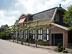
| House |
House |
1900 |
|
Zaagmolenweg 4 |
52°15′46″N 6°44′02″E / 52.26268°N 6.73392°E / 52.26268; 6.73392 (RM507485 - Zaagmolenweg 4) |
507485 |
|
| Huis |
House |
1900 |
|
Zaagmolenweg 6 |
52°15′45″N 6°44′00″E / 52.26251°N 6.73346°E / 52.26251; 6.73346 (RM507486 - Zaagmolenweg 6) |
507486 |

|
| Dubble houses |
House |
1916 |
|
Zaagmolenweg 3-5 |
52°15′43″N 6°44′04″E / 52.26182°N 6.73438°E / 52.26182; 6.73438 (RM507487 - Zaagmolenweg 3-5) |
507487 |

|
| St. Anne |
Farm |
1842 |
|
Oude Benteloseweg 32 |
52°15′20″N 6°42′08″E / 52.25544°N 6.70211°E / 52.25544; 6.70211 (RM507489 - Oude Benteloseweg 32) |
507489 |

|
| Wooden shed |
Farm |
1842 |
|
Oude Benteloseweg 32 |
52°15′20″N 6°42′08″E / 52.25544°N 6.70211°E / 52.25544; 6.70211 (RM507490 - Oude Benteloseweg 32) |
507490 |

Upload Photo
|
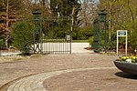
| Entry gate to the cemetery |
 Cemetery Cemetery |
1829 |
|
Langestraat 200 |
52°15′42″N 6°41′27″E / 52.26168°N 6.69097°E / 52.26168; 6.69097 (RM507492 - Langestraat 200) |
507492 |
|
| Tomb of the Van Heeckeren family |
Cemetery |
<1929 |
|
Langestraat 200 |
52°15′40″N 6°41′25″E / 52.26108°N 6.69038°E / 52.26108; 6.69038 (RM507493 - Langestraat 200) |
507493 |

|
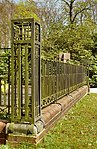
| Fencing surrounding the family grave of the Gewin family |
Cemetery |
1829 |
|
Langestraat 200 |
52°15′42″N 6°41′27″E / 52.26168°N 6.69097°E / 52.26168; 6.69097 (RM507494 - Langestraat 200) |
507494 |
|
| Municipal building/Saltmuseum |
Government |
1873 |
J. Moll |
Langestraat 30 |
52°15′46″N 6°42′45″E / 52.26279°N 6.71254°E / 52.26279; 6.71254 (RM507495 - Langestraat 30) |
507495 |

|
| Monument |
 Memorial Memorial |
1894 |
|
Markt bij 1 |
52°15′46″N 6°42′45″E / 52.26268°N 6.71245°E / 52.26268; 6.71245 (RM507496 - Markt bij 1) |
507496 |

|
| Zuiderhaghe |
House |
1917 |
Jansen en Schrakamp |
Zuiderhagen 8 |
52°15′41″N 6°42′42″E / 52.26142°N 6.71172°E / 52.26142; 6.71172 (RM507497 - Zuiderhagen 8) |
507497 |

|
| Manor house |
House |
c. 1890 |
|
Langestraat 1 |
52°15′47″N 6°42′52″E / 52.26293°N 6.71437°E / 52.26293; 6.71437 (RM507498 - Langestraat 1) |
507498 |

|
| House |
House |
1935 |
F.A. van Hal |
Zuiderhagen 15 |
52°15′45″N 6°42′51″E / 52.26249°N 6.71426°E / 52.26249; 6.71426 (RM507499 - Zuiderhagen 15) |
507499 |

|
| Cramershof |
House |
c. 1906 |
|
Cramerswegje 2 |
52°15′43″N 6°42′55″E / 52.26205°N 6.71522°E / 52.26205; 6.71522 (RM507500 - Cramerswegje 2) |
507500 |

|
| Bruggeman |
Farm |
1880 |
|
Hengelosestraat 22 |
52°15′44″N 6°43′32″E / 52.26210°N 6.72567°E / 52.26210; 6.72567 (RM507502 - Hengelosestraat 22) |
507502 |

|
| Dubble houses belonging to Twickel estate |
House |
1925 |
H.A. Pothoven |
Watertorenstraat 2-4 |
52°15′53″N 6°42′32″E / 52.26466°N 6.70880°E / 52.26466; 6.70880 (RM507503 - Watertorenstraat 2-4) |
507503 |

|
| Dubble houses |
House |
1925 |
H.A. Pothoven |
Watertorenstraat 1-3 |
52°15′54″N 6°42′32″E / 52.26510°N 6.70875°E / 52.26510; 6.70875 (RM507504 - Watertorenstraat 1-3) |
507504 |

|
| Water tower in Neo-Renaissance style, belonging to Twickel estate |
Public utility |
1894 |
Hidde Petrus Nicolaas Halbertsma |
Watertorenstraat bij 5 |
52°15′59″N 6°42′32″E / 52.26639°N 6.70898°E / 52.26639; 6.70898 (RM507505 - Watertorenstraat bij 5) |
507505 |

|
| Braamrot |
Farm |
c. 1900 |
|
Twickelerlaan 4 |
52°15′56″N 6°43′07″E / 52.26548°N 6.71870°E / 52.26548; 6.71870 (RM507506 - Twickelerlaan 4) |
507506 |

|
| Bagatelle |
House |
c. 1870 |
|
Van Nispenweg 2 |
52°15′39″N 6°42′59″E / 52.26073°N 6.71643°E / 52.26073; 6.71643 (RM507508 - Van Nispenweg 2) |
507508 |

|
| Huis 't Eysink |
Additional buildings castles etc. |
1839 |
|
Hengelosestraat 24 |
52°15′43″N 6°43′36″E / 52.26197°N 6.72666°E / 52.26197; 6.72666 (RM507641 - Hengelosestraat 24) |
507641 |

|
| Kronenhof |
House |
1923 |
|
Dr. Gewinstraat 6 |
52°15′40″N 6°42′52″E / 52.26114°N 6.71454°E / 52.26114; 6.71454 (RM507644 - Dr. Gewinstraat 6) |
507644 |

|
| Chimney of wollen fabrics factory |
Industry |
1866 |
|
Kortestraat 11 |
52°15′44″N 6°42′48″E / 52.26217°N 6.71325°E / 52.26217; 6.71325 (RM507947 - Kortestraat 11) |
507947 |
 |


