Nor'Wester Mountains
Mountain range in Ontario, Canada
From Wikipedia, the free encyclopedia
The Nor'Wester Mountains are a group of mountains immediately south of Thunder Bay, Ontario, Canada, located on the southern limits of the City of Thunder Bay and south of the Kaministiquia River.[1]: 32, 33 Mount McKay is the highest, most northern and best known of these mountains. Other prominent peaks include Godfrey, Hurlburt, Johnson, Matchett, McRae, McQuaig, Rose, and Squaretop.

| Nor'Wester Mountains | |
|---|---|
The Nor'Westers seen from Neebing Township | |
| Highest point | |
| Peak | Mount McKay |
| Elevation | 483 m (1,585 ft) |
| Coordinates | 48°20′43″N 89°17′8″W |
| Geography | |
  Nor'Wester Mountains Location in Ontario | |
Country | Canada |
Province | Ontario |
Loch Lomond, 287 m (942 ft) above sea level, collects most of the runoff within the Nor’Wester Mountains; Loch Lomond is drained by the Lomond River.[1]: 5 A few square kilometers of mountain slope south of Mount McKay are drained by Whiskeyjack Creek.[1]: 5
Gallery
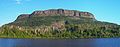 Mount McKay
