
Camphin-en-Pévèle
französische Gemeinde
From Wikipedia, the free encyclopedia
Camphin-en-Pévèle ist eine französische Gemeinde mit 2.518 Einwohnern (Stand: 1. Januar 2023) im Département Nord in der Region Hauts-de-France. Sie gehört zum Arrondissement Lille und zum Kanton Templeuve-en-Pévèle. Die Einwohner werden Camphinois und Camphinoises genannt.
.svg)
| Camphin-en-Pévèle | ||
|---|---|---|
|
|
| |
| Staat |  Frankreich Frankreich | |
| Region | Hauts-de-France | |
| Département (Nr.) | Nord (59) | |
| Arrondissement | Lille | |
| Kanton | Templeuve-en-Pévèle | |
| Gemeindeverband | Pévèle-Carembault | |
| Koordinaten | 50° 36′ N, 3° 16′ O | |
| Höhe | 37–56 m | |
| Fläche | 6,45 km² | |
| Einwohner | 2.518 (1. Januar 2023) | |
| Bevölkerungsdichte | 390 Einw./km² | |
| Postleitzahl | 59780 | |
| INSEE-Code | 59124 | |
| Website | www.camphin-en-pevele.fr | |
 Rathaus (Mairie) von Camphin-en-Pévèle | ||


Geographie
Camphin-en-Pévèle liegt etwa 15 Kilometer ostsüdöstlich des Stadtzentrums von Lille an der Grenze zu Belgien. Umgeben wird Camphin-en-Pévèle von den Nachbargemeinden Baisieux im Norden, Tournai im Osten, Wannehain im Süden, Bourghelles im Süden und Südwesten, Cysoing im Südwesten sowie Gruson im Westen. Durch das Gemeindegebiet führt die Autoroute A27.
Durch die Gemeinde führt die Autoroute A27.
Bevölkerungsentwicklung
| Jahr | 1962 | 1968 | 1975 | 1982 | 1990 | 1999 | 2006 | 2012 | 2020 |
| Einwohner | 1038 | 1076 | 1123 | 1212 | 1341 | 1570 | 1620 | 2152 | 2497 |
Sehenswürdigkeiten
- Domäne Luchin
- Kirche Saint-Amand
- Britischer Militärfriedhof
 Ortszentrum
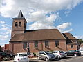 Kirche Saint-Amand
 Kapelle Luchin


.JPG)
Literatur
- Le Patrimoine des Communes du Nord. Flohic Editions, Band 1, Paris 2001, ISBN 2-84234-119-8, S. 596–598.
Weblinks
Commons: Camphin-en-Pévèle – Sammlung von Bildern
