Agate, North Dakota
From Wikipedia, the free encyclopedia
Agate, North Dakota | |
|---|---|
  Agate Location within the state of North Dakota  Agate Agate (the United States) | |
| Coordinates: 48°37′22″N 99°29′36″W / 48.62278°N 99.49333°W | |
| Country | United States |
| State | North Dakota |
| County | Rolette, Towner |
| Elevation | 1,657 ft (505 m) |
| Time zone | UTC-6 (Eastern (CST)) |
| • Summer (DST) | UTC-5 (EDT) |
| ZIP codes | 58310 |
| Area code | 701 |
| GNIS feature ID | 1033828[1] |
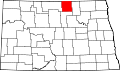
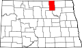
Agate is an unincorporated community in southeastern Rolette and western Towner counties in the U.S. state of North Dakota. It lies along North Dakota Highway 66, south of Rolla and northwest of Cando, the respective seats of Rolette and Towner Counties.[2] Its elevation is 1,657 feet (505 m). Agate has the ZIP code 58310.[3]