Amund, Iowa
From Wikipedia, the free encyclopedia
Amund, Iowa | |
|---|---|
  Amund, Iowa | |
| Coordinates: 43°28′24″N 93°47′36″W / 43.47333°N 93.79333°W | |
| Country | United States |
| State | Iowa |
| County | Winnebago |
| Elevation | 1,240 ft (380 m) |
| Time zone | UTC-6 (Central (CST)) |
| • Summer (DST) | UTC-5 (CDT) |
| Area code | 641 |
| GNIS feature ID | 464046[1] |
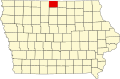
Amund was a rural unincorporated community in Eden Township, Winnebago County, Iowa, United States.[1] Founded in the late 1800s, the community was considered prosperous in the early 20th century, but the population remained small. By the 1970s, the town was one of 11 abandoned communities in Winnebago County.
Amund is located along county highways A16 and R34.[2] The community is in Eden Township northwest of the Good Neighbors Marsh Wildlife Management Area.[3] The community was in the northwest corner of section 22 of Eden Township.[4]