Bayou Blue, Louisiana
From Wikipedia, the free encyclopedia
Bayou Blue, Louisiana | |
|---|---|
  Bayou Blue  Bayou Blue | |
| Coordinates: 29°38′03″N 90°40′23″W / 29.63417°N 90.67306°W | |
| Country | United States |
| State | Louisiana |
| Parish | Lafourche, Terrebonne |
| Area | |
• Total | 23.53 sq mi (60.94 km2) |
| • Land | 23.27 sq mi (60.28 km2) |
| • Water | 0.26 sq mi (0.67 km2) |
| Elevation | 7 ft (2.1 m) |
| Population (2020) | |
• Total | 13,352 |
| • Density | 573.7/sq mi (221.51/km2) |
| Time zone | UTC-6 (Central (CST)) |
| • Summer (DST) | UTC-5 (CDT) |
| Area code | 985 |
| GNIS feature ID | 2583527[2] |
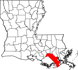
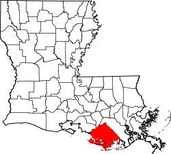
Bayou Blue is a metropolitan area in Lafourche and Terrebonne parishes, Louisiana, United States. As of the 2020 census, Bayou Blue had a population of 13,352.[3]
In June 1981, an arson attack on a local nightclub killed five people.[4]
According to the U.S. Census Bureau, the community has an area of 23.520 square miles (60.92 km2); 23.263 square miles (60.25 km2) of its area is land, and 0.257 square miles (0.67 km2) is water.[5]