Berks, Nebraska
From Wikipedia, the free encyclopedia
Berks, Nebraska | |
|---|---|
 | |
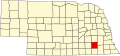
 Berks Location in Nebraska  Berks Location in the United States | |
| Coordinates: 40°39′31″N 96°54′49″W / 40.65861°N 96.91361°W | |
| Country | United States |
| State | Nebraska |
| Counties | Lancaster & Saline |
| Elevation | 1,417 ft (432 m) |
| Time zone | UTC-6 (Central (CST)) |
| • Summer (DST) | UTC-5 (CDT) |
| ZIP codes | 68333 |
| GNIS feature ID | 835247[1] |
Berks is an unincorporated community in Lancaster and Saline counties in Nebraska, United States.[1] The community is located approximately three miles (4.8 km) northeast of Crete on the BNSF Railroad Line and north of Nebraska Highway 33.[2]
Some people hold Berks was the name of an early settler, while others believe the community was named after Berks County, Pennsylvania.[3] The name was also probably chosen to conform with the alphabetical stops on the new Burlington & Quincy Railroad line traveling westward from Lincoln: Berks, Crete, Dorchester, Exeter, Fairmont, Grafton, Huxley, etc.[4] The Berks post office was discontinued in 1912.[5]