Bethel Historic District (Bethel, Missouri)
From Wikipedia, the free encyclopedia
LocationRoughly bounded by Liberty, King, 1st, and 4th Sts., Bethel, Missouri
Built1844
Bethel Historic District | |
 | |
   | |
| Location | Roughly bounded by Liberty, King, 1st, and 4th Sts., Bethel, Missouri |
|---|---|
| Coordinates | 39°52′42″N 92°1′24″W / 39.87833°N 92.02333°W |
| Built | 1844 |
| NRHP reference No. | 70000350 [1] |
| Added to NRHP | November 10, 1970 |
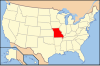
Bethel Historic District is roughly bounded by Liberty, King, 1st, and 4th Sts. in Bethel, Missouri. Construction of the town, which was for over thirty years a successful experiment in communal living, began in 1844. The leader of the community was a German emigrant, charismatic autocrat Dr. William Keil. After his death, the communal structure gradually collapsed and the communal property was split among the community members. The district was added to the National Register of Historic Places in 1970. There are twenty-six contributing properties.[2]