Bolsterlang
From Wikipedia, the free encyclopedia
Bolsterlang | |
|---|---|
 Bolsterlang seen from the east | |
 Coat of arms | |
Location of Bolsterlang
within Oberallgäu district 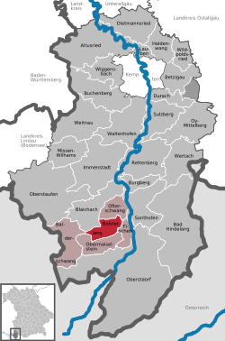 | |
 Location of Bolsterlang | |
 Bolsterlang  Bolsterlang | |
| Coordinates: 47°28′N 10°14′E / 47.467°N 10.233°E | |
| Country | Germany |
| State | Bavaria |
| Admin. region | Schwaben |
| District | Oberallgäu |
| Government | |
| • Mayor (2019–25) | Rolf Walter[1] |
| Area | |
• Total | 20.37 km2 (7.86 sq mi) |
| Elevation | 892 m (2,927 ft) |
| Population (2023-12-31)[2] | |
• Total | 1,131 |
| • Density | 55.52/km2 (143.8/sq mi) |
| Time zone | UTC+01:00 (CET) |
| • Summer (DST) | UTC+02:00 (CEST) |
| Postal codes | 87538 |
| Dialling codes | 08326 |
| Vehicle registration | OA |
| Website | www.bolsterlang.de |
Bolsterlang (German pronunciation: [ˈbɔlstɐlaŋ]; Alemannic German: Bolschterlang) is a municipality in the district of Oberallgäu in Bavaria in Germany.