Boyes, Montana
From Wikipedia, the free encyclopedia
Boyes, Montana | |
|---|---|
 Interactive map of Boyes, Montana | |
| Coordinates: 45°16′5″N 105°1′52″W / 45.26806°N 105.03111°W | |
| Country | |
| State | |
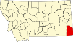
| County | Carter |
| Elevation | 3,327 ft (1,014 m) |
| Time zone | Mountain (MST) |
| • Summer (DST) | MDT |
| Postal code | 59316 |
| Area code | 406 |
| GNIS feature ID | 802052[1] |
Boyes is an unincorporated village in southwestern Carter County, Montana, United States. It lies along U.S. Route 212 southwest of the town of Ekalaka, the county seat of Carter County.[2] Its elevation is 3,327 feet (1,014 m) and it is located at 45°16′5″N 105°1′52″W / 45.26806°N 105.03111°W.[1]
The town was named after Henry Edward Boyes, an early homesteader and stagecoach driver who stopped off to change horses.[3] The town was originally located at the head of Scott Creek. In 1931, it was moved to be closer to U.S. Route 212.[3] A post office, established in 1906,[4] is still in operation serving ZIP code 59316.[5]