Brown Station, Maryland
From Wikipedia, the free encyclopedia
Brown Station | |
|---|---|
  Brown Station Location within the state of Maryland Show map of Maryland Brown Station Brown Station (the United States) Show map of the United States | |
| Coordinates: 38°51′14″N 76°47′53″W / 38.854°N 76.798°W / 38.854; -76.798 | |
| Country |  United States of America United States of America |
| State |  Maryland Maryland |
| County |  Prince George's Prince George's |
| Area | |
• Total | 6.22 sq mi (16.12 km2) |
| • Land | 6.17 sq mi (15.97 km2) |
| • Water | 0.058 sq mi (0.15 km2) |
| Population (2020) | |
• Total | 3,298 |
| • Density | 534.8/sq mi (206.49/km2) |
| Time zone | UTC-5 (Eastern (EST)) |
| • Summer (DST) | UTC-4 (EDT) |
| FIPS code | 24-10737 |
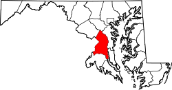
Brown Station is a census designated place in Prince George's County, Maryland, United States.[2][3] Per the 2020 Census, the population was 3,298.[4]
The Brown Station CDP was first defined by the U.S. Census Bureau for the 2020 U.S. census.[5] The areas for Brown Station were taken from Brock Hall and Westphalia as defined in the 2010 U.S. census.[6][7] Brown Station Road contains the Prince George's County landfill, as well as its new animal shelter.
Demographics
| Census | Pop. | Note | %± |
|---|---|---|---|
| 2020 | 3,298 | — | |
| U.S. Decennial Census[8] 2020[9] | |||
Brown Station first appeared as a census designated place in the 2020 U.S. census.[10]
2020 census
As of the 2020 census, the median age was 46.3 years. 19.7% of residents were under the age of 18 and 20.3% of residents were 65 years of age or older. For every 100 females there were 84.5 males, and for every 100 females age 18 and over there were 79.0 males age 18 and over.[11][12]
92.1% of residents lived in urban areas, while 7.9% lived in rural areas.[13]
There were 1,132 households in Brown Station, of which 31.0% had children under the age of 18 living in them. Of all households, 53.7% were married-couple households, 11.2% were households with a male householder and no spouse or partner present, and 32.9% were households with a female householder and no spouse or partner present. About 24.8% of all households were made up of individuals and 14.3% had someone living alone who was 65 years of age or older.[11]
There were 1,163 housing units, of which 2.7% were vacant. The homeowner vacancy rate was 1.8% and the rental vacancy rate was 1.7%.[11]
| Race / Ethnicity (NH = Non-Hispanic) | Pop 2020[9] | % 2020 |
|---|---|---|
| White alone (NH) | 143 | 4.34% |
| Black or African American alone (NH) | 2,699 | 81.84% |
| Native American or Alaska Native alone (NH) | 6 | 0.18% |
| Asian alone (NH) | 73 | 2.21% |
| Native Hawaiian or Pacific Islander alone (NH) | 3 | 0.09% |
| Other race alone (NH) | 8 | 0.24% |
| Mixed race or Multiracial (NH) | 124 | 3.76% |
| Hispanic or Latino (any race) | 242 | 7.34% |
| Total | 3,298 | 100.00% |
Education
It is in Prince George's County Public Schools.[14]
Schools in the CDP include:[15] Barack Obama Elementary School,[16] and Dr. Henry A. Wise Jr. High School.[17] These schools, in the 2010 U.S. census, were in the Westphalia CDP.[18]
School zones include:
- Elementary: Obama, Arrowhead, and Perrywood (in separate zones)[19]
- Middle: Kettering and James Madison (in separate zones)[20]
- High: Wise, and Largo High School (in separate zones)[21]
Obama Elementary was the first school in the Washington, D.C., area that was named after the former president.[22] It is adjacent to Wise High School.[23] The Prince George's County school board approved of the name of the school on June 25, 2009;[22] all board members voted in favor of the renaming.[23] The school opened on August 23, 2010, and had a cost of $25 million. The architect was Grimm + Parker Architects,[24] and it was built for 792 students.[23] The school's cooling system relies on over 144 geothermal pumps.[25] The initial enrollment was 798, slightly higher than the school's stated capacity.[22] Its opening relieved Arrowhead, Marlton, Melwood, Patuxent and Perrywood, elementary schools.[24] The first principal was Pearl Harmon, a Liberian American;[25] in 2014 she was reassigned to an administrative position in the PG County school system.[26] Several school board members argued that naming a school after Obama would inspire area students. Many schools in PG County were named after African-Americans, and PG County voters primarily support the Democratic Party, Obama's political party.[27] In the 2008 U.S. Presidential Election, 89% of PG County residents voted for Obama. The chairperson of the PG County Republican Party Central Committee, Mykel Harris, argued that the county should not name a school after a current president, while the chairperson of the board, Ron L. Watson, stated that the vote was not done out of political considerations.[23]
References
- ↑ "2020 U.S. Gazetteer Files". United States Census Bureau. Retrieved April 26, 2022.
- ↑ "Brown Station Census Designated Place". Geographic Names Information System. United States Geological Survey, United States Department of the Interior. Retrieved March 13, 2021.
- ↑ Rowlands, DW (January 20, 2021). "A first look at our region's new Census-Designated Places". "GGWash". Washington, DC. Retrieved February 26, 2021.
- ↑ "Brown Station CDP, Maryland". United States Census Bureau. Retrieved March 13, 2022.
- ↑ "2020 CENSUS - CENSUS BLOCK MAP: Brown Station CDP, MD" (PDF). U.S. Census Bureau. Retrieved February 5, 2024. - Compare to the schools' addresses.
- ↑ "2010 CENSUS - CENSUS BLOCK MAP (INDEX): Brock Hall CDP, MD." U.S. Census Bureau. Retrieved on August 28, 2018. Pages: 1, 2, 3, and 4.
- ↑ "2010 CENSUS - CENSUS BLOCK MAP (INDEX): Westphalia CDP, MD." U.S. Census Bureau. Retrieved on August 27, 2018. Pages: 1, 2, 3, and 4.
- ↑ "Decennial Census of Population and Housing by Decades". US Census Bureau.
- 1 2 "P2 Hispanic or Latino, and Not Hispanic or Latino by Race – 2020: DEC Redistricting Data (PL 94-171) - Brown Station CDP, Maryland". United States Census Bureau.
- ↑ "2020 Geography Changes". United States Census Bureau.
- 1 2 3 "2020 Decennial Census Demographic Profile (DP1)". United States Census Bureau. 2021. Retrieved April 29, 2026.
- 1 2 "2020 Decennial Census Redistricting Data (Public Law 94-171)". United States Census Bureau. 2021. Retrieved April 29, 2026.
- ↑ "2020 Decennial Census Demographic and Housing Characteristics (DHC)". United States Census Bureau. 2023. Retrieved April 29, 2026.
- ↑ "2020 CENSUS - SCHOOL DISTRICT REFERENCE MAP: Prince George's County, MD" (PDF). U.S. Census Bureau. Retrieved February 5, 2024. - Text list
- ↑ "2020 CENSUS - CENSUS BLOCK MAP: Brown Station CDP, MD" (PDF). U.S. Census Bureau. Retrieved February 5, 2024. - Compare to the schools' addresses.
- ↑ Home. Barack Obama Elementary School. Retrieved on August 28, 2018. "Barack Obama Elementary 12700 Brooke Lane Upper Marlboro, MD 20772"
- ↑ "Dr. Henry A. Wise Jr. High (2021–2022 school year)". National Center for Educational Statistics (NCES).
Mailing Address: 12650 Brooke Ln Upper Marlboro, MD 20772
- ↑ "2010 CENSUS - CENSUS BLOCK MAP (INDEX): Westphalia CDP, MD" (PDF). U.S. Census Bureau. p. 4. Retrieved February 5, 2024. - Compare to the schools' addresses.
- ↑ "NEIGHBORHOOD ELEMENTARY SCHOOLS AND BOUNDARIES SCHOOL YEAR 2023-2024." Prince George's County Public Schools. Retrieved on February 5, 2024 - Compare to the CDP map
- ↑ "NEIGHBORHOOD MIDDLE SCHOOLS AND BOUNDARIES SCHOOL YEAR 2023-2024." Prince George's County Public Schools. Retrieved on February 5, 2024 - Compare to the CDP map
- ↑ "NEIGHBORHOOD HIGH SCHOOLS AND BOUNDARIES SCHOOL YEAR 2023-2024." Prince George's County Public Schools. Retrieved on February 5, 2024 - Compare to the CDP map
- 1 2 3 Dickson, Akeya (October 21, 2010). "Much hope at dedication of Barack Obama Elementary School in Upper Marlboro". Washington Post. p. 1.
- 1 2 3 4 King, Megan (June 26, 2009). "School board approves Barack Obama Elementary name". The Gazette.
- 1 2 Dickson, Akeya (October 21, 2010). "Much hope at dedication of Barack Obama Elementary School in Upper Marlboro". Washington Post. p. 2.
- 1 2 Tillman, Zoe (2010). "Upper Marlboro school makes final touches". Prince George's County The Gazette. Retrieved August 28, 2018.
- ↑ Wiggins, Ovetta (June 30, 2014). "Barack Obama Elementary School principal in Prince George's County is transferred". Washington Post. Retrieved August 28, 2018.
- ↑ Hernandez, Nelson (June 24, 2009). "Prince George's County Board of Education May Name Upper Marlboro School After Obama". Washington Post. Retrieved August 28, 2018.