Bryant, Oklahoma
From Wikipedia, the free encyclopedia
Bryant, Oklahoma | |
|---|---|
  Bryant, Oklahoma Location within the state of Oklahoma  Bryant, Oklahoma Bryant, Oklahoma (the United States) | |
| Coordinates: 35°23′32″N 96°03′44″W / 35.39222°N 96.06222°W | |
| Country | United States |
| State | Oklahoma |
| County | Okmulgee |
| Area | |
• Total | 0.15 sq mi (0.39 km2) |
| • Land | 0.15 sq mi (0.39 km2) |
| • Water | 0 sq mi (0.00 km2) |
| Elevation | 738 ft (225 m) |
| Population (2020) | |
• Total | 19 |
| • Density | 124.6/sq mi (48.11/km2) |
| Time zone | UTC-6 (Central (CST)) |
| • Summer (DST) | UTC-5 (CDT) |
| FIPS code | 40-09700 |
| GNIS feature ID | 2812862[2] |
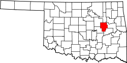
Bryant is a Creek Indian Nation townsite in Okmulgee County, Oklahoma, United States. Bryant is southwest of Henryetta and southeast of the town of Pharoah, being both south of Interstate 40 and east of U.S. Route 75 on Bryant Road.[3]
It is the subject of a book by Mickey J. Martin.[4][5]
As of the 2020 census, Bryant had a population of 19.[6]