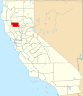
Capay, Glenn County, California
From Wikipedia, the free encyclopedia
39°47′48″N 122°05′04″W / 39.79667°N 122.08444°W
CountryUnited States
Elevation187 ft (57 m)
Capay | |
|---|---|
  Capay Location in California  Capay Capay (the United States) | |
| Coordinates: 39°47′48″N 122°05′04″W / 39.79667°N 122.08444°W | |
| Country | United States |
| State | California |
| County | Glenn County |
| Elevation | 187 ft (57 m) |
Capay (Wintun: Kapai, meaning "Stream")[2][3] is an unincorporated community in Glenn County, California.[1] It is located 7 miles (11 km) east-northeast of Orland,[4] at an elevation of 187 feet (57 m).[1]
The Capay Rancho, encompassing the present site of Capay, was granted to Josefa Soto in 1844 by the Mexican government; it was one of only three such California land grants recognized by the US government, and was formally transferred to Soto by President James Buchanan in 1859.[5]