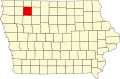
Clay Township, Clay County, Iowa
From Wikipedia, the free encyclopedia
Clay Township | |
|---|---|
 Location in Clay County | |
| Coordinates: 43°02′27″N 095°19′39″W / 43.04083°N 95.32750°W | |
| Country |  United States United States |
| State |  Iowa Iowa |
| County | Clay |
| Area | |
• Total | 36.35 sq mi (94.15 km2) |
| • Land | 36.35 sq mi (94.15 km2) |
| • Water | 0 sq mi (0 km2) 0% |
| Elevation | 1,401 ft (427 m) |
| Population (2000) | |
• Total | 696 |
| • Density | 19/sq mi (7.4/km2) |
| GNIS feature ID | 0467602 |
Clay Township is a township in Clay County, Iowa, USA. As of the 2000 census, its population was 696.
Clay Township was the first township in Clay County. When it was created in 1859, it comprised the entire county.[1]
Geography
Transportation
Clay Township contains one airport or landing strip, Royal Airport.