Clearfield, Kentucky
From Wikipedia, the free encyclopedia
Clearfield, Kentucky | |
|---|---|
 Clearfield  Clearfield | |
| Coordinates: 38°09′43″N 83°25′44″W / 38.16194°N 83.42889°W | |
| Country | United States |
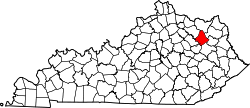
| State | Kentucky |
| County | Rowan |
| Elevation | 732 ft (223 m) |
| Time zone | UTC-5 (Eastern (EST)) |
| • Summer (DST) | UTC-4 (EDT) |
| ZIP code | 40313 |
| Area code | 606 |
| GNIS feature ID | 511402[1] |
Clearfield is an unincorporated community in Rowan County, Kentucky, United States.[1] The community is located along Kentucky Route 519 1.5 miles (2.4 km) south of Morehead. Clearfield has a post office with ZIP code 40313.[2][3]