Cloverdale, Lauderdale County, Alabama
From Wikipedia, the free encyclopedia
Cloverdale, Alabama | |
|---|---|
 Cloverdale  Cloverdale | |
| Coordinates: 34°56′19″N 87°46′17″W / 34.93861°N 87.77139°W | |
| Country | United States |
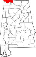
| State | Alabama |
| County | Lauderdale |
| Elevation | 597 ft (182 m) |
| Time zone | UTC-6 (Central (CST)) |
| • Summer (DST) | UTC-5 (CDT) |
| ZIP code | 35617 |
| Area codes | 256 & 938 |
| GNIS feature ID | 116285[1] |
Cloverdale, also known as Raw Hide, is an unincorporated community in Lauderdale County, Alabama, United States. Cloverdale is located on Alabama State Route 157, 11 miles (18 km) north-northwest of Florence. Cloverdale has a post office with ZIP code 35617, which opened on April 8, 1872.[2][3]
Cloverdale is bordered by Waterloo to the west, Oakland to the south, and Underwood-Petersville to the southeast.
The community was formerly known as Raw Hide and was home to a large tan yard.[4] The name Cloverdale was adopted in 1889 for the abundance of clover in the area.[5]