Cottonwood, Apache County, Arizona
From Wikipedia, the free encyclopedia
Cottonwood, Arizona | |
|---|---|
 Cottonwood | |
| Coordinates: 36°43′38″N 112°01′30″W / 36.72722°N 112.02500°W | |
| Country | United States |
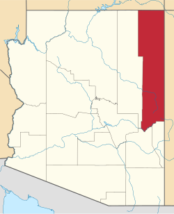
| State | Arizona |
| County | Apache |
| Area | |
• Total | 0.16 sq mi (0.41 km2) |
| • Land | 0.16 sq mi (0.41 km2) |
| • Water | 0.00 sq mi (0.00 km2) |
| Elevation | 3,461 ft (1,055 m) |
| Population (2020) | |
• Total | 167 |
| • Density | 1,063.69/sq mi (411.34/km2) |
| Time zone | UTC-7 (MST) |
| • Summer (DST) | UTC-6 (MDT) |
| FIPS code | 04-16360 |
| GNIS feature ID | 2410242[2] |
Cottonwood is a census-designated place (CDP) in Apache County, Arizona, United States. The population was 226 at the 2010 census.[3]
Cottonwood is located about 21 miles (34 km) west of Chinle and 22 miles (35 km) east of Pinon.
According to the United States Census Bureau, the CDP has a total area of 0.14 square miles (0.37 km2), all land.[3]