Cölbe
Municipality in Hesse, Germany
From Wikipedia, the free encyclopedia
Cölbe (German pronunciation: [ˈkœlbə] ⓘ) is a municipality in Marburg-Biedenkopf district in Hesse, Germany.

Cölbe | |
|---|---|
The town hall (former railway station) | |
 Coat of arms | |
Location of Cölbe
within Marburg-Biedenkopf district 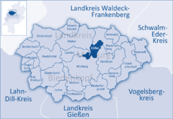 | |
 Location of Cölbe | |
 Cölbe  Cölbe | |
| Coordinates: 50°51′02″N 08°47′03″E | |
| Country | Germany |
| State | Hesse |
| Admin. region | Gießen |
| District | Marburg-Biedenkopf |
| Government | |
| • Mayor (2018–24) | Jens Ried[1] (Ind.) |
| Area | |
• Total | 26.68 km2 (10.30 sq mi) |
| Elevation | 213 m (699 ft) |
| Population (2024-12-31)[2] | |
• Total | 6,491 |
| • Density | 243.3/km2 (630.1/sq mi) |
| Time zone | UTC+01:00 (CET) |
| • Summer (DST) | UTC+02:00 (CEST) |
| Postal codes | 35091 |
| Dialling codes | 06421/ 06427 |
| Vehicle registration | MR |
| Website | www.coelbe.de |


Location
Cölbe's municipal area lies on the southern edge of the Burgwald, a low mountain range and part of the Hessisches Bergland (Hessian Highland), and borders directly on the university city of Marburg to the south. The namesake constituent municipality is found on a bow in the river Lahn where it bends from its mainly easterly flow to a mainly southerly one.
Neighbouring municipalities
Cölbe borders in the northwest on the town of Wetter, in the northeast on the town of Rauschenberg, in the east on the town of Kirchhain, in the south on the town of Marburg, and in the west on the municipality of Lahntal (all in Marburg-Biedenkopf).
Divisions
The municipality consists of six constituent municipalities named Bernsdorf, Bürgeln, Cölbe, Reddehausen, Schönstadt and Schwarzenborn.
Coat of arms
Cölbe's civic coat of arms might be described thus: Gules a bend argent surmounted by six hearts reversed gules in bend three and three. Reversed hearts are also taken in heraldry as stylized testicles.
Clubs
- Fußballverein 1927 Cölbe (football)
- Fröhlicher Kreis e.V. Cölbe ("Merry District")
- Turnverein 06 Cölbe e.V. (Gymnastics)
- Freiwillige Feuerwehr Cölbe – Bürgeln (Volunteer fire brigade)
- Schützenverein 1930/63 Cölbe e.V. (Shooting club)
- Männergesangsverein Cölbe 1878 e.V. (Men's singing club)
- Bläserchor 1901 Schönstadt e.V. (Brass Band)
Politics
Partnerships
Sundry

The Institute for Theoretical Geodesy in Bonn has ascertained that the European Union's centre point after the 2004 expansion lies at the coordinates 50°51′10″N 8°46′43″E. This spot is to be found within Cölbe's municipal limits, 895 m from the municipality's own centre point. Newer efforts delving into this question, however, have yielded different results, putting the EU's centre point most recently at Gadheim in Bavaria.[3]