Doniaga
Village in Friesland, Netherlands
From Wikipedia, the free encyclopedia
Doniaga (West Frisian: Dunegea) is a small village in De Fryske Marren municipality in the province Friesland of the Netherlands and has around 100 citizens (2017).[3]

Doniaga
Dunegea | |
|---|---|
Village | |
Bell tower of Doniaga | |
 Location in De Friese Meren municipality | |
  Doniaga Location in the Netherlands  Doniaga Doniaga (Netherlands) | |
| Country |  Netherlands Netherlands |
| Province |  Friesland Friesland |
| Municipality |  De Fryske Marren De Fryske Marren |
| Area | |
• Total | 6.84 km2 (2.64 sq mi) |
| Elevation | −0.2 m (−0.66 ft) |
| Population (2021)[1] | |
• Total | 85 |
| • Density | 12/km2 (32/sq mi) |
| Time zone | UTC+1 (CET) |
| • Summer (DST) | UTC+2 (CEST) |
| Postal code | 8516[1] |
| Dialing code | 0513 |
It is located west of the Tjeukemeer and named after the Donia family.[4]
History
The village was first mentioned in 1448 as Doyenga.[4] In 1840, it was home to 104 people. It used to have a little village centre with a school, inn, church and library, but only the belfry remains. The church was demolished in the 19th century. The belfry dates from 1901.[5]
Before 2009, Doniaga was part of the Skarsterlân municipality and before 1984 it was part of Doniawerstal.[5]
Gallery
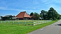 Farm in Doniaga
 Farm in Doniaga
 American wind mill (1955)


,_Bestanddeelnr_170-2618.jpg)

