Dooley's Ferry Fortifications Historic District
From Wikipedia, the free encyclopedia
Nearest citySpring Hill
Area24 acres (9.7 ha)
Dooley's Ferry Fortifications Historic District | |
 Cemetery with earthworks | |
   | |
| Nearest city | Spring Hill |
|---|---|
| Coordinates | 33°30′27″N 93°43′03″W / 33.5075°N 93.7175°W |
| Area | 24 acres (9.7 ha) |
| NRHP reference No. | 04001031[1] |
| Added to NRHP | September 22, 2004 |
The Dooley's Ferry Fortifications Historic District protects a series of military earthworks erected in southwestern Arkansas, along the Red River in Hempstead County. They were constructed in late 1864 by Confederate troops under orders from Major-General John B. Magruder as a defense against the potential movements of Union Army forces toward Shreveport, Louisiana. They command a formerly major road intersection just east of Dooley's Ferry, one of the most important regional crossings of the Red River. After the war a cemetery for African-Americans was established adjacent to one of the gun emplacements.[2]
The fortifications were listed on the National Register of Historic Places in 2004.[1]
 Thomas Dooley 1837 Land Patent.
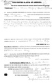 Thomas Dooley 1839 Land Patent.
 Map circa 1861–1865.
 Survey map 1900.


