Dori, Burkina Faso
From Wikipedia, the free encyclopedia
Dori | |
|---|---|
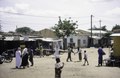
 A farmer on the streets of Dori | |
 Dori Location within Burkina Faso, West Africa | |
| Coordinates: 14°02′N 0°02′W / 14.03°N 0.03°W | |
| Country | |
| Region | Sahel Region |
| Province | Séno Province |
| Elevation | 286 m (938 ft) |
| Population (2019 census)[1] | |
• Total | 46,512 |
| Time zone | UTC+0 (GMT) |
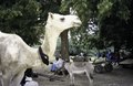
Dori (also known as Winde or Wendu[2]) is a town in northeastern Burkina Faso, near the border of Niger. It is located at around 14°02′N 0°02′W / 14.03°N 0.03°W. It is the capital of Sahel Region and has a population of 46,512 (2019).[1] The main ethnic group is the Fula (Fulani) but Tuaregs and Songhai are often present. It is a town known for its herders and popular livestock markets.[3]
Dori recorded a temperature of 47.2 °C (117.0 °F) in 1984, which is the highest temperature to have ever been recorded in Burkina Faso.[4]
In 2020, it was reported that the Emir of Liptako lived in Dori.[5]
Dori has a semi-arid climate (Köppen climate classification BSh).
| Climate data for Dori (1991–2020) | |||||||||||||
|---|---|---|---|---|---|---|---|---|---|---|---|---|---|
| Month | Jan | Feb | Mar | Apr | May | Jun | Jul | Aug | Sep | Oct | Nov | Dec | Year |
| Record high °C (°F) | 40.8 (105.4) |
43.5 (110.3) |
44.6 (112.3) |
47.5 (117.5) |
46.4 (115.5) |
45.0 (113.0) |
42.3 (108.1) |
41.1 (106.0) |
42.6 (108.7) |
42.6 (108.7) |
41.6 (106.9) |
39.9 (103.8) |
47.5 (117.5) |
| Mean daily maximum °C (°F) | 32.6 (90.7) |
36.0 (96.8) |
40.0 (104.0) |
42.4 (108.3) |
41.8 (107.2) |
38.8 (101.8) |
35.5 (95.9) |
33.7 (92.7) |
35.9 (96.6) |
38.9 (102.0) |
37.6 (99.7) |
33.9 (93.0) |
37.3 (99.1) |
| Daily mean °C (°F) | 23.6 (74.5) |
26.8 (80.2) |
31.0 (87.8) |
34.2 (93.6) |
34.6 (94.3) |
32.4 (90.3) |
29.7 (85.5) |
28.3 (82.9) |
29.6 (85.3) |
31.0 (87.8) |
28.0 (82.4) |
24.5 (76.1) |
29.5 (85.1) |
| Mean daily minimum °C (°F) | 15.5 (59.9) |
18.4 (65.1) |
22.6 (72.7) |
26.7 (80.1) |
28.8 (83.8) |
27.2 (81.0) |
25.0 (77.0) |
24.1 (75.4) |
24.8 (76.6) |
24.8 (76.6) |
19.4 (66.9) |
16.1 (61.0) |
22.8 (73.0) |
| Record low °C (°F) | 7.8 (46.0) |
10.7 (51.3) |
14.0 (57.2) |
16.4 (61.5) |
20.6 (69.1) |
20.8 (69.4) |
18.7 (65.7) |
19.8 (67.6) |
19.9 (67.8) |
17.8 (64.0) |
12.9 (55.2) |
8.3 (46.9) |
7.8 (46.0) |
| Average precipitation mm (inches) | 0.3 (0.01) |
0.0 (0.0) |
2.6 (0.10) |
4.8 (0.19) |
25.7 (1.01) |
68.3 (2.69) |
127.9 (5.04) |
186.9 (7.36) |
73.8 (2.91) |
16.7 (0.66) |
0.0 (0.0) |
0.0 (0.0) |
507.0 (19.96) |
| Average precipitation days (≥ 1.0 mm) | 0.1 | 0.0 | 0.2 | 0.5 | 3.0 | 5.2 | 8.9 | 10.6 | 6.7 | 2.2 | 0.0 | 0.0 | 37.4 |
| Mean monthly sunshine hours | 281.3 | 255.8 | 264.7 | 254.2 | 265.6 | 245.9 | 245.4 | 237.5 | 249.2 | 280.0 | 288.4 | 291.9 | 3,159.9 |
| Source: NOAA[6] | |||||||||||||
Mines
Notable people
- Roukiatou Maiga, humanitarian
- Albert Ouédraogo, former interim Burkinabé Prime Minister
- Ousmane Amirou Dicko, Emir of Liptako