Emmet, North Dakota
From Wikipedia, the free encyclopedia
Emmet, North Dakota | |
|---|---|
 Emmet in 2009 | |
 Emmet  Emmet | |
| Coordinates: 47°38′47″N 101°39′13″W / 47.64639°N 101.65361°W | |
| Country | United States |
| State | North Dakota |
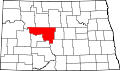
| County | McLean |
| Elevation | 2,014 ft (614 m) |
| Time zone | UTC-6 (Central (CST)) |
| • Summer (DST) | UTC-5 (CDT) |
| Area code | 701 |
| GNIS feature ID | 1028885[1] |
Emmet[1] was a small rural community in McLean County, North Dakota, United States. It is about twelve miles west of Garrison.[2] There is no longer anything at the location, although it may still be marked on some maps.[3] Emmet was in existence until at least 1966.[4]