Falmouth (CDP), Maine
From Wikipedia, the free encyclopedia
Falmouth, Maine | |
|---|---|
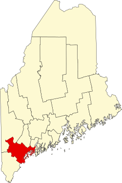
_highlighted.svg) Location in Cumberland County and the state of Maine | |
| Coordinates: 43°42′23″N 70°14′31″W / 43.70639°N 70.24194°W | |
| Country | United States |
| State | Maine |
| County | Cumberland |
| Town | Falmouth |
| Area | |
• Total | 3.15 sq mi (8.16 km2) |
| • Land | 2.40 sq mi (6.22 km2) |
| • Water | 0.75 sq mi (1.93 km2) |
| Elevation | 23 ft (7.0 m) |
| Population (2020) | |
• Total | 1,988 |
| • Density | 827.3/sq mi (319.43/km2) |
| Time zone | UTC-5 (Eastern (EST)) |
| • Summer (DST) | UTC-4 (EDT) |
| ZIP Code | 04105 |
| Area code | 207 |
| FIPS code | 23-24480 |
| GNIS feature ID | 2583557[2] |
Falmouth is a census-designated place (CDP) within the town of Falmouth in Cumberland County, Maine, United States. The population was 1,855 at the 2010 census.[3] It is part of the Portland–South Portland–Biddeford, Maine Metropolitan Statistical Area.