Floweree, Montana
From Wikipedia, the free encyclopedia
Floweree, Montana | |
|---|---|
 Floweree  Floweree | |
| Coordinates: 47°43′29″N 111°01′31″W / 47.72472°N 111.02528°W | |
| Country | United States |
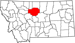
| State | Montana |
| County | Chouteau |
| Area | |
• Total | 1.18 sq mi (3.05 km2) |
| • Land | 1.18 sq mi (3.05 km2) |
| • Water | 0 sq mi (0.00 km2) |
| Elevation | 3,232 ft (985 m) |
| Population (2020) | |
• Total | 19 |
| • Density | 16.1/sq mi (6.23/km2) |
| Time zone | UTC-7 (Mountain (MST)) |
| • Summer (DST) | UTC-6 (MDT) |
| ZIP code | 59440[3] |
| Area code | 406 |
| GNIS feature ID | 2804273[2] |
Floweree is an unincorporated community in Chouteau County, Montana, United States. Floweree is 18 miles (29 km) west-southwest of Fort Benton. It is off of U.S. Route 87. As of the 2020 census, Floweree had a population of 19.[4]
The community is named for Daniel Floweree, a Texas cattle rancher who established his F Triangle Ranch in the area in the late 19th century.[5] Floweree had its own post office from 1910 to 2004 and still has its own ZIP code, 59440.[6]