Gilmanton (community), Wisconsin
From Wikipedia, the free encyclopedia
Gilmanton, Wisconsin | |
|---|---|
 | |
 Gilmanton  Gilmanton | |
| Coordinates: 44°28′15″N 91°40′34″W / 44.47083°N 91.67611°W | |
| Country | |
| State | |
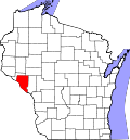
| County | Buffalo |
| Town | Gilmanton |
| Area | |
• Total | 3.378 sq mi (8.75 km2) |
| • Land | 3.345 sq mi (8.66 km2) |
| • Water | 0.033 sq mi (0.085 km2) |
| Elevation | 781 ft (238 m) |
| Population (2017)[2] | |
• Total | 131 |
| • Density | 39.2/sq mi (15.1/km2) |
| Time zone | UTC-6 (Central (CST)) |
| • Summer (DST) | UTC-5 (CDT) |
| ZIP code | 54743 |
| Area codes | 715 & 534 |
| GNIS feature ID | 1565537[3] |
Gilmanton (/ˈɡɪlməntən/ GHIL-mən-tən)[4] is a census-designated place located in the town of Gilmanton, in Buffalo County, Wisconsin, United States. Gilmanton is located at the junction of Wisconsin highways 88 and 121, 7 miles (11 km) south of Mondovi.[5] Gilmanton has a post office with ZIP code 54743.[6] Its population was 131 in 2017.[2]