Gjerstad (village)
Village in Southern Norway, Norway
From Wikipedia, the free encyclopedia
Gjerstad is the administrative centre of Gjerstad municipality in Agder county, Norway. The village is located at the northern end of the Lake Gjerstadvatnet at the northern end of Norwegian County Road 418. The Sørlandsbanen railway line passes through the village and stops at Gjerstad Station. The 0.34-square-kilometre (84-acre) village has a population (2017) of 289 which gives the village a population density of 850 inhabitants per square kilometre (2,200/sq mi).[1] Gjerstad Church is located in the village along with a school and several stores.[3]

Gjerstad | |
|---|---|
Village | |
View of the village from the lake Gjerstadvatnet | |
  Gjerstad Location of the village  Gjerstad Gjerstad (Norway) | |
| Coordinates: 58.8809°N 09.0175°E | |
| Country | Norway |
| Region | Southern Norway |
| County | Agder |
| District | Østre Agder |
| Municipality | Gjerstad |
| Area | |
• Total | 0.34 km2 (0.13 sq mi) |
| Elevation | 83 m (272 ft) |
| Population (2017)[1] | |
• Total | 289 |
| • Density | 850/km2 (2,200/sq mi) |
| Time zone | UTC+01:00 (CET) |
| • Summer (DST) | UTC+02:00 (CEST) |
| Post Code | 4980 Gjerstad |
Name
The village is named after the old Gjerstad farm (Old Norse: Geirreksstaðir), since the Gjerstad Church was built there. One explanation of the name says that the first element is the genitive case of the male name Geirrekr and the last element is staðir which means "homestead" or "farm".[4][5] Another possibly explanation of the first part of the name says that it comes from the word geirr which means "spear". Historically, the name has been spelled Gerikstadum (c. 1400), Gierestat (c. 1567), Gierrestad, and Gjerrestad.
Climate
| Climate data for Gjerstad stasjon 1991–2020 (32 m, average high/low 2012-2025) | |||||||||||||
|---|---|---|---|---|---|---|---|---|---|---|---|---|---|
| Month | Jan | Feb | Mar | Apr | May | Jun | Jul | Aug | Sep | Oct | Nov | Dec | Year |
| Mean daily maximum °C (°F) | 0.2 (32.4) |
2.6 (36.7) |
7 (45) |
11.5 (52.7) |
17.2 (63.0) |
21.1 (70.0) |
22.9 (73.2) |
21.1 (70.0) |
17.3 (63.1) |
10.9 (51.6) |
5.4 (41.7) |
1.7 (35.1) |
11.6 (52.9) |
| Daily mean °C (°F) | −3 (27) |
−2.6 (27.3) |
0.5 (32.9) |
5 (41) |
10.6 (51.1) |
14.7 (58.5) |
16.9 (62.4) |
15.6 (60.1) |
11.7 (53.1) |
6.3 (43.3) |
1.8 (35.2) |
−2.4 (27.7) |
6.3 (43.3) |
| Mean daily minimum °C (°F) | −6.9 (19.6) |
−5.8 (21.6) |
−3.4 (25.9) |
−0.3 (31.5) |
5.5 (41.9) |
9.8 (49.6) |
11.7 (53.1) |
10.5 (50.9) |
8.2 (46.8) |
3.6 (38.5) |
−0.1 (31.8) |
−4.6 (23.7) |
2.3 (36.2) |
| Average precipitation mm (inches) | 112 (4.4) |
68 (2.7) |
63 (2.5) |
59 (2.3) |
78 (3.1) |
84 (3.3) |
92 (3.6) |
116 (4.6) |
117 (4.6) |
136 (5.4) |
137 (5.4) |
107 (4.2) |
1,169 (46.1) |
| Source 1: yr.no (mean)[6] | |||||||||||||
| Source 2: seklima (average high/low)[7] | |||||||||||||
Media gallery
 View of the village from the train station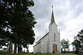

 Tunnel leading into the village


