Gracey, Kentucky
From Wikipedia, the free encyclopedia
Gracey, Kentucky | |
|---|---|
 Gracey | |
| Coordinates: 36°52′41″N 87°39′44″W / 36.87806°N 87.66222°W | |
| Country | |
| State | |
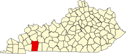
| County | Christian |
| Area | |
• Total | 0.24 sq mi (0.62 km2) |
| • Land | 0.24 sq mi (0.62 km2) |
| • Water | 0 sq mi (0.00 km2) |
| Elevation | 509 ft (155 m) |
| Population (2020) | |
• Total | 117 |
| • Density | 486.8/sq mi (187.96/km2) |
| ZIP code | 42232 |
| Area code | 270 |
| GNIS feature ID | 0493072[2] |
Gracey is an unincorporated community and census-designated place in Christian County, Kentucky, United States. As of the 2020 census, the population was 117, down from 138 in the 2010 census.[3]