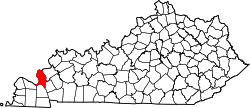
Gravel Switch, Livingston County, Kentucky
From Wikipedia, the free encyclopedia
Gravel Switch, Kentucky | |
|---|---|
 Dam, quarries, and port in area | |
  Gravel Switch Location in Kentucky  Gravel Switch Location in the United States | |
| Coordinates: 37°00′51″N 88°14′56″W / 37.01417°N 88.24889°W | |
| Country | United States |
| State | Kentucky |
| County | Livingston |
| Elevation | 387 ft (118 m) |
| Time zone | UTC-6 (Central (CST)) |
| • Summer (DST) | UTC-5 (CST) |
| GNIS feature ID | 493181[1] |
Gravel Switch is an area along the Paducah & Louisville Railway (PAL) between the Kentucky Dam on the Tennessee River and Grand Rivers in Livingston County, Kentucky, United States near the interchange of U.S. Route 62 and Kentucky Route 453.[2] The gravel of the area was prized as one of the best cementing gravels for the construction of railroad track ballast.[3] It remains a rail, barge, and transloading terminal for aggregates for Vulcan Materials Company's Grand Rivers Quarry.[4][5][6]
In the early 1900s PAL's predecessor, the Illinois Central Railroad, had a spur line (its Kentucky Division[7]) to this locale where rock was harvested for use as track ballast for the laying of track.[8] Older maps (1936) show the spurs and surroundings.[9]
After the Kentucky Dam was built and the Tennessee River basin filled (1955 maps), half of the Gravel Switch area and part of the rail line was submerged. The rail line was re-routed over the dam[10] and through the Gravel Switch spur area, which was left above water level,[9] the elevation difference about 36 feet (11 m).[a]