Gundlupet
Town in Karnataka, India
From Wikipedia, the free encyclopedia
Gundlupet (Gundlupētē in Kannada) is a municipal town situated in the Chamarajanagar district of Karnataka, India.

Gundlupet
Gundlupete | |
|---|---|
Town | |
 Gundlupete - Ooty road | |
 Gundlupet Location in Karnataka, India | |
| Coordinates: 11.8°N 76.68°E | |
| Country | |
| State | Karnataka |
| District | Chamarajanagar |
| Government | |
| • Type | Gundlupet Town Municipal Council (TMC) |
| • Body | Municipality |
| Area | |
• Total | 7.86 km2 (3.03 sq mi) |
| Elevation | 816 m (2,677 ft) |
| Population (2011)[1] | |
• Total | 28,105 |
| • Density | 3,580/km2 (9,260/sq mi) |
| Languages | |
| • Official | Kannada |
| Time zone | UTC+5:30 (IST) |
| PIN | 571111 |
| Telephone code | 08229 |
| Vehicle registration | KA-10 |
| Website | www |

It is also known as "The flower pot of India". It is situated on NH 766, 60 km away from Mysuru and approximately 200 km from the state administrative capital, Bengaluru. Gundlupet is the last town in Karnataka on the National Highway 766 which goes through Mysore, Ooty, Wayanad, and Kozhikode. It is situated very close to the Tamil Nadu and Kerala state borders. NH 181 begins from Gundlupet and ends in Nagapattinam in Tamil Nadu via Ooty and Coimbatore.[2]
The Bandipur National Park is situated 17 km away from Gundlupet, giving the town the epithet also known as "Land of Tigers". Gundlupet was previously known as Vijayapura, named after the ancient Vijayanarayana Temple.[3]
Geography
Gundlupet is located at 11.8°N 76.68°E.[4] It has an average elevation of 816 metres (2,677 feet).[5]
Demographics
Population by religion - Gundlupet Taluka
| Religion | Total | Male | Female | |
|---|---|---|---|---|
| Hindu | 214,896 | (96.34%) | 106,989 | 107,907 |
| Muslim | 6,754 | (3.03%) | 3,412 | 3,342 |
| Christian | 492 | (0.22%) | 246 | 246 |
| Sikh | 27 | (0.01%) | 14 | 13 |
| Buddhist | 107 | (0.05%) | 55 | 52 |
| Jain | 225 | (0.1%) | 118 | 107 |
| Other Religion | 16 | (0.01%) | 9 | 7 |
| No Religion Specified | 553 | (0.25%) | 266 | 287 |
Climate
It is a fairly dry region on the rain-shadow side of the Western Ghats, with an average annual rainfall of about 60 cm.[7]
Image gallery
 Bus Station
 NH 766 view from Gundalpet to Wayanad
 D.B.G.C
 Karate School
 Tree Worship
 St.Johns School
 Bandipur Tiger Reserve
 Vijayanarayana Swamy temple
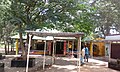


.jpg)


