Hahnheim
From Wikipedia, the free encyclopedia
Hahnheim | |
|---|---|
 Coat of arms | |
Location of Hahnheim
within Mainz-Bingen district 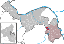 | |
 Location of Hahnheim | |
 Hahnheim  Hahnheim | |
| Coordinates: 49°51′38″N 8°14′12″E / 49.86056°N 8.23667°E | |
| Country | Germany |
| State | Rhineland-Palatinate |
| District | Mainz-Bingen |
| Municipal assoc. | Rhein-Selz |
| Government | |
| • Mayor (2019–24) | Werner Kalbfuß[1] (SPD) |
| Area | |
• Total | 6.39 km2 (2.47 sq mi) |
| Elevation | 124 m (407 ft) |
| Population (2023-12-31)[2] | |
• Total | 1,671 |
| • Density | 262/km2 (677/sq mi) |
| Time zone | UTC+01:00 (CET) |
| • Summer (DST) | UTC+02:00 (CEST) |
| Postal codes | 55278 |
| Dialling codes | 06737 |
| Vehicle registration | MZ |
| Website | www.hahnheim.de |
Hahnheim (German pronunciation: [ˈhaːnhaɪm]) is an Ortsgemeinde – a municipality belonging to a Verbandsgemeinde, a kind of collective municipality – in the Mainz-Bingen district in Rhineland-Palatinate, Germany.
Location
Hahnheim lies between Mainz and Worms on the river Selz. The winegrowing centre belongs to the Verbandsgemeinde Rhein-Selz, whose seat is in Oppenheim.
Politics
Municipal council
The council is made up of 17 council members, counting the part-time mayor, with seats apportioned thus:
| CDU | SPD | WGH | Total | |
|---|---|---|---|---|
| 2024 | 6 | 10 | 7 | 16 |
(as at the municipal election held on 9 June 2024)
Coat of arms
The municipality's arms might be described as thus: Per fess gules and argent, a cock repassant counterchanged.
Culture and sightseeing
Jewish graveyard
In the countryside towards Köngernheim on the highway going towards Bundesstraße 420 is an old Jewish graveyard.
Biotopes
In the countryside, especially along the Selz and on the former Alzey–Bodenheim railway right-of-way – the “Amiche” – several biotopes have been established.
