Harbinger, North Carolina
From Wikipedia, the free encyclopedia
Harbinger, North Carolina | |
|---|---|
 Harbinger, North Carolina  Harbinger, North Carolina | |
| Coordinates: 36°06′08″N 75°48′51″W / 36.10222°N 75.81417°W | |
| Country | United States |
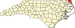
| State | North Carolina |
| County | Currituck |
| Elevation | 13 ft (4.0 m) |
| Time zone | UTC-5 (Eastern (EST)) |
| • Summer (DST) | UTC-4 (EDT) |
| ZIP code | 27941 |
| Area code | 252 |
| GNIS feature ID | 1020616[1] |
Harbinger is an unincorporated community in Currituck County, North Carolina, United States. The community is located along U.S. Highway 158 near the southern tip of the peninsula which forms mainland Currituck County. Harbinger has a post office with ZIP code 27941.[2][3]