Herrngiersdorf
From Wikipedia, the free encyclopedia
Herrngiersdorf | |
|---|---|
 Coat of arms | |
Location of Herrngiersdorf within Kelheim district 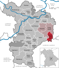 | |
 Herrngiersdorf  Herrngiersdorf | |
| Coordinates: 48°48′N 12°4′E / 48.800°N 12.067°E | |
| Country | Germany |
| State | Bavaria |
| Admin. region | Niederbayern |
| District | Kelheim |
| Municipal assoc. | Langquaid |
| Area | |
• Total | 25.09 km2 (9.69 sq mi) |
| Elevation | 405 m (1,329 ft) |
| Population (2023-12-31)[1] | |
• Total | 1,395 |
| • Density | 56/km2 (140/sq mi) |
| Time zone | UTC+01:00 (CET) |
| • Summer (DST) | UTC+02:00 (CEST) |
| Postal codes | 84097 |
| Dialling codes | 09452 |
| Vehicle registration | KEH |
| Website | www |
Herrngiersdorf is a municipality in the district of Kelheim in Bavaria in Germany. The village is dominated by the large, square Schloss Herrngiersdorf, a brewery.


