Highway M07 (Ukraine)
Highway in Ukraine
From Wikipedia, the free encyclopedia
Highway M07 is a Ukrainian international highway (M-highway) connecting Kyiv to Yahodyn on the border with Poland, where it continues into Poland as National Road 12 (DK12).[1][2]

Length486.5 km (302.3 mi)
488.4 km (303.5 mi) with access roads
WestendPolish border at Yahodyn checkpoint
| ||||
|---|---|---|---|---|
| Автошлях М07 | ||||
 | ||||
| Route information | ||||
| Part of | ||||
| Length | 486.5 km (302.3 mi) 488.4 km (303.5 mi) with access roads | |||
| Major junctions | ||||
| East end | ||||
| West end | Polish border at Yahodyn checkpoint | |||
| Location | ||||
| Country | Ukraine | |||
| Oblasts | Kyiv, Kyiv, Zhytomyr, Rivne, Volyn | |||
| Highway system | ||||
| ||||
In Soviet times, the M07 was identified as A255. Today, the highway stretches through four oblasts and ends at the border checkpoint Yahodyn in Liuboml Raion (Volyn Oblast). The entire route is part of European route E373.
The highway was planned in 1966 and constructed between 1967 and 1983. In common speech the road is known as Varshavka (Ukrainian: Варшавка), as its general course leads from Kyiv in the direction of Warsaw.[3]
Route
Gallery
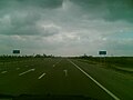 M07 Highway near Lyuboml'
 M07 in Volyn Oblast

