Highway M29 (Ukraine)
Highway in Ukraine
From Wikipedia, the free encyclopedia
M29 is a Ukrainian international highway (M-highway) in eastern Ukraine that runs from Kharkiv to Dnipro parallel to the M18. It is also known as Kharkiv – Dnipro motorway, although it does not have an official motorway designation. The entire route is part of European route E105.[1][2]

| ||||
|---|---|---|---|---|
| Автошлях М29 | ||||
 Road M29 (marked green on the right side of the map) | ||||
_near_Rokytne_(Kharkiv_oblast).jpg) | ||||
| Route information | ||||
| Part of | ||||
| Length | 160.7 km (99.9 mi) | |||
| Major junctions | ||||
| North end | ||||
| South end | ||||
| Location | ||||
| Country | Ukraine | |||
| Oblasts | Kharkiv, Dnipropetrovsk | |||
| Highway system | ||||
| ||||
Main route
Gallery
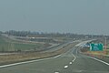 M29 motorway in Kharkiv Oblast
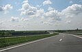 Kharkiv-Dnipro Motorway

