Illerrieden
From Wikipedia, the free encyclopedia
Illerrieden | |
|---|---|
 Church of Saint Agatha | |
 Coat of arms | |
Location of Illerrieden within Alb-Donau-Kreis district 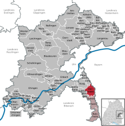 | |
 Illerrieden  Illerrieden | |
| Coordinates: 48°16′14″N 10°3′8″E / 48.27056°N 10.05222°E | |
| Country | Germany |
| State | Baden-Württemberg |
| Admin. region | Tübingen |
| District | Alb-Donau-Kreis |
| Government | |
| • Mayor (2020–28) | Jens Kaiser[1] (CDU) |
| Area | |
• Total | 18.17 km2 (7.02 sq mi) |
| Elevation | 492 m (1,614 ft) |
| Population (2022-12-31)[2] | |
• Total | 3,375 |
| • Density | 190/km2 (480/sq mi) |
| Time zone | UTC+01:00 (CET) |
| • Summer (DST) | UTC+02:00 (CEST) |
| Postal codes | 89186 |
| Dialling codes | 07306 |
| Vehicle registration | UL |
| Website | www.illerrieden.de |
Illerrieden is a town in the district of Alb-Donau in Baden-Württemberg in Germany. The city has 3,305 inhabitants and spans 18.17 km squared, with an average density of 181.89 inhabitants per km squared. The city can be reached by the A7 motorway and is an hour away from Munich by car.[3]
Jens Kaiser (CDU) is the current mayor of Illerrieden, re-elected in 2020.[1]
Alb-Donau has a tourism website for information and activities in Illerrieden.