Indian Springs, Texas
From Wikipedia, the free encyclopedia
Indian Springs, Texas | |
|---|---|
 Interactive map of Indian Springs, Texas | |
| Coordinates: 30°41′21″N 94°44′56″W / 30.68917°N 94.74889°W | |
| Country | |
| State | |
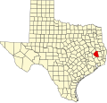
| County | Polk |
| Area | |
• Total | 1.9 sq mi (4.9 km2) |
| • Land | 1.8 sq mi (4.7 km2) |
| • Water | 0.077 sq mi (0.2 km2) |
| Elevation | 358 ft (109 m) |
| Population (2010) | |
• Total | 785 |
| • Density | 430/sq mi (170/km2) |
| Time zone | UTC-6 (Central (CST)) |
| • Summer (DST) | UTC-5 (CDT) |
| Zip Code | 77351 |
| GNIS feature ID | 2586941[1] |
Indian Springs is a census-designated place (CDP) in Polk County, Texas, United States. As of the 2020 census, Indian Springs had a population of 892.[2]
This was a new CDP for the 2010 census.[3]
Indian Springs has a total area of 1.9 square miles (4.9 km2), of which 1.8 square miles (4.7 km2) is land and 0.1 square miles (0.26 km2) is water.[4]