Jessie, North Dakota
From Wikipedia, the free encyclopedia
Jessie, North Dakota | |
|---|---|
 St. Lawrence Church in Jessie | |
  Jessie  Jessie | |
| Coordinates: 47°32′25″N 98°13′45″W / 47.54028°N 98.22917°W | |
| Country | United States |
| State | North Dakota |
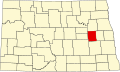
| County | Griggs |
| Area | |
• Total | 0.47 sq mi (1.23 km2) |
| • Land | 0.47 sq mi (1.23 km2) |
| • Water | 0 sq mi (0.00 km2) |
| Elevation | 1,450 ft (440 m) |
| Population (2020) | |
• Total | 22 |
| • Density | 46/sq mi (17.9/km2) |
| Time zone | UTC-6 (Central (CST)) |
| • Summer (DST) | UTC-5 (CDT) |
| ZIP codes | 58452 |
| Area code | 701 |
| FIPS code | 38-40740 |
| GNIS feature ID | 2584348[2] |
Jessie is a census-designated place in northern Griggs County, North Dakota, United States. As of the 2020 census, Jessie had a population of 22.[3] An unincorporated community, it was designated as part of the U.S. Census Bureau's Participant Statistical Areas Program on March 31, 2010. It was not counted separately during the 2000 Census,[4] but was included in the 2010 Census.[5]
It lies along North Dakota Highway 65 northwest of the city of Cooperstown, the county seat of Griggs County.