Karaman Province
Province in Turkey
From Wikipedia, the free encyclopedia
Karaman Province (Turkish: Karaman ili) is a province of south-central Turkey. Its area is 8,678 km2,[2] and its population is 260,838 (2022).[1] According to the 2000 census, the population was 243,210. The population density is 30 people/km2. The traffic code is 70. The capital is the city of Karaman. Karaman was the location of the Karamanid Beylik, which came to an end in 1486.

Karaman Province
Karaman ili | |
|---|---|
 Taşeli-Plateau, Moca Pass | |
 Location of the province within Turkey | |
| Country | Turkey |
| Seat | Karaman |
| Government | |
| • Governor | Hayrettin Çiçek |
Area | 8,678 km2 (3,351 sq mi) |
| Population (2022)[1] | 260,838 |
| • Density | 30.06/km2 (77.85/sq mi) |
| Time zone | UTC+3 (TRT) |
| Area code | 0338 |
| Website | www |
Districts and Towns

Karaman Province is divided into 6 districts:
Place of interest
- Binbirkilise, a region around Mount Karadağ 30 km (19 mi) north of Karaman with Byzantine church ruins.
Churches
- Çeşmeli Kilise (Surp Asvadzadzin Ermeni Kilisesi)
- Fisandon Church
- Binbir Church
See also
- Görmeli, a village on the hillside of the Taurus Mountains near Ermenek
- Mount Karadağ, an extinct volcano north of Karaman city
- List of populated places in Karaman Province
Gallery
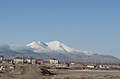
 Street in Karaman
 Taşeli-Plateau, Ermenek River
 Yeşildere, Akköprü
 Yeşildere rock formation
 Ermenek old houses
 Ruins of Binbirkilise, meaning "Thousand and One Churches" in Üçkuyu
 Yaylapazarı, Ermenek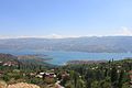
 Houses in Taşkale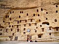

 Yaylapazarı, Ermenek
 Taşeli-Plateau Oberer Ermenek Stream Gökdere Stream
 Taşeli-Plateau Gezende Dam


.jpg)


.jpg)
_Blick_nach_Süd.jpg)


.jpg)


