Keizersgracht
From Wikipedia, the free encyclopedia
 Huidenstraat - Runstraat bridge over Keizersgracht, Negen Straatjes, July 2019 | |
 | |
| Length | 2.8 kilometres (1.7 mi) |
|---|---|
| Location | Amsterdam |
| Postal code | 1015, 1016, 1017 |
| Coordinates | 52°22′17″N 4°53′05″E / 52.371425°N 4.884780°E |
| Northwest end | Brouwersgracht |
| To | Amstel |
| Construction | |
| Construction start | 17th century |
The Keizersgracht (Dutch pronunciation: [ˈkɛizərsˌxrɑxt]; "Emperor's canal") is a canal in Amsterdam, the Netherlands. It is the second of the three main Amsterdam canals that together form the Grachtengordel, or canal belt, and lies between the inner Herengracht and outer Prinsengracht.
The first part of the Keizersgracht, between Brouwersgracht and (approximately) the current Leidsegracht, was dug in the summer of 1615 at the initiative of mayor Frans Hendricksz Oetgens, city carpenter Hendrick Jacobsz Staets and city surveyor Lucas Jansz Sinck. The Keizersgracht was named after Maximilian I, Holy Roman Emperor.[1] It is the widest canal in the center of Amsterdam, namely one hundred Amsterdam feet, that is 28.31 metres (92.9 ft). The Keizersgracht is the second of the three main canals to have been dug; the Prinsengracht was dug in 1614.
In September 1614 there arose an intention to turn the Keizersgracht into a chic boulevard without water, following the example of Lange Voorhout in The Hague. This idea was abandoned for a number of reasons. It was expected that the future buyers of lots on the Keizersgracht would want to be able to reach their home or warehouse by boat. Other considerations may have been the need for water storage, the easier supply of building and raising material, but especially the shortage of infill material. The construction of the fortifications at the same time also required a lot of infill material.
The allotment on the east side was completed in November 1615. The plots were given the same width, 30 feet, as on the Herengracht. The buildings went up quickly; by 1618 hardly any vacant lots remained.
The section between the Leidsegracht and the Amstel belongs to the fourth Amsterdam expansion of 1658. The actual digging of this part of the Keizersgracht began in 1663. In 1667 both parts of the Keizersgracht were connected to each other. The section between the Amstel and the Plantage Muidergracht was laid last. This part was named Nieuwe Keizersgracht. During the second phase in 1663, city architect Daniël Stalpaert devised an additional street between Keizersgracht and Prinsengracht, the Kerkstraat, in order to provide the canal houses with a back entrance where they could build a coach house.
In 1949 the municipality had all the trees on the canal cut down due to the elm disease, after which linden trees were planted.
Architecture and monuments
There are many monuments and monumental canal houses on the Keizersgracht, including:
Even numbers
- 102: Rode Hoed (Vrijburg), from 1630
- 220: Church of Our Lady, from 1854
- 224: Saxenburg, renewed after 1755.[2][3]
- 242–252: Groote Keijser, built between 1620 and 1730
- 324: Felix Meritis, from 1787
- 334-346: De Claes Reinierszhofje, from 1618
- 384: The Dylan Hotel, formerly Roman Catholic Poor's Office and before that the first Theatre of Van Campen (1637-1664)
- 566: Keizersgrachtkerk, from 1888
- 672-674: The Van Raey Houses, now Museum Van Loon, from 1671
- 676: The Nieuwe Waalse Kerk, Keizersgracht 676, from 1856
Odd numbers
- 105: d'Bruynvis, from 1763
- 123: Huis met de Hoofden, from 1622
- 141: South Africa House
- 143: Keizersgracht 143, historic canal house
- 177: Coymanshuis, by architect Jacob van Campen, from 1625
- 209: De Hoop, from 1734, restored in 2001
- 225: The Koopermoole, from 1746
- 401: Huis Marseille, from 1665, the first photography museum in The Netherlands
- 609: Foam Fotografiemuseum Amsterdam
- 633: Museum Geelvinck-Hinlopen
- 745: ING Bank
A number of buildings were built by the Amsterdam architects Philips Vingboons (1607-1678) and Adriaan Dortsman (1635-1682).
The Homomonument on the Westermarkt is in part, in the form of a jetty, above the Keizersgracht.
 Keizersgracht 54-62, with ice fun on the frozen canal
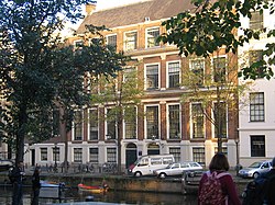 Keizersgracht 177, the Coymans houses in 2008
 Keizersgracht 85-87
 Huis Marseille, Museum for Photography, Keizersgracht 401
 Huis met de Hoofden, Keizersgracht 123
 Astoria building, Keizersgracht 174-176


Numbering and orientation
The Keizersgracht starts in the north at the Brouwersgracht, bends parallel between Herengracht and the Prinsengracht to the southeast and flows into the Amstel. The odd-numbered side of the canal is on the side of the heart of the city (Dam Square).
- At Keizersgracht 200 and 183 is the intersection with Westermarkt and Raadhuisstraat
- At Keizersgracht 508 and 455 is the intersection with Leidsestraat
- At Keizersgracht 648 and 589 is the intersection with Vijzelstraat
- At Keizersgracht 764 and 709 is the intersection with Utrechtsestraat
- At Keizersgracht 826 and 765, the canal flows into the Amstel
Bridges
The Keizersgracht is spanned by 14 bridges, all fixed.
| Number | Name | Street | Canal width |
Canal Clearance |
Clearance at 4m width |
Managed by |
|---|---|---|---|---|---|---|
| 55 | Pastoorsbrug | Brouwersgracht | 7,00 | 2,22 | 1,80 | Centrum |
| 54 | Noordsche Compagniebrug | Herenstraat | 6,81 | 1,80 | Centrum | |
| 51 | Leliegracht | 6,70 | 2,27 | 1,80 | Centrum | |
| 106 | Niek Engelschmanbrug | Westermarkt | 2x7,00 | 1,70 | DiVV | |
| 49 | Kees Fensbrug | Hartenstraat | 6,70 | 2,27 | 1,80 | Centrum |
| 48 | (Felix Meritisbrug) | Wolvenstraat | 6,70 | 2,27 | 1,80 | Centrum |
| 47 | Huidenstraat | 6,70 | 2,27 | 1,80 | Centrum | |
| 46 | (Quellijnbrug) | Leidsegracht | 6,70 | 2,27 | 1,80 | Centrum |
| 43 | Leidsestraat | 6,70 | 1,77 | DiVV | ||
| 42 | (Wielrijdersbrug) | Nieuwe Spiegelstraat | 6,70 | 2,27 | 1,80 | Centrum |
| 41 | Johanna Borskibrug | Vijzelstraat | 6,88 | 1,80 | DiVV | |
| 38 | (Oetgenssluis) | Reguliersgracht | 6,80 | 2,38 | 1,84 | Centrum |
| 37] | (Peylsluis) | Utrechtsestraat | 6,83 | 1,24 | DiVV | |
| 36 | L.J.Sinckbrug | Amstel | 5,14 | 2,89 | 2,42 | Centrum |
The bridge names in parentheses are the unofficial names of bridges, names which have lapsed since April 2016.
With the passage heights in the above table, take into account the fact that the Keizersgracht, like all other canals in the city center, is 0.40 metres (1 ft 4 in) below the Amsterdam Ordnance Datum.
Skating
If ice forms in winter, there is a possibility of skating on the Amsterdam canals. Waternet will stop circulation of water in the canals by closing the locks, and boats will be prohibited from sailing on a number of canals, including the Keizersgracht. The Keizersgracht is then designated as the main canal for skating.[4] In 2008 a tour boat from shipping company Meyers broke to pieces against the rules in the very first layer of ice; questions about this were asked to the city center district board.[5]
The Keizersrace is a sprint race that is held between the Leidsestraat and the Spiegelgracht. The winner of the race may call himself/herself the Keizer(in) of Amsterdam. The race was held in 1991, 1996, 1997 and 2012.[6]
Tunnel
The so-called Poentunnel was opened below the Keizersgracht in 1974, an underground walking route between the De Bazel and Vijzelbank bank buildings in Vijzelstraat. Today, the tunnel is still present, but out of use and bricked up on the north side.
.jpg)