Kenwood, Oklahoma
From Wikipedia, the free encyclopedia
Kenwood, Oklahoma | |
|---|---|
  Kenwood  Kenwood | |
| Coordinates: 36°18′04″N 94°59′52″W / 36.30111°N 94.99778°W[1] | |
| Country | United States |
| State | Oklahoma |
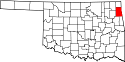
| Counties | Delaware, Mayes |
| Area | |
• Total | 45.06 sq mi (116.70 km2) |
| • Land | 45.06 sq mi (116.70 km2) |
| • Water | 0 sq mi (0.00 km2) |
| Elevation | 814 ft (248 m) |
| Population | |
• Total | 904 |
| • Density | 20.1/sq mi (7.75/km2) |
| Time zone | UTC-6 (Central (CST)) |
| • Summer (DST) | UTC-5 (CDT) |
| ZIP Codes | |
| Area codes | 539/918 |
| GNIS feature ID | 2584383[1] |
| FIPS code | 40-39450 |
Kenwood is an unincorporated community and census-designated place (CDP) in Delaware and Mayes counties, Oklahoma, United States. As of the 2020 census, it had a population of 904,[3] down from 1,224 in 2010.[4]
Kenwood once had a post office, which opened on May 25, 1922. The community's name came from a combination of William Kennedy and the National Hardwood Company.[5]
Geography
The eastern half of Kenwood is in Delaware County, while the western half is in Mayes County. Kenwood is 20 miles (32 km) by road southwest of Jay, the Delaware County seat. It is 11 miles (18 km) east of Salina. According to the U.S. Census Bureau, the Kenwood CDP has an area of 45.1 square miles (116.8 km2), all of it recorded as land.[2] The community is drained by Saline Creek, which flows west through the center of the CDP and joins the Neosho River in Lake Hudson 3 miles (5 km) to the west of the CDP's border.