Ketchuptown, South Carolina
From Wikipedia, the free encyclopedia
Ketchuptown, South Carolina | |
|---|---|
 Country store at the crossroads | |
  Ketchuptown  Ketchuptown | |
| Coordinates: 34°07′05″N 79°09′25″W / 34.11806°N 79.15694°W[1] | |
| Country | United States |
| State | South Carolina |
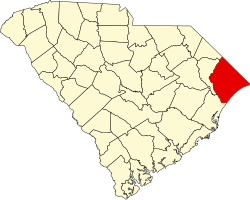
| County | Horry |
| Established | 1920s |
| Area | |
• Total | 2.71 sq mi (7.02 km2) |
| • Land | 2.71 sq mi (7.02 km2) |
| • Water | 0 sq mi (0.00 km2) |
| Elevation | 72 ft (22 m) |
| Population | |
• Total | 84 |
| • Density | 31.0/sq mi (11.97/km2) |
| Time zone | UTC-5 (Eastern (EST)) |
| • Summer (DST) | UTC-4 (EDT) |
| ZIP Code | 29581 (Nichols) |
| Area code | 843 |
| FIPS code | 45-38110 |
| GNIS feature ID | 2812961[1] |
Ketchuptown is a historic unincorporated community and census-designated place (CDP) located in Horry County, South Carolina, United States. Ketchuptown is at the intersection of Highways 23 and 99, about 9 miles (14 km) north of Aynor. As of the 2020 census, it had a population of 84.[4][5]