Kirchzarten
From Wikipedia, the free encyclopedia
Kirchzarten | |
|---|---|
 Aerial view of Kirchzarten | |
 Coat of arms | |
Location of Kirchzarten within Breisgau-Hochschwarzwald district 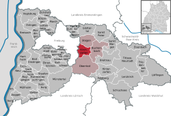 | |
 Kirchzarten  Kirchzarten | |
| Coordinates: 47°57′54″N 7°57′20″E / 47.96500°N 7.95556°E | |
| Country | Germany |
| State | Baden-Württemberg |
| Admin. region | Freiburg |
| District | Breisgau-Hochschwarzwald |
| Government | |
| • Mayor (2016–24) | Andreas Hall[1] (CDU) |
| Area | |
• Total | 21.13 km2 (8.16 sq mi) |
| Elevation | 380 m (1,250 ft) |
| Population (2023-12-31)[2] | |
• Total | 10,193 |
| • Density | 480/km2 (1,200/sq mi) |
| Time zone | UTC+01:00 (CET) |
| • Summer (DST) | UTC+02:00 (CEST) |
| Postal codes | 79199 |
| Dialling codes | 07661 |
| Vehicle registration | FR |
| Website | www.kirchzarten.de |
Kirchzarten (German pronunciation: [ˈkɪʁçˌtsaʁtn̩]) is a municipality in the district of Breisgau-Hochschwarzwald in the federal-state of Baden-Württemberg in southwestern Germany.
A Zionist agricultural training farm was founded in Kirchzarten in 1919 to prepare young people to become farmers in Mandatory Palestine [Eretz Israel].[3]
The Kirchzarten synagogue had a set of Jugendstil windows by artist Friedrich Adler, who made a duplicate set now in the Tel Aviv Museum of Art.[3]
Population development:[4]
|


